Corral Hollow Creek facts for kids
Quick facts for kids Corral Hollow Creek |
|
|---|---|
|
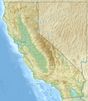
Location of the mouth of Corral Hollow Creek in California
|
|
| Native name | Arroyo De Los Buenos Aires or Ayres |
| Other name(s) | Buenos Ayres Creek |
| Country | United States |
| State | California |
| Counties | Alameda, San Joaquin |
| Physical characteristics | |
| Main source | Head of Corral Canyon 1.9 mi (0 km) north of Mount Boardman, San Joaquin County 37°30′34.02″N 121°28′49.37″W / 37.5094500°N 121.4803806°W |
| River mouth | Delta-Mendota Canal 4.3 miles South of Tracy, California, San Joaquin County 197 ft (60 m) 37°40′42″N 121°25′58″W / 37.67833°N 121.43278°W |
| Length | 21.39 mi (34.42 km) |
Corral Hollow Creek is a stream in central California. It flows through Alameda County and San Joaquin County. This creek is a small river that eventually joins the larger San Joaquin River. It used to have a different name, El Arroyo de los Buenos Ayres, which means "The Creek of the Good Winds" in Spanish. Later, it was called Buenos Ayres Creek before getting its current name.
Contents
Exploring Corral Hollow Creek
Corral Hollow Creek is a stream that starts in the mountains and flows into a valley. It is an important part of the natural landscape in this area.
Where Does the Creek Start?
The creek begins high up in the eastern part of the Diablo Range mountains. This starting point is called its headwaters. It's like the very beginning of a long journey for the water.
The Creek's Journey
Corral Hollow Creek starts in a place called Corral Canyon. This is about 1.9 miles (3 kilometers) north of Mount Boardman in San Joaquin County.
From there, the creek flows north for about 1.9 miles (3 kilometers). Then, it turns and flows west-northwest for about 8.5 miles (13.7 kilometers). During this part of its journey, it enters Alameda County and a valley known as Corral Hollow.
After that, the creek makes a sharp turn to the east near a place called Tesla. It flows east for about 2.5 miles (4 kilometers), going back into San Joaquin County. It continues for another 2.5 miles (4 kilometers) before turning again. This time, it flows northeast for about 6 miles (9.7 kilometers).
Finally, Corral Hollow Creek reaches the Delta-Mendota Canal. This is about 4.3 miles (6.9 kilometers) south of Tracy, California, in the San Joaquin Valley. The canal is where the creek's journey ends.
The History of Corral Hollow Creek's Name
The name of Corral Hollow Creek has changed over time. It tells us a bit about the history of the area.
Spanish Beginnings
When the Spanish explored this region, they named the creek Arroyo de los Buenos Ayres or Aires. This means "The Creek of the Good Winds." This name likely described the pleasant breezes they felt in the area.
Changes Over Time
Even after Americans arrived and the Gold Rush began, the creek kept its Spanish name for a while. For example, a map from 1852 by Charles Drayton Gibbes still showed it as "Arroyo Buenos Ayres."
By 1857, maps started to show the canyon as "Corral Hollow." However, the creek itself was still called Buenos Ayres Creek. Its name was Anglicized, meaning it was changed to sound more English.
Finally, by 1873, a State Geological Survey map showed that the name change was complete. The creek was officially called Corral Hollow Creek, matching the name of the canyon it flows through.
 | Delilah Pierce |
 | Gordon Parks |
 | Augusta Savage |
 | Charles Ethan Porter |


