
Crab Island (Queensland) facts for kids
.png)
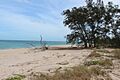
Satellite image of Crab Island
|
|

A map of the Torres Strait Islands showing Crab Island in the Gulf of Carpentaria
|
|
| Geography | |
|---|---|
| Location | Northern Australia |
| Coordinates | 10°58′23″S 142°06′22″E / 10.973°S 142.106°E |
| Adjacent bodies of water | Gulf of Carpentaria |
| Area | 2.8 km2 (1.1 sq mi) |
| Administration | |
|
Australia
|
|
| State | Queensland |
| Demographics | |
| Population | Uninhabited |
Crab Island, also known as Moent Island in the local language, is a small island in Australia. It is not currently home to any people.
The island is located west of a place called Muttee Heads. It is also near the coastal town of Seisia. Seisia is close to Bamaga, which is at the very tip of the Cape York Peninsula.
Crab Island is found within the Endeavour Strait in the Gulf of Carpentaria. This gulf is part of Queensland, Australia.
Contents
About Crab Island
Crab Island covers an area of about 2.8 square kilometers. That's about 280 hectares. The closest mainland is only 1.4 kilometers away.
The island sits between Australia and the island of New Guinea. New Guinea is part of Melanesia. Crab Island is in the southwestern part of the Torres Strait. It faces the Arafura Sea to its west.
Who Lived on Crab Island?
The first people to live on Crab Island were the Apukwi branch of the Ankamuti people. They were the original inhabitants of this area.
Home to Sea Turtles
Crab Island is very important for wildlife. It is the main breeding ground for the flatback turtle (Natator depressus). These turtles come to the island to lay their eggs.
Sometimes, other types of sea turtles also nest here. These include the hawksbill sea turtle (Eretmochelys imbricata) and the olive ridley sea turtle (Lepidochelys olivacea).
However, the island also has predators. Large saltwater crocodiles live there. They can be a danger to the turtles and their nests.
Location in the Torres Strait
Crab Island is located south of the main group of Torres Strait Islands. These islands are a group of more than 274 small islands. They are located in the Torres Strait, which separates Australia and New Guinea.
Images for kids
-
Crab Island, Cape York

