Crag Fell facts for kids
Quick facts for kids Crag Fell |
|
|---|---|

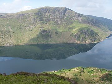
Crag Fell across Ennerdale Water from Bowness Knott
|
|
| Highest point | |
| Elevation | 1,715 ft (523 m) |
| Prominence | c. 115m |
| Parent peak | Pillar |
| Listing | Wainwright |
| Geography | |
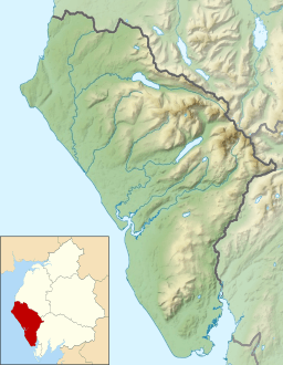
| Location | Cumbria, England |
| Parent range | Lake District, Western Fells |
| OS grid | NY097144 |
| Topo map | OS Landranger 89, 90, Explorer OL4 |
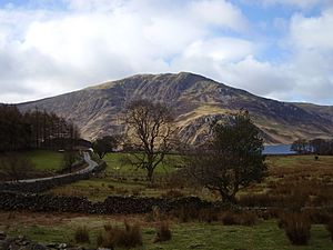
Crag Fell is a cool hill located in the beautiful Lake District in England. It's part of a group of hills called Lank Rigg. This fell stands tall above Ennerdale Water, which is a long, wild lake. The name "Crag Fell" comes from its rocky, steep northern side that faces the lake. You can see these crags clearly from the car park at Bowness Knott. Many people start their climb to the top from the foot of Ennerdale Water.
Contents
What is Crag Fell Like?
Where is Crag Fell?
The Western Fells are a group of hills in the Lake District. They form a big horseshoe shape around Ennerdale Water. Crag Fell is located at one end of this horseshoe, on the southern side.
Crag Fell's Neighbors
The main line of hills stretches west from Great Gable. This line includes famous fells like Pillar and Haycock. Crag Fell is part of the Lank Rigg group, which is the last set of high hills in this area of the National Park. Crag Fell and Grike are at the western end of this ridge.
Slopes and Crags
The northern side of Crag Fell drops steeply down to Ennerdale Water. You'll see two main areas of crags (rocky cliffs). One is right below the top, called Revelin Crag. The other is closer to the lake, known as Anglers Crag. This spot is also sometimes called Robin Hood's Chair. On the other hand, the southern slopes of Crag Fell gently go down towards the River Calder. Some parts of these lower slopes are covered with trees.
Mining History
Iron Mines on Crag Fell
If you explore the area above Ennerdale Water, you might find old signs of iron mining. Small test mines were dug under Revelin Crag and above Anglers Crag. More mines were also on the upper eastern slopes. Miners were looking for a type of iron ore called haematite. However, they never found enough to make it a big operation. All these mines closed down by 1896.
Reaching the Top
What's at the Summit?
The very top of Crag Fell has two small grassy bumps. The one towards the northwest is the highest point. The whole area at the top is a bit bumpy and covered in grass. From here, you get amazing views of the coast. You can also see the head of Ennerdale Water to the east, surrounded by a ring of high hills. On a clear day, you might even spot distant fells like Fairfield and Ullscarf peeking through gaps in the mountains.
How to Climb Crag Fell
There's a small road that goes east from the village of Ennerdale Bridge. This road leads to car parks near where the lake's water flows out. From here, you have a couple of main ways to climb Crag Fell:
- One way is to follow a stream called Ben Gill, walking next to the tree plantation. Then, you turn left to head towards the summit.
- A more exciting route is to walk along the lake path to the top of Anglers Crag. From there, you climb up the hillside, going around Revelin Crag to the west. This path takes you past what are called the Crag Fell Pinnacles. These are cool, broken rock formations that stick up about 80 feet!
You can also start your climb from the Coldfell Road, which is south of Ennerdale Bridge. There's an old mine track you can follow almost all the way to the top. This track goes over the slopes of Grike. You could even do a longer hike from here, exploring the whole Lank Rigg group of fells.
 | James B. Knighten |
 | Azellia White |
 | Willa Brown |


