Fairfield (Lake District) facts for kids
Quick facts for kids Fairfield |
|
|---|---|
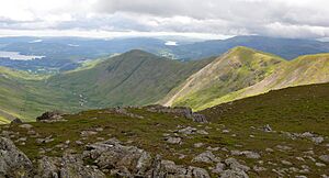
Fairfield (right) and St Sunday Crag, seen from Seat Sandal
|
|
| Highest point | |
| Elevation | 873 m (2,864 ft) |
| Prominence | 299 m (981 ft) |
| Parent peak | Helvellyn |
| Listing | Hewitt, Marilyn, Nuttall, Wainwright |
| Geography | |
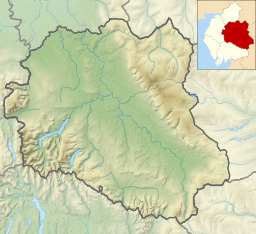
| Location | Cumbria, England |
| Parent range | Lake District, Eastern Fells |
| OS grid | NY358117 |
| Topo map | OS Landranger 90, Explorer OL5 |
Fairfield is a famous mountain, or "fell," located in the beautiful Lake District in England. It's the tallest mountain in a group of hills called the Eastern Fells. Fairfield stands just south of the Helvellyn mountain range, offering amazing views all around.
Contents
Fairfield's Shape and Surroundings
Fairfield looks very different depending on which side you see it from. From the south, it appears as wide, grassy slopes. But from the north, it looks much more dramatic! Here you can see steep cliffs, long piles of rocks (called scree), and deep, hidden valleys.
Fairfield connects to several other fells through its ridges. It's shaped a bit like a bow-tie if you look at it from above. The top part of the mountain runs from east to west, with ridges stretching out north and south from each end.
The Fairfield Horseshoe Walk
Two of the southern ridges form a very popular walking route called the Fairfield horseshoe. This walk starts in Ambleside and goes in a big circle around the valley of Rydale. On the western side, the ridges lead down to Great Rigg, Heron Pike, and Nab Scar. On the eastern side, they connect to Hart Crag, Dove Crag, High Pike, and Low Pike.
Fairfield also has ridges going north. One goes northwest to St Sunday Crag across a pass called Deepdale Hause. Another goes northeast into Deepdale valley, dropping over Greenhow End. There's also a path that runs west to Seat Sandal across Grisedale Hause.
The northern and eastern parts of Fairfield rise high above the quiet upper Deepdale valley. This area has steep, bowl-shaped hollows called corries, like Cawk Cove and Link Cove, which are surrounded by Fairfield's high slopes.
Grisedale Tarn: A Nearby Lake
Northwest of Fairfield, you'll find Grisedale Tarn. This is a good-sized mountain lake, about 540 meters (1,770 feet) high. It's over 30 meters (100 feet) deep and is home to brown trout, perch, and eels.
Legend says that the crown of King Dunmail rests at the bottom of Grisedale Tarn. He was a king who was supposedly defeated in battle nearby. The water from Grisedale Tarn flows into Ullswater, which is about 5 kilometers (3 miles) to the northeast.
Fairfield's Summit: Views from the Top
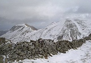
The very top of Fairfield is a rough, stony area. The highest point is at the western end. The summit is quite flat and has many piles of stones, called cairns. There are also two large stone windbreaks where you can shelter from the wind.
It's important to be careful when walking on the summit, especially in mist, because there are steep cliffs to the north and west. But the views from the top are amazing! You can see all the main mountain groups in the Lake District. You can also look down into the deep valley of Deepdale, which is very close by.
From the summit, you can clearly see other fells like Helvellyn, with its famous narrow ridge called Striding Edge. You can also spot Nethermost Pike, Saint Sunday Crag, and Cofa Pike (which is a smaller peak of Fairfield). Looking south towards Ambleside and Rydal, you can see the beautiful lakes of Windermere and Coniston Water.
How to Climb Fairfield
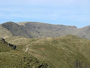
Fairfield is most often climbed as part of the Fairfield horseshoe walk. When coming from Great Rigg, the long, grassy ridge leads straight to the summit. If you're coming from Hart Crag, you climb up from Link Hause, with a great view of Scrubby Crag, before walking across the stony top of Fairfield.
Another excellent way to climb Fairfield is from Patterdale. This route goes via Birks and St Sunday Crag. You follow a narrow ridge down to Deepdale Hause, then climb up to Cofa Pike. Cofa Pike has a fine pointed shape, which looks very impressive until you see the wide, flat top of Fairfield behind it.
You can also reach Fairfield by climbing up from Grisedale Hause. This pass can be reached from Grasmere (by following Tongue Gill), from Dunmail Raise, or from Patterdale. The path up from Grisedale Hause is a rough zigzag through loose rocks. Grisedale Hause can also be reached by walking along the ridge from Seat Sandal.
Some more challenging routes climb out of Deepdale valley, heading into Link Cove before going over Greenhow End.
 | Sharif Bey |
 | Hale Woodruff |
 | Richmond Barthé |
 | Purvis Young |


