St Sunday Crag facts for kids
Quick facts for kids St Sunday Crag |
|
|---|---|
 |
|
| Highest point | |
| Elevation | 841 m (2,759 ft) |
| Prominence | 166 m (545 ft) |
| Parent peak | Fairfield |
| Listing | Marilyn, Hewitt, Wainwright, Nuttall |
| Geography | |
| Location | Cumbria, England |
| Parent range | Lake District, Eastern Fells |
| OS grid | NY369135 |
| Topo map | OS Landrangers 89, 90, Explorer OL5 |
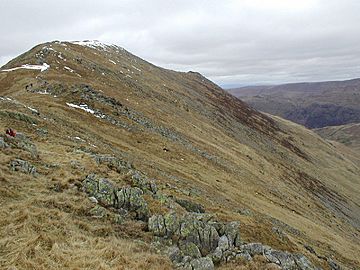
St Sunday Crag is a famous fell (which is a type of mountain or hill) located in the beautiful Lake District in England. It's part of a group of mountains called the Fairfield group, found in the eastern part of the Lake District.
This mountain stands out in the views from Patterdale village. It has a special rounded shape that makes it easy to spot. Some people even call it 'the Ullswater Fell' because it looks so great from the upper part of Ullswater lake.
Contents
What is St Sunday Crag Like?
St Sunday Crag is the highest point on the north-eastern ridge that stretches from Fairfield. This ridge is about two miles long. It then slopes down towards the valley behind Patterdale village.
The Path to the Top
From the flat top of Fairfield, a rough slope goes down to a smaller peak called Cofa Pike. After that, you reach a narrow dip in the ridge known as Deepdale Hause. This spot is about 680 meters (2,200 feet) high. Many walkers have used this path, making it quite worn.
From Deepdale Hause, the ground rises again to form St Sunday Crag. The mountain then towers over the valleys on both sides. After the main summit, the land drops quickly to a lower area called Birks. Beyond Birks, there is another smaller peak named Arnison Crag.
The East Ridge
The very top of St Sunday Crag is shaped like a triangle. One of its sides forms a third ridge that goes directly east. This ridge crosses a dip called The Cape. Then, it reaches a lower peak known as Gavel Pike, which is 784 meters (2,572 feet) high.
From below, Gavel Pike looks like a neat pyramid. However, when you are on top of St Sunday Crag, you can clearly see that Gavel Pike is a smaller, connected peak. Below Gavel Pike is another small peak called Lord's Seat. After that, the short east ridge drops steeply into the Deepdale valley.
The Crags of St Sunday Crag
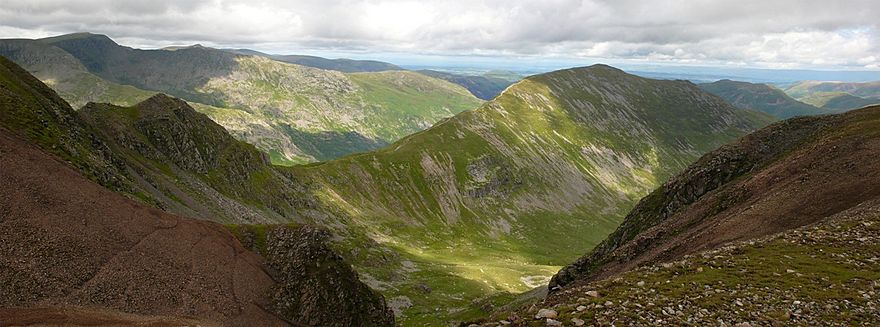
The most impressive part of St Sunday Crag is its north-western side, which overlooks Grisedale valley. This side features a long, graceful curve at the top. Below it is a half-mile-long wall of rock, known as a crag. This entire rock face looks very balanced and even.
Several deep, narrow channels cut through these crags. These channels, along with the rocky ridges between them, are popular spots for climbers. The crags become less steep at about 550 meters (1,800 feet) high. Below this, there is a steep slope of loose rocks that goes down another 250 meters (800 feet) to the valley floor. You can get amazing views of this rocky face from Helvellyn and Birkhouse Moor across the valley.
To the south-east of the mountain is the Deepdale valley. This valley separates St Sunday Crag from Hart Crag and Hartsop above How. This side of the mountain is also steep and rough. However, it does not have as many large, continuous rock outcrops. Between Gavel Pike and Birks is Cold Cove. This is a "hanging valley," which means it's a valley that ends high up on the side of a larger valley. All the small streams (called becks) that flow from St Sunday Crag eventually reach the top of Ullswater lake at Patterdale.
What is St Sunday Crag Made Of?
The rocks at the very top of St Sunday Crag are made of a material called andesite. This rock sits on top of a 50-meter-thick layer of rhyodactic lapilli-tuff. This layer is known as the St Sunday Crag Member. You can see parts of this layer on the east ridge of the mountain.
Reaching the Summit
Even though St Sunday Crag has steep ridges on its sides, the very top is surprisingly flat and covered in green grass. You will find two cairns (piles of stones) on the highest part of the summit, where rocks stick out from the ground. Another cairn at the northern end of the summit shows the best spot to view Ullswater lake.
There is also a quartz cross on the summit, but it's hard to find now among the bilberry plants. It marks the top of East Chockstone Gully. From the summit, you can see a large part of the Lake District. Helvellyn's Striding Edge and the rocky crags of Fairfield are especially easy to see. Gavel Pike also offers great views of the head of Deepdale valley.
How to Climb St Sunday Crag
Many people start their climb of St Sunday Crag from Patterdale village. You can either climb directly up or walk across Birks first. Some hikers also add Arnison Crag to their route. The north-east ridge gives amazing views of Ullswater as you look back.
Another way to climb from Patterdale is by using the Elmhow zig-zag path. This path goes up the Grisedale side of the mountain, just north of the main crags. You can also climb Lord's Seat and the east ridge from Deepdale. For this route, you would start from the car park at Bridgend.
It's also possible to climb St Sunday Crag from the west. To do this, you would first head towards Grisedale Tarn. This approach makes the summit reachable from places like Grasmere or Dunmail Raise.
St Sunday Crag is now part of Alfred Wainwright's famous Coast to Coast Walk. This means many more people are now walking over its summit.
Where Did the Name Come From?
Saint Sunday is a local name for Saint Dominic. However, it's not entirely clear how this saint's name became connected to the mountain.
 | Georgia Louise Harris Brown |
 | Julian Abele |
 | Norma Merrick Sklarek |
 | William Sidney Pittman |


