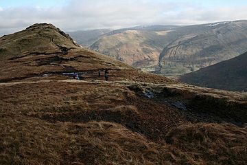
Hartsop above How facts for kids
Quick facts for kids Hartsop above How |
|
|---|---|
 |
|
| Highest point | |
| Elevation | 586 m (1,923 ft) |
| Prominence | c. 30 m |
| Parent peak | Hart Crag |
| Listing | Wainwright |
| Geography | |
| Location | Cumbria, England |
| Parent range | Lake District, Eastern Fells |
| OS grid | NY383120 |
| Topo map | OS Explorer OL5, OL7 |
Hartsop above How is a small mountain, also called a 'fell', in England's beautiful Lake District. It's part of the Helvellyn range in the Eastern Fells. This fell stands proudly above a lake called Brothers Water. You can also see it from the road that connects Ullswater and Ambleside.
Contents
About Hartsop above How
Hartsop above How is actually a long ridge that stretches out from a bigger mountain called Hart Crag. However, a famous writer named Alfred Wainwright decided to give it its own special place in his guidebooks. He wrote Pictorial Guide to the Lakeland Fells, which helps people explore these amazing mountains.
The name "Hartsop above How" is how it appears on official maps. Sometimes, people write it with a hyphen. Alfred Wainwright also mentioned that local people sometimes call this fell "Gill Crag."
Exploring the Ridge
Hartsop above How is a long, curving ridge that looks a bit like a billhook (a tool with a curved blade). It stretches for about three miles.
Valleys Around the Fell
To the north of the ridge is a long valley called Deepdale. This valley curves around and can be a bit marshy in places. On the southern side, you'll find Dovedale. This valley is known for its lovely woodlands and pretty waterfalls. Both of these valleys eventually meet the main valley of Kirkstone/Goldrill Beck. This beck (or stream) flows north through Patterdale all the way to Ullswater.
Features of the Ridge
The ridge of Hartsop above How has several small hills, or 'knolls', along its length. The highest points are near Gill Crag, which is the summit, and Gale Crag. The ridge is mostly covered in grass. However, you'll also see lots of rocks sticking out, especially on the Deepdale side. Some of the rocky parts here are called Bleaberry Knott, Gale Crag, Holly Crag, and Erne Nest Crag. On the Dovedale side, you can spot Gill Crag, The Perch, and Black Crag. A stone wall runs along the top of the ridge almost all the way to the summit.
Low Wood and the Old Mine
At the bottom of the Dovedale side, near Brothers Water, there's an area of natural woodland called Low Wood. Hidden within this wood are the remains of an old mine called Hartsop Hall Mine. This was a lead mine that started operating a very long time ago, in the 1600s! It finally closed in 1942. Miners dug four tunnels into the side of Hartsop above How, but they never found a huge amount of lead ore.
The Summit View
When you reach the top of Hartsop above How, you'll find a small pile of stones, called a cairn, on the grassy summit. The view from here is really good! You can see the rocky tops of Deepdale and Dovedale up close.
How to Climb Hartsop above How
Most people who want to walk up Hartsop above How follow the path along the ridge. You can start climbing from Deepdale Bridge at one end of the ridge. Another way is to cut up the southern side from Cow Bridge, which is near Brothers Water. A clear path follows the top of the ridge. It then continues across some peaty ground towards the rocky top of Hart Crag.
 | Jackie Robinson |
 | Jack Johnson |
 | Althea Gibson |
 | Arthur Ashe |
 | Muhammad Ali |


