Crossover Peak facts for kids
Quick facts for kids Crossover Peak |
|
|---|---|

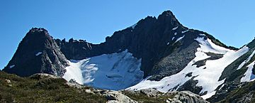
Crossover Peak, northeast aspect
|
|
| Highest point | |
| Elevation | 2,175 m (7,136 ft) |
| Prominence | 185 m (607 ft) |
| Parent peak | Slesse Mountain |
| Listing | Mountains of British Columbia |
| Geography | |
| Location | British Columbia, Canada |
| Parent range | Skagit Range North Cascades |
| Topo map | NTS 92H/04 |
| Geology | |
| Mountain type | Intrusive |
| Volcanic arc/belt | Pemberton Volcanic Belt |
| Climbing | |
| Easiest route | Scramble class 4 |
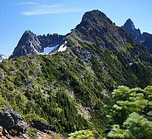
Crossover Peak is a mountain in southwestern British Columbia, Canada. It stands about 2,175-metre (7,136-foot) tall. This peak is part of the Cascade Mountains. It is located about 4.5 km (3 mi) north of the Canada–United States border. It's also near Mount MacFarlane and Slesse Mountain.
Water from Crossover Peak flows into Slesse Creek and Nesakwatch Creek. These creeks then join the Chilliwack River. The mountain got its name from a popular hiking route. This route "crosses over" from the Pierce Lake trail to the Slesse trail. Glenn Woodsworth of the Alpine Club of Canada suggested the name. It became official on May 21, 1981.
How Crossover Peak Formed
Crossover Peak is part of a large rock formation called the Chilliwack batholith. This rock formed deep underground about 26 to 29 million years ago. It's also linked to the Pemberton Volcanic Belt. This was once an active volcanic area. It formed when Earth's giant plates slowly moved and one slid under another.
Ice Ages and Mountains
Over two million years ago, during the Pleistocene period, huge glaciers covered this area. These glaciers moved across the land many times. They carved out the "U"-shaped valleys we see today. The mountains also got their tall, rugged shapes from the Earth's crust moving. This movement pushed land upwards and created cracks, called faults.
The North Cascades are known for their rough and beautiful landscape. You can see sharp peaks, deep valleys carved by glaciers, and tall granite spires. All these amazing features were created by geological events long ago. These events also led to different climates and types of plants in the area.
Weather at Crossover Peak
Crossover Peak has a "marine west coast" climate. This means it's often wet and mild, like places near the ocean. Most of the weather comes from the Pacific Ocean. As weather systems move east, they hit the Cascade Range. The mountains force the air upwards. This makes the air cool down and drop its moisture as rain or snow.
Rain and Snow
Because of this, the Cascade Mountains get a lot of rain and snow. Winter months see heavy snowfall. Temperatures can drop very low, sometimes below −20 °C. With the wind, it can feel even colder. The best time to visit or climb Crossover Peak is usually from July to September. The weather is much nicer then.


