Crosswicks, New Jersey facts for kids
Quick facts for kids
Crosswicks, New Jersey
|
|
|---|---|
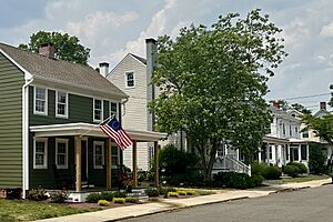
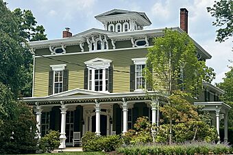
The J. Ivins House on Church Street, part of the Crosswicks Historic District
|
|
| Country | |
| State | |
| County | Burlington |
| Township | Chesterfield |
| Area | |
| • Total | 1.84 sq mi (4.78 km2) |
| • Land | 1.82 sq mi (4.73 km2) |
| • Water | 0.02 sq mi (0.05 km2) |
| Elevation | 82 ft (25 m) |
| Population
(2020)
|
|
| • Total | 849 |
| • Density | 465.21/sq mi (179.63/km2) |
| Time zone | UTC−05:00 (Eastern (EST)) |
| • Summer (DST) | UTC−04:00 (EDT) |
| Area code(s) | 609, 640 |
| FIPS code | 34-16060 |
| GNIS feature ID | 875749 |
Crosswicks is a small community in Chesterfield Township, Burlington County, New Jersey. It's located right next to the Crosswicks Creek. This area is also known as a census-designated place (CDP), which means it's a special area defined for gathering population information. The local United States Postal Service ZIP Code for Crosswicks is 08515. In 2020, about 849 people lived here.
Contents
A Look Back: Crosswicks History
Chesterfield Township has three main communities: Chesterfield, Crosswicks, and Sykesville. Crosswicks is the oldest of these. It was first settled in 1677 by a group of people called Quakers. The name "Crosswicks" comes from the Lenape language word "Crossweeksung," which means "house of separation."
The Battle of Crosswicks (1778)
A small but important battle happened here during the American Revolutionary War. On June 23, 1778, American forces fought British troops near the bridge over Crosswicks Creek. American generals Philemon Dickinson and William Maxwell helped slow down the British army. This delay was important because it happened just before the bigger Battle of Monmouth on June 28.
Community Buildings and Life
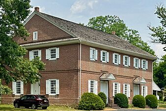
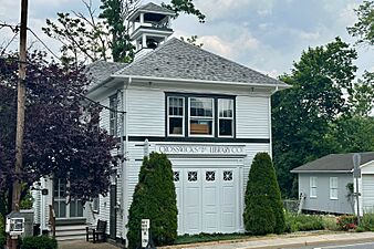
Crosswicks is home to a historic Friends Meeting House, which is a place of worship for Quakers. There's also an old library building that used to be the Crosswicks Fire Department. The fire department moved to its current home in 1968. Their building was originally a schoolhouse built in 1909.
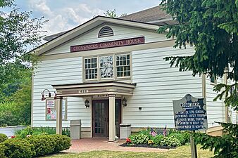
The Crosswicks Community Association hosts a fun event every July. It's a family-style croquet tournament and music festival held on the village green. You can enjoy live music from local bands and grab food from vendors. There are also lawn games for kids to play.
Exploring the Crosswicks Historic District
The Crosswicks Historic District is a special area that covers about 50 acres. It includes parts of Chesterfield-Crosswicks Road, Main Street, Church Street, and Front Street. This district was added to the National Register of Historic Places in 1976. It's important because of its architecture, military history, religious sites, and how it relates to old transportation routes.
Buildings in the Historic District
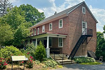
The district has 95 buildings that contribute to its historic value. One of the most important is the Crosswicks Friends Meeting House. This meeting house, also known as the Chesterfield Friends Meeting House, has a long history. The first meeting house was built here in 1692. It was replaced by a larger brick building in 1706. The current building, a two-and-a-half-story brick structure, was built in 1773. It shows a style called Provincial Georgian architecture. Right next to it is the Friends First Day School, which has a similar look.
You can also see the J. M. Bunting House, a three-story building with Italianate architecture. The public library building in the district used to be a fire station.
Where is Crosswicks? Geography Facts
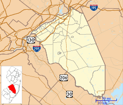
Crosswicks covers an area of about 4.78 square kilometers (1.84 square miles). It sits on the bank of the Crosswicks Creek. This creek flows into the Delaware River. Crosswicks is about 9.1 kilometers (5.7 miles) from Trenton, which is the capital city of New Jersey. It's also about 27 kilometers (17 miles) from Philadelphia.
Crosswicks Population: Demographics
According to the 2020 United States census, the population of Crosswicks was 849 people.
| Historical population | |||
|---|---|---|---|
| Census | Pop. | %± | |
| 2020 | 849 | — | |
| U.S. Decennial Census 2020 |
|||
 | Laphonza Butler |
 | Daisy Bates |
 | Elizabeth Piper Ensley |


