Dalbeg, Queensland facts for kids
Quick facts for kids DalbegQueensland |
|||||||||||||||
|---|---|---|---|---|---|---|---|---|---|---|---|---|---|---|---|

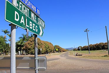
Road signs to Dalberg, 2010
|
|||||||||||||||
| Population | 32 (2021 census) | ||||||||||||||
| • Density | 0.798/km2 (2.07/sq mi) | ||||||||||||||
| Postcode(s) | 4807 | ||||||||||||||
| Area | 40.1 km2 (15.5 sq mi) | ||||||||||||||
| Time zone | AEST (UTC+10:00) | ||||||||||||||
| Location |
|
||||||||||||||
| LGA(s) | Shire of Burdekin | ||||||||||||||
| State electorate(s) | Burdekin | ||||||||||||||
| Federal Division(s) | |||||||||||||||
|
|||||||||||||||
Dalbeg is a small country town in Queensland, Australia. It is located in the Shire of Burdekin. In 2021, only 32 people lived in the Dalbeg area.
Contents
What is Dalbeg Like?
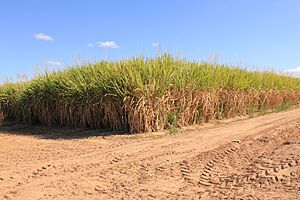
Dalbeg is mostly a farming community. It is located inland from the coastal towns of Ayr and Home Hill. The town sits right by the Burdekin River. This area has very rich soil. Farmers here grow lots of sugar cane and vegetables.
River Crossings in Dalbeg
If you look at some old maps, you might see a road crossing the Burdekin River at Dalbeg. This spot was once a place where people could cross the river. Early explorers used this crossing point. They came from the Gulf region and crossed the river here. Today, you can no longer cross the river at this spot.
A Quick Look at Dalbeg's Past
The area around Dalbeg was first known as Akala. Later, the Queensland Surveyor General changed the name to Dalbeg. This new name came from a large farm area. A farmer named James Hall Scott started this farm in 1863.
Farming and Irrigation
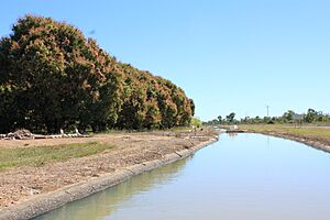
In the early 1950s, a special water system was built in Dalbeg. This system was for irrigation. It helped farmers get water to their crops. The plan was to give irrigated land to soldiers returning from war. These soldiers were called "soldier settlers." They were meant to grow tobacco and rice. However, many settlers chose to grow other crops. They preferred to grow sugarcane, which needs a lot of water.
Dalbeg's Post Office and School
Dalbeg used to have its own Post Office. It opened in 1956 and closed in 1971. There was also a school in Dalbeg. Dalbeg State School opened in 1955. It taught students for many years before closing in 1999. The old school was located on Delpratt Street.
Flying in Dalbeg
Dalbeg was once home to a flying club. It was called the North Queensland Soaring Centre. It was also known as the Burdekin Soaring Club.
Who Lives in Dalbeg?
The number of people living in Dalbeg has changed over time. In 2016, there were 76 people living in the area. By 2021, the population had changed to 32 people.
Learning and Schools
There are no schools in Dalbeg today. The closest primary school is Millaroo State School. It is in the nearby town of Millaroo, to the north. For high school, students have a few choices. They can learn through distance education. This means they study from home. Another option is to go to a boarding school.
 | James Van Der Zee |
 | Alma Thomas |
 | Ellis Wilson |
 | Margaret Taylor-Burroughs |


