Del Rey Oaks, California facts for kids
Quick facts for kids
City of Del Rey Oaks
|
|||
|---|---|---|---|

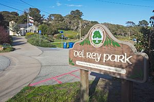
Del Rey Park with the Old Town Hall
|
|||
|
|||

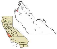
Location in Monterey County, California
|
|||
| Country | United States | ||
| State | California | ||
| County | Monterey | ||
| Incorporated | September 3, 1953 | ||
| Area | |||
| • Total | 1.06 sq mi (2.74 km2) | ||
| • Land | 1.05 sq mi (2.73 km2) | ||
| • Water | 0.00 sq mi (0.01 km2) 0.42% | ||
| Elevation | 82 ft (25 m) | ||
| Population
(2020)
|
|||
| • Total | 1,592 | ||
| • Density | 1,510.44/sq mi (582.95/km2) | ||
| Time zone | UTC−08:00 (PST) | ||
| • Summer (DST) | UTC−07:00 (PDT) | ||
| ZIP Code |
93940
|
||
| Area code | 831 | ||
| FIPS code | 06-18688 | ||
| GNIS feature ID | 1658400 | ||
Del Rey Oaks is a small city in Monterey County, California, United States. Its name, Del Rey, means "Of the King" in Spanish. The city is located just southeast of Seaside. It sits at an elevation of about 82 feet (25 meters) above sea level.
In 2020, about 1,592 people lived in Del Rey Oaks. The city is part of the Association of Monterey Bay Area Governments. This group helps local governments work together in the Monterey Bay area.
Contents
History of Del Rey Oaks
Del Rey Oaks became an official city on September 3, 1953. Before it was incorporated, the town was known by a slightly different name: Del Rey Woods. A post office for Del Rey Oaks opened in 1968.
Geography and Location
Del Rey Oaks is in the northwestern part of Monterey County. It shares its northern border with the city of Seaside. To its west and south, it borders the city of Monterey. Downtown Monterey is about 4 miles (6.4 km) to the west.
Main Roads and Travel
California State Route 218, also called Canyon Del Rey Boulevard, is the main road through Del Rey Oaks. This road connects the city to State Route 1 at Monterey State Beach. It also leads to State Route 68 just outside the city limits. Salinas, which is the main city of Monterey County, is about 15 miles (24 km) northeast of Del Rey Oaks via State Route 68.
City Size and Area
The United States Census Bureau reports that Del Rey Oaks covers a total area of about 1.1 square miles (2.74 square kilometers). Almost all of this area is land, with only a very small part being water.
Climate in Del Rey Oaks
Del Rey Oaks has a type of weather known as a warm-summer Mediterranean climate. This means the summers are warm and dry, but not extremely hot. The average monthly temperatures do not go above 71.6°F (22°C).
Population and People
| Historical population | |||
|---|---|---|---|
| Census | Pop. | %± | |
| 1960 | 1,831 | — | |
| 1970 | 1,823 | −0.4% | |
| 1980 | 1,557 | −14.6% | |
| 1990 | 1,661 | 6.7% | |
| 2000 | 1,650 | −0.7% | |
| 2010 | 1,624 | −1.6% | |
| 2020 | 1,592 | −2.0% | |
| U.S. Decennial Census | |||
Population in 2010
The 2010 United States Census counted 1,624 people living in Del Rey Oaks. Most of the population, about 81.7%, identified as White. About 7.9% were Asian, and 1.0% were African American. People from two or more races made up 5.3% of the population. About 10.4% of the people identified as Hispanic or Latino.
The average household in Del Rey Oaks had about 2.32 people. The median age of residents was 46.2 years. This means half the population was older than 46.2, and half was younger.
Population in 2000
In the 2000 census, Del Rey Oaks had a population of 1,650 people. The racial makeup was similar to 2010, with about 86.36% White residents. About 5.15% were Asian, and 1.58% were Black or African American. About 6.61% of the population identified as Hispanic or Latino.
Parks and Nature
Del Rey Oaks is home to the Frog Pond Wetland Preserve. This is a 17-acre (6.9-hectare) wetland area. It is a popular spot for people who enjoy watching birds.
Media Services
Television service for Del Rey Oaks comes from the Monterey-Salinas-Santa Cruz area. Radio stations also serve this region. The local newspaper for the community is the Monterey County Herald.
See also
 In Spanish: Del Rey Oaks para niños
 | Emma Amos |
 | Edward Mitchell Bannister |
 | Larry D. Alexander |
 | Ernie Barnes |


