
Department of Lambayeque facts for kids
Quick facts for kids
Department of Lambayeque
|
|||
|---|---|---|---|
|
|||
.svg)
Location of the department of Lambayeque in Peru
|
|||
| Country | Peru | ||
| Subdivisions | 3 provinces and 38 districts | ||
| Capital | Chiclayo | ||
| Area | |||
| • Total | 14,231.3 km2 (5,494.7 sq mi) | ||
| Highest elevation | 3,078 m (10,098 ft) | ||
| Lowest elevation | 0 m (0 ft) | ||
| Population
(2017)
|
|||
| • Total | 1,197,260 | ||
| • Density | 84.13/km2 (217.9/sq mi) | ||
| UBIGEO |
14
|
||
| Dialing code | 074 | ||
| ISO 3166 code | PE-LAM | ||
| Principal resources | Rice, sugarcane and fruit | ||
| Poverty rate | 30% | ||
| Percentage of Peru's GDP | 3.89% | ||
| Website | www.regionlambayeque.gob.pe | ||


Lambayeque is a region in northwestern Peru. It is famous for its rich history, especially the ancient Moche and Chimú civilizations. The region gets its name from the old pre-Inca civilization called the Lambayeque.
Lambayeque is the second-smallest region in Peru. However, it is also one of the most crowded and the eighth most populated region in the country.
Contents
What Does Lambayeque Mean?
The name Lambayeque comes from the god Yampellec. People believed that the first Lambayeque king, Naymlap, worshipped this god. The Spanish explorers later gave this name to the local people.
Geography of Lambayeque
The Lambayeque region has many flat plains. Rivers flowing from the Andes mountains water these plains. Farming is only possible in a small part of this dry area, using irrigation systems.
Farming and Water Projects
These fertile river valleys produce half of Peru's sugarcane crop. Also, Lambayeque and the department of Piura grow most of the rice eaten in Peru.
A big project called the Olmos Transandino Project is helping farmers. This project moves water from the Huancabamba River to Lambayeque. This means even more crops can be grown.
Islands and Borders
There are two small islands off the coast of Lambayeque: Lobos de Afuera and Lobos de Tierra.
The Lambayeque region shares borders with other areas:
- To the north: The Piura Region.
- To the southeast: The Cajamarca Region.
- To the south: The La Libertad Region.
- To the west: The Pacific Ocean.
History of Lambayeque
Long ago, a legend says that a group of balsa rafts arrived at the beaches near what is now San José cove. A brave leader named Naymlap led nine foreign warriors. He is known as the mythical founder of the first civilization in this northwestern area.
Ancient Civilizations
The Moche and Chimú people were descendants of Naymlap. The Chimú built a great civilization in Lambayeque before the Inca Empire conquered them. The Chimú were skilled farmers, textile makers, and amazing goldsmiths. They created beautiful gold artworks.
The Inca conquest of Lambayeque took almost 40 years. Three Inca emperors, Pachacuti, Tupac Inca Yupanqui, and Huayna Cápac, ruled during this time.
Spanish Arrival
In the 1500s, the Spanish leader Francisco Pizarro traveled through this region. He was on his way to Cajamarca to defeat the Inca Empire. Pizarro was amazed by the gold he saw in vases and other items.
During the time of Spanish rule, there was a rivalry between the towns of Lambayeque and Santiago de Miraflores de Saña. Saña was very wealthy, which even attracted pirates. However, a big flood in 1720 destroyed Saña, ending its rich history.
The people of Lambayeque fought for independence from Spain. They followed Juan Manuel Iturregui, who spread ideas of freedom and helped get weapons for the cause.
Archaeological Discoveries

In November 2019, archaeologists led by Walter Alva found an ancient temple in the Oyotún district. This temple was about 3,000 years old and 130 feet long. It was a megalithic 'water cult' temple with 21 tombs.
Experts believe the temple was left empty around 250 BC. Later, the Chumy people used it as a burial ground. Twenty of the tombs belonged to the Chumy people. One tomb held an adult male from an even older time, buried with a special ceramic bottle.
Archaeologists found that the temple was built in three main stages:
- The first stage was between 1500 BC and 800 BC. People built the foundations using cone-shaped clay.
- The second stage was between 800 BC and 400 BC. The large stone temple was built, influenced by the Chavin civilization.
- The final stage was between 400 BC and 100 BC. People added round pillars to support the temple's roof.
Political Divisions

The Lambayeque region is divided into 3 provinces. These provinces are then split into 38 districts. The provinces and their capital cities are:
- Chiclayo (Capital: Chiclayo)
- Ferreñafe (Capital: Ferreñafe)
- Lambayeque (Capital: Lambayeque)
Places to Visit
- Pómac Forest Historical Sanctuary
- Tucume Pyramids
Music from Lambayeque
One of the most famous composers from Lambayeque was Luis Abelardo Nuñez. He was born in Ferreñafe on November 22, 1926. His songs are very popular in Peruvian music. Some of his well-known songs include:
- "Marinera norteña"
- Waltz: "Porqué no volverás?"
- Waltz: "Embrujo"
Images for kids
-
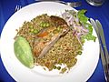
Presentation of a dish of Arroz con pato

See also
 In Spanish: Departamento de Lambayeque para niños
