
Dinosaur, Colorado facts for kids
Quick facts for kids
Dinosaur, Colorado
|
||
|---|---|---|

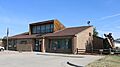
A sign for Tyrannosaurus Trail, a street in Dinosaur
|
||
|
||

Location in Moffat County, Colorado
|
||

Dinosaur, Colorado
Location in the United States

Dinosaur, Colorado
Location in Colorado
|
||
| Country | ||
| State | ||
| County | Moffat County | |
| Incorporated | December 18, 1947 | |
| Named for | Dinosaur National Monument | |
| Government | ||
| • Type | Statutory Town | |
| Area | ||
| • Total | 0.930 sq mi (2.408 km2) | |
| • Land | 0.930 sq mi (2.408 km2) | |
| • Water | 0 sq mi (0.000 km2) | |
| Elevation | 5,922 ft (1,805 m) | |
| Population
(2020)
|
||
| • Total | 243 | |
| • Density | 261/sq mi (101/km2) | |
| • Metro | 13,292 | |
| • CSA | 38,121 | |
| Time zone | UTC−07:00 (MST) | |
| • Summer (DST) | UTC−06:00 (MDT) | |
| ZIP codes |
81610 & 81633
|
|
| Area code(s) | 970 | |
| FIPS code | 08-20495 | |
| GNIS ID | 171542</ref> | |
Dinosaur is a small town in Moffat County, Colorado, United States. It is known as a "Statutory Town," which means it follows certain laws set by the state. In 2020, about 243 people lived there. This town is part of a larger area called the Craig, CO Micropolitan Statistical Area.
History of Dinosaur Town
The town of Dinosaur has had a few different names over the years. It was first called "Baxter Springs." This name came from Art and Fanny Baxter, who owned the land.
Later, the town was renamed "Artesia." This new name was chosen because the area had a valuable water supply. A town was planned here in the 1940s because of an oil boom, which meant a lot of oil was being found.
The Artesia post office opened in 1946. The town officially became a town on December 18, 1947. Then, on January 1, 1966, the town's name changed again to "Dinosaur." This new name was chosen because it is very close to the famous Dinosaur National Monument. The main office for the monument is just east of the town, right on U.S. Highway 40.
Geography of Dinosaur
Dinosaur is located in the western part of Colorado. It sits at about 40 degrees north latitude and 109 degrees west longitude. The town covers an area of about 2.0 square kilometers (or about 0.77 square miles), and all of it is land.
One fun fact about Dinosaur is that many of its streets are named after dinosaurs! You can find streets like Cletisaurus Circle, Tyrannosaurus Trail, and Antrodemus Alley. This helps the town celebrate its connection to the ancient creatures.
People of Dinosaur
| Historical population | |||
|---|---|---|---|
| Census | Pop. | %± | |
| 1950 | 281 | — | |
| 1960 | 318 | 13.2% | |
| 1970 | 247 | −22.3% | |
| 1980 | 313 | 26.7% | |
| 1990 | 324 | 3.5% | |
| 2000 | 314 | −3.1% | |
| 2010 | 339 | 8.0% | |
| 2020 | 243 | −28.3% | |
| U.S. Decennial Census | |||
In the year 2000, there were 320 people living in Dinosaur. These people lived in 124 different homes, and 88 of those homes were families. The population density was about 400 people per square mile.
About 98% of the people in Dinosaur were White. A small number of people were from other racial backgrounds. About 3.76% of the population identified as Hispanic or Latino.
Many homes in Dinosaur had children under 18 living there, about 34.7%. Most homes were married couples living together. Some homes had a single female head of household, and others were made up of individuals or non-families. The average household had about 2.57 people.
The town's population was spread out across different age groups. About 28.5% of the people were under 18 years old. About 11.9% were 65 years or older. The average age in the town was 36 years old.
See also
 In Spanish: Dinosaur (Colorado) para niños
Images for kids
-
Dinosaur Town Hall

