Dolan Springs, Arizona facts for kids
Quick facts for kids
Dolan Springs, Arizona
|
|
|---|---|

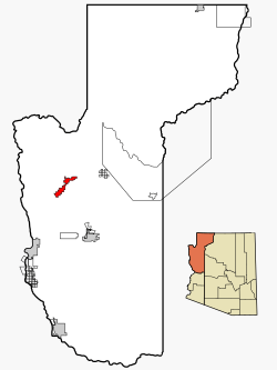
Location in Mohave County and the state of Arizona
|
|
| Country | United States |
| State | Arizona |
| County | Mohave |
| Area | |
| • Total | 58.13 sq mi (150.54 km2) |
| • Land | 58.13 sq mi (150.54 km2) |
| • Water | 0.00 sq mi (0.00 km2) |
| Elevation | 3,400 ft (1,036 m) |
| Population
(2020)
|
|
| • Total | 1,989 |
| • Density | 29.83/sq mi (11.52/km2) |
| Time zone | UTC-7 (MST) |
| ZIP code |
86441
|
| Area code(s) | 928 |
| FIPS code | 04-19630 |
| GNIS feature ID | 25302 |
Dolan Springs is a small community in Mohave County, Arizona, in the United States. It's known as a census-designated place (CDP), which means it's an area with a lot of people but isn't officially a city or town. In 2020, about 1,989 people lived there.
Where is Dolan Springs?
Dolan Springs is located in the northern part of Mohave County. A major road, U.S. Route 93, runs along its western side. The community stretches across a valley called Detrital Valley. It is nestled between the Cerbat Mountains to the south and Table Mountain Plateau to the north.
The center of Dolan Springs is about 6 miles northeast of US 93. This road connects to Kingman, the county seat of Mohave County, about 30 miles southeast. It also goes to Boulder City, Nevada, about 47 miles northwest. The total area of Dolan Springs is about 58.1 square miles, and it's all land.
How Many People Live Here?
| Historical population | |||
|---|---|---|---|
| Census | Pop. | %± | |
| 2000 | 1,867 | — | |
| 2010 | 2,033 | 8.9% | |
| 2020 | 1,734 | −14.7% | |
| U.S. Decennial Census | |||
In 2020, the population of Dolan Springs was 1,734 people. This means there were about 29.8 people living in each square mile. There were 1,320 homes, and about 63.4% of them were lived in.
Most of the people living in Dolan Springs were White (76.7%). Other groups included Black or African American (0.8%), Native American (1.4%), and Asian (0.8%). About 20.1% of the population was Hispanic or Latino.
The average yearly income for a family in Dolan Springs was about $47,821. However, about 41% of the people lived below the poverty line. This included many young people under 18. About 25% of the people had jobs.
Emergency Services
Getting help quickly in an emergency can be difficult in Dolan Springs. The Lake Mohave Ranchos Fire District (LMRFD) has only one ambulance. This ambulance covers a very large area of Mohave County, about 2,200 square miles. It covers a long stretch of US 93, from the Hoover Dam to near Dolan Springs. It also covers areas from the Hualapai Indian reservation to the Nevada Arizona border.
The LMRFD has some volunteer firefighters who help with fires. They also have two paid firefighter EMTs (Emergency Medical Technicians). These EMTs are the first to respond to fires, but they also drive the ambulance. This can sometimes mean they have to choose between responding to a fire or an ambulance call.
US Route 93 in Arizona has been called a very dangerous highway. This road is about 200 miles long. It runs between Wickenburg, Arizona, and the Hoover Dam Bypass Bridge. Many people use this road when driving between Las Vegas and Phoenix. Most serious accidents happen in Mohave County. From 2010 to 2016, there were 70 fatal crashes on this highway.
Recently, changes have been made to the intersection of US 93 and Pierce Ferry Road. Pierce Ferry Road leads to the Grand Canyon West. Also, new truck stops have opened north of Dolan Springs on US 93. These changes have made the highway even more dangerous. Slow-moving trucks entering or crossing US 93 can cause high-speed crashes. In 2022, there were several serious accidents on US 93 near Dolan Springs.
See also
 In Spanish: Dolan Springs para niños
 | Claudette Colvin |
 | Myrlie Evers-Williams |
 | Alberta Odell Jones |


