
Doonside, New South Wales facts for kids
Quick facts for kids DoonsideSydney, New South Wales |
|||||||||||||||
|---|---|---|---|---|---|---|---|---|---|---|---|---|---|---|---|
Kildare_Road_Doonside.jpg)
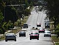
Kildare Road, Doonside
|
|||||||||||||||
| Population | 13,614 (2021 census) | ||||||||||||||
| Established | 1929 | ||||||||||||||
| Postcode(s) | 2767 | ||||||||||||||
| Elevation | 43 m (141 ft) | ||||||||||||||
| Location | 40 km (25 mi) west of Sydney CBD | ||||||||||||||
| LGA(s) | City of Blacktown | ||||||||||||||
| State electorate(s) | Blacktown | ||||||||||||||
| Federal Division(s) | Chifley | ||||||||||||||
|
|||||||||||||||
Doonside is a suburb in Sydney, New South Wales, Australia. It is located about 40 kilometers (25 miles) west of the Sydney central business district. Doonside is part of the City of Blacktown area and the Greater Western Sydney region. Two popular places to visit here are Featherdale Wildlife Park and the Nurragingy Nature Reserve.
Contents
Doonside's Past: A Look at Its History
Traditional Owners and Early Settlers
The Duruk people were the first owners of the land where Doonside is now. They called this area 'Bungarribee'. This name means 'creek' and 'cockatoo'.
In 1802, Governor Philip Gidley King set aside a large area for government animals. For the next 20 years, convicts looked after cattle and sheep here. In 1822, Governor Thomas Brisbane gave some of this land to Robert Crawford, a Scottish immigrant. He first called his 1,000-acre (4 km²) property "Milton". Later, he renamed it "Hill End".
In 1826, John Crawford bought land next to Hill End. He named his land Doonside. Over time, the whole area became known as Doonside.
The Crawford Family's Legacy
Robert James Crawford (1799–1848) had four children with Mary Campbell. Their names were Mary, Robert, George, and Agnes. Today, these names are used for the sports teams at Crawford Public School.
Robert Crawford (1827–1906) also had a son named Robert (1868–1930). This younger Robert became a well-known poet.
Bungarribee House: A Lost Landmark
.jpg)
In 1822, John Campbell, a Scottish settler, was given land south of Hill End. This land included Bungarribee House.
Over the years, many different people owned or rented the house. In 1949, the Commonwealth Overseas Telecommunications Commission (O.T.C.) bought it. The National Trust tried to save the house, but they couldn't agree on terms. A local historian even offered to fix it up, but the O.T.C. said no. Sadly, the house was pulled down in 1958.
Doonside Railway Station: Connecting the Community
The railway line reached Rooty Hill in 1861. At first, there was no official station in Doonside, just a rail siding called Crawford siding. Doonside Railway Station officially opened on 27 September 1880.
Electric trains started running to Doonside in 1955. Edith Crawford, a member of the founding family and the oldest person living there, cut the ribbon for the new electric service. She passed away in 1956.
Back in 1913, the station platforms were dark. Passengers had to signal the train driver if they wanted the train to stop. Toilets were added to the platform in 1922. The station buildings were updated in 1955.
The Name Change to Wolkara
For a short time in 1921, Doonside was called 'Wolkara'. This was an Aboriginal name. The new railway station and post office were also called Wolkara. However, local residents protested the name change. So, in April 1929, the name was changed back to Doonside.
Life in Doonside Around World War I
Before 1916, only the Crawford family lived in Doonside. Their home was on the south side of the railway line. Other family members also had houses nearby. A brick cottage owned by the Luparno family was on the north side.
The only main road into Doonside was Doonside Road. Other roads were rough tracks. There was no electricity until 1929. Water came from wells. Bread and meat were delivered by horse-drawn carts. People had to take the train to Blacktown for shops. The closest high schools were in Parramatta and Penrith.
A small store and post office opened in 1926. It was run by Bill Francis. His nephew, Jack Francis, later ran the post office on the other side of the railway line. It moved back to its original spot in 1987.
How Doonside Grew Over Time
In 1912, a large part of the Bungarribee estate was divided into smaller lots. In 1919, land south of the station was set aside for soldiers returning from war.
In 1923, the first major land sales happened. The "Doonside Station Estate" was advertised for people wanting to build homes or businesses. This area stretched from the station north to Power Street. The Crawford Estate was also divided up in 1931 and again in the 1970s.
After a tile factory (PGH) closed, the suburb of Woodcroft was built on its site in the early 1990s. The suburb of Bungarribee was developed in the 2000s.
Heritage Sites in Doonside
Doonside has some important historical places. These include:
- Doonside Road: Bungarribee Homestead Site
People Living in Doonside
In 2021, Doonside had a population of 13,614 people. About 4.7% of the people were Aboriginal and Torres Strait Islander.
Many homes in Doonside are rented (43.6%). About 21.6% of homes are owned outright, and 30.6% are being bought. The average household income was $1,340 per week. The most common job for people was working in hospitals.
About 48.1% of people were born in Australia. Other common birthplaces include the Philippines (10.5%), India (6.5%), and Fiji (3.3%). Many people speak English at home (47.2%). Other languages spoken include Tagalog, Arabic, and Hindi. The most common religions are Catholic, No Religion, and Hinduism.
Famous People from Doonside
Some well-known people who have lived in Doonside include:
- Josh Addo-Carr, a rugby league player
- Robert Crawford (1868–1930), a poet
- Hooligan Hefs, a rapper
- Craig Moore, a soccer player
- Mark Winterbottom, a race car driver
Getting Around Doonside: Transport
Doonside railway station is on the Main Western railway line. This makes it easy to travel by train. The Great Western Highway runs along the southern edge of Doonside. The M4 (Sydney) motorway is also very close by.
Busways offers several bus services in Doonside:
- Route 753 goes from Doonside station to Blacktown station.
- Routes 725/726 also go from Doonside to Blacktown station.
- Route 756 travels from Blacktown to Mount Druitt. It passes through northern Doonside and connects to suburbs like Woodcroft and Rooty Hill.
Schools in Doonside
Doonside has several schools for students of all ages.
- Doonside Public School (primary school)
- Crawford Public School (primary school)
- Doonside Technology High School (high school)
- Mountain View Adventist College (Kindergarten to Year 12)
- St John Vianneys Primary School (Catholic primary school)
Doonside Public School's Journey
A small "Provisional" school opened in 1903 but closed quickly. It reopened in 1911 for two years. Doonside Primary School officially opened on 22 November 1937.
People first asked for a school in 1934, but it was denied. They tried again in 1935, but it was still declined. Finally, approval was given on 14 July 1936. The school building cost 1,850 pounds. Mr. Oscar Swanson was the first teacher.
When it opened, 53 students enrolled. By 1939, there were 94 students. The number grew to 202 by 1956 and 600 by 1962. This growth was because new homes and estates were being built in the area.
Doonside Technology High School
This high school opened in 1964 as Doonside High School. It became a Technology High School in 1989.
Crawford Public School
Crawford Public School opened in 1977.
St John Vianneys Primary School
St John Vianneys Primary School opened in 1986.
Fun and Recreation in Doonside
Doonside offers many places for fun and sports.
Nurragingy Reserve is on the western side of Doonside. It's a large park with picnic areas and natural bushland. It became a nature reserve in 1981. It was named after Nurragingy, a Darug man who received land in the Blacktown area in 1819.
Just south of the railway line is Featherdale Wildlife Park. This is a private zoo that opened in 1953. It specializes in Australian native animals and birds. You can see many different species there.
Across the railway line from Nurragingy is Kareela Reserve. This is a sports complex. It's home to local sports teams like the Doonside Roos rugby league team, Doonside Cricket Club, and Doonside Little Athletics. The Doonside Hawks soccer club plays in nearby Glendenning. The Doonside Diamonds Netball Club plays in Blacktown. All these clubs use maroon and white as their team colors.
Doonside Junior Rugby League Club
The Doonside Roos rugby league club started in 1967. Their first games were played in 1968 at Doonside High School's oval. Later, they moved to their permanent home ground, Kareela Reserve. The club won its first championship in 1971.
Doonside Cricket Club
Doonside Cricket Club was formed in 1975. They play their games at Kareela Reserve.
Doonside Hawks Soccer Club
The soccer club started in 1981. Their first home ground was not ready in time, so they played at Mt Druitt Sports Centre. Today, their home ground is Glendenning Reserve.
Featherdale Wildlife Park
Featherdale Wildlife Park is a wildlife park and zoo in Doonside. It covers 3.29 hectares (about 8 acres). It has over 260 different kinds of animals and birds. You can also have interactive experiences with some of the animals.
Images for kids
-
Kildare Road, Doonside
-
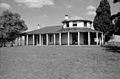
Bungarribee Homestead, 1954 Doonside
