Drillham, Queensland facts for kids
Quick facts for kids DrillhamQueensland |
|||||||||||||||
|---|---|---|---|---|---|---|---|---|---|---|---|---|---|---|---|

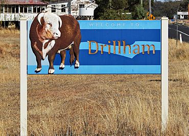
Welcome to Drillham sign, 2019
|
|||||||||||||||
| Population | 113 (2021 census) | ||||||||||||||
| • Density | 0.3139/km2 (0.813/sq mi) | ||||||||||||||
| Postcode(s) | 4424 | ||||||||||||||
| Area | 360.0 km2 (139.0 sq mi) | ||||||||||||||
| Time zone | AEST (UTC+10:00) | ||||||||||||||
| Location | |||||||||||||||
| LGA(s) | Western Downs Region | ||||||||||||||
| State electorate(s) | Callide | ||||||||||||||
| Federal Division(s) | Maranoa | ||||||||||||||
|
|||||||||||||||
Drillham is a small country town in the Western Downs Region of Queensland, Australia. It's also the name of the area around the town. In 2021, about 113 people lived in the Drillham area.
Contents
Where is Drillham?
Drillham is located in a region called the Darling Downs. It sits right on the Warrego Highway. This highway is a major road connecting places in Queensland. The town is about 358 kilometers (222 miles) north-west of Brisbane, which is the capital city of Queensland.
The Western railway line also runs through Drillham. This railway helps transport goods and people. The main train station serving the town is called Drillham railway station.
Drillham's Past
How Drillham Started
Drillham began as a place for three large farms called pastoral stations. These were Dulacca, Binbian, and Wallan Creek. The town itself was officially started in 1878. It grew because of the railway line being built. Workers who were building a bridge over Drillham Creek had a camp here.
The town and the creek were first called 'Delerium'. This unusual name came from a sickness called typhoid fever that affected the workers' camp. The Drillham Post Office opened in 1910, making it easier for people to send and receive mail.
School Days in Drillham
Drillham Provisional School first opened its doors on August 28, 1899. A "provisional" school is usually a smaller, temporary school. It became a full "State School" on January 1, 1909. This meant it was a permanent school run by the government.
A Historical Marker
On January 15, 1893, a sad event happened at Drillham Creek. Four children from the Roehrig family passed away in an accident in the creek. Their names were Matilda, Isabella, Charles, and Jane. News of this event was shared in newspapers across Australia.
Today, there is a special monument near the creek, by the Warrego Highway. It has a plaque that remembers the children. The Miles and District Historical Society placed this plaque there on July 23, 1966. It helps people remember this part of Drillham's history.
People of Drillham
The number of people living in Drillham has changed over the years.
- In 2011, about 217 people lived in the Drillham area.
- By 2016, the population was around 126 people.
- In the most recent count in 2021, 113 people called Drillham home.
What Drillham Does
Drillham is an important place for farming. The main activities in the area are:
- Raising livestock: This means farming animals like cattle for meat or other products.
- Growing grains: Farmers here grow crops like wheat or barley.
Learning in Drillham
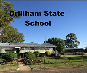
Drillham State School is the local primary school. It teaches students from Prep (the first year of school) up to Year 6. It's located at 13 Jardine Street. In 2018, the school had 33 students and a team of teachers and staff.
If students want to go to high school, they usually travel to Miles State High School. Miles is a nearby town located to the east of Drillham.
 | Emma Amos |
 | Edward Mitchell Bannister |
 | Larry D. Alexander |
 | Ernie Barnes |


