
Duboistown, Pennsylvania facts for kids
Quick facts for kids
Duboistown, Pennsylvania
|
|
|---|---|
|
Borough
|
|

Euclid Avenue in Duboistown
|
|

Location of Duboistown in Lycoming County, Pennsylvania.
|
|

Map of Pennsylvania highlighting Lycoming County
|
|
| Country | United States |
| State | Pennsylvania |
| County | Lycoming |
| Settled | 1773 |
| Laid out | 1852 |
| Incorporated | 1878 |
| Area | |
| • Total | 0.68 sq mi (1.76 km2) |
| • Land | 0.55 sq mi (1.43 km2) |
| • Water | 0.13 sq mi (0.33 km2) |
| Elevation
(center of borough)
|
580 ft (180 m) |
| Highest elevation
(southwestern boundary of borough)
|
940 ft (290 m) |
| Lowest elevation
(West Branch Susquehanna River)
|
510 ft (160 m) |
| Population
(2020)
|
|
| • Total | 1,200 |
| • Density | 2,173.91/sq mi (838.85/km2) |
| Time zone | UTC-5 (Eastern (EST)) |
| • Summer (DST) | UTC-4 (EDT) |
| ZIP code |
17702
|
| Area code(s) | 570 |
| FIPS code | 42-20144 |
| GNIS feature ID | 1192377 |
Duboistown is a small town, called a "borough," in Pennsylvania, USA. It's located in Lycoming County. In 2020, about 1,198 people lived there. It's part of the larger Williamsport area.
Contents
History of Duboistown
Duboistown (say it 'doo-BOYS town') gets its name from brothers John and Mathias DuBois. They bought a lot of land (about 489 acres or 1.98 square kilometers) between 1852 and 1857. The brothers split their land into smaller pieces. This is how the town, named after them, started. John DuBois later left the area. He sold his businesses and moved away. He became very rich, and another city, DuBois, was named after him too!
Early Settlements and Native Americans
Even before the DuBois brothers, this area had a long history. Duboistown is located where Mosquito Run meets the West Branch Susquehanna River. A tribe of Susquehannock Native Americans had a large village here. Early European settlers found signs of this old village. Archaeologists have found old pottery, tools, and ornaments in the area. This land is across the river from Lycoming Creek. It is also near where the Sheshequin Path, an old Native American trail, crossed the river.
Walnut Bottom and First Settlers
The land where Duboistown now stands was first mapped in 1769. Back then, it was called "Walnut Bottom." This was because of the many black walnut trees growing on the flat land. Samuel Boone, who was a cousin of the famous Daniel Boone, was the first to own land here.
Andrew Culbertson was one of the first successful settlers in the Duboistown area. He started buying land in 1773, including Samuel Boone's plot. Culbertson likely arrived by following an old Native American trail over White Deer Mountain. This trail is now called Culbertson's Path.
Soon after arriving, Culbertson built a sawmill where the creek met the river. He lived there for several years.
The American Revolutionary War and the Big Runaway
During the American Revolutionary War, settlers in the Susquehanna valley faced attacks. These attacks came from Loyalists (people loyal to Britain) and their Native American allies. After a big battle in 1778, many settlers fled. This event was called the "Big Runaway." People left their homes and farms. They moved their animals south and floated their belongings down the river to Sunbury. Their empty homes were often burned.
Some settlers came back, but then had to flee again in 1779. This was called the "Little Runaway."
Culbertson's Mills and Tavern
Andrew Culbertson returned to the area after the war. He rebuilt his sawmill. He also built a gristmill (for grinding grain), a distillery, and a press for making oils. His gristmill was very important for the area. Farmers could easily bring their grain by canoe right to the mill. Other farmers used Culbertson's Path to reach it.
Culbertson also saw another chance to help the farmers. He built a tavern where they could eat and drink while waiting for their grain. This tavern became a popular spot for young people in the valley. Today, Culbertson's mill and tavern are gone. The area is now mostly overgrown riverbank.
Candy Cane Lane
Each December, the 200 block of Summer Street in Duboistown is decorated for Christmas. It is known as Candy Cane Lane. In 2007, the mayor officially declared December as "Candy Cane Lane month forever more in DuBoistown."
Geography of Duboistown
Duboistown is located at 41°13′31″N 77°2′6″W / 41.22528°N 77.03500°W. It is next to South Williamsport to the east. Armstrong Township is to the south and west. The West Branch Susquehanna River is to the north, with Williamsport on the other side of the river.
Duboistown is about 130 miles (209 kilometers) northwest of Philadelphia. It is also about 165 miles (266 kilometers) east-northeast of Pittsburgh.
The borough covers a total area of about 0.6 square miles (1.6 square kilometers). Most of this is land, but about 0.1 square miles (0.3 square kilometers) is water.
Population and People
| Historical population | |||
|---|---|---|---|
| Census | Pop. | %± | |
| 1880 | 662 | — | |
| 1890 | 697 | 5.3% | |
| 1900 | 650 | −6.7% | |
| 1910 | 682 | 4.9% | |
| 1920 | 756 | 10.9% | |
| 1930 | 1,049 | 38.8% | |
| 1940 | 1,047 | −0.2% | |
| 1950 | 1,140 | 8.9% | |
| 1960 | 1,358 | 19.1% | |
| 1970 | 1,468 | 8.1% | |
| 1980 | 1,218 | −17.0% | |
| 1990 | 1,201 | −1.4% | |
| 2000 | 1,280 | 6.6% | |
| 2010 | 1,205 | −5.9% | |
| 2020 | 1,198 | −0.6% | |
| 2021 (est.) | 1,191 | −1.2% | |
| Sources: | |||
In 2000, there were 1,280 people living in Duboistown. There were 540 households and 372 families. The population density was about 2,293 people per square mile (885 people per square kilometer).
Most people in Duboistown were White (98.67%). A small number were African American, Native American, Asian, or Pacific Islander. Some people were of two or more races. Less than 1% were Hispanic or Latino.
About 28% of households had children under 18. Most households (58.5%) were married couples. About 27% of households were single people. About 14% of people living alone were 65 or older.
The average household had 2.36 people. The average family had 2.87 people.
The population was spread out by age:
- 22.7% were under 18
- 6.3% were 18 to 24
- 27.2% were 25 to 44
- 22.8% were 45 to 64
- 20.9% were 65 or older
The average age was 41 years. For every 100 females, there were about 93.6 males.
The median income for a household was $35,132. For a family, it was $41,450. About 5.3% of the population lived below the poverty line. This included 3.5% of those under 18.
Images for kids
-
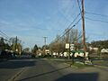
Euclid Avenue in Duboistown
-

Location of Duboistown in Lycoming County, Pennsylvania.
-
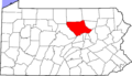
Map of Pennsylvania highlighting Lycoming County
See also
 In Spanish: Duboistown para niños
