Dunnose, Isle of Wight facts for kids
Quick facts for kids Dunnose |
|
|---|---|
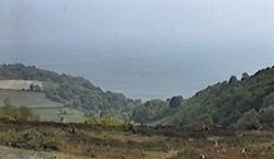
 Luccombe Down - The view over Dunnose |
|
| Unitary authority | |
| Ceremonial county | |
| Region | |
| Country | England |
| Sovereign state | United Kingdom |
| EU Parliament | South East England |
| UK Parliament |
|
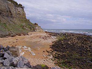
Dunnose is a special cape found on the Isle of Wight. This island is located in the English Channel. A cape is a piece of land that sticks out into the sea.
Dunnose is easy to spot from far out at sea. Sailors often use it as a landmark to help them navigate their ships. This headland has also been very important for mapping Great Britain.
Contents
Where is Dunnose?
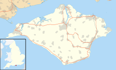
Dunnose Point is located on the eastern side of the Isle of Wight. It is just east of the town of Ventnor. You can get there by following the A3055 road.
The area around Dunnose can be a bit tricky for boats. The sea floor between Dunnose and St Catherine's Point is very rocky. Some of these rocks might not even show up on sea maps. This means sailors need to be extra careful when passing by.
Local Legends and History
Some people say that HMS Eurydice haunts the waters near Dunnose. This ship was a Royal Navy training vessel. It sadly sank off the point on March 24, 1878. Many lives were lost in this tragic event.
Dunnose: A Key Mapping Point
Dunnose has played a huge role in creating accurate maps of Great Britain. It was used as a starting point for a process called "triangulation."
What is Triangulation?
Triangulation is a way to measure distances and positions on a large scale. Imagine you have three points that form a triangle. If you know the length of one side and the angles, you can figure out the other sides and angles. Mapmakers use this idea to create very precise maps.
The Great British Survey
Around the year 1800, Dunnose became a main base point for mapping Great Britain. A man named Captain William Mudge led this important work. He measured a long line stretching north from Dunnose into Yorkshire. This line helped mapmakers figure out the exact positions of many places across the country.
The first major survey using Dunnose happened in 1801 and 1802. Mapmakers carefully measured 23 points between Dunnose and a place called Beacon Hill near Doncaster. They wanted to be as accurate as possible.
Later, in 1812, some questions were raised about the accuracy of these early measurements. However, Dunnose was chosen again as a base point when the "Retriangulation of Great Britain" began in 1935. This shows how important Dunnose was for mapping the country.
Ordnance Survey Maps
Dunnose was also the starting point for some very detailed maps. These were the 6-inch and 1:2500 scale maps made by the Ordnance Survey. These maps covered many central English counties, including the Isle of Wight itself.
 | Dorothy Vaughan |
 | Charles Henry Turner |
 | Hildrus Poindexter |
 | Henry Cecil McBay |


