Dyer, Indiana facts for kids
Quick facts for kids
Dyer, Indiana
|
|||
|---|---|---|---|
 |
|||
|
|||
| Motto(s):
Striving Higher in Dyer
|
|||

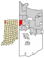
Location of Dyer in Lake County, Indiana.
|
|||
| Country | |||
| State | |||
| County | Lake | ||
| Township | St. John | ||
| Settled | 1838 | ||
| Incorporated | January 24, 1910 | ||
| Government | |||
| • Type | Town | ||
| • Body | Town Council | ||
| Area | |||
| • Total | 6.18 sq mi (16.00 km2) | ||
| • Land | 6.18 sq mi (16.00 km2) | ||
| • Water | 0.00 sq mi (0.00 km2) | ||
| Elevation | 663 ft (202 m) | ||
| Population
(2020)
|
|||
| • Total | 16,517 | ||
| • Density | 2,673.09/sq mi (1,032.10/km2) | ||
| Standard of living (2008-12) | |||
| Time zone | UTC-6 (Central) | ||
| • Summer (DST) | UTC-5 (Central) | ||
| ZIP code |
46311
|
||
| Area code | 219 | ||
| FIPS code | 18-19270 | ||
| GNIS feature ID | 2396914 | ||
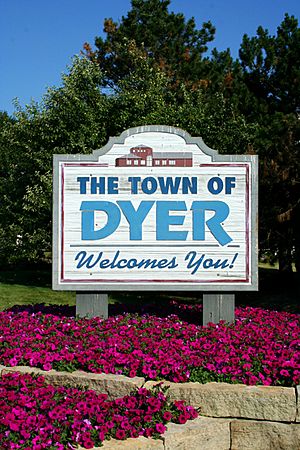
Dyer (pronounced DY-ər) is a town located in Lake County, Indiana, United States. It is part of St. John Township. In 2020, about 16,517 people lived there. Dyer is a suburb southeast of Chicago, a major city.
Contents
Where is Dyer Located?
Dyer is located in the northwest part of Indiana. It shares borders with several other towns. To the north, you'll find Munster. To the south, there's unincorporated St. John Township. Schererville is to the east. To the west, Dyer borders Lynwood and Sauk Village, which are both in Illinois. The state line between Indiana and Illinois forms Dyer's entire western edge.
Dyer is about 30 miles (48 km) from downtown Chicago. One of its neighborhoods, Briar Ridge, is so big it stretches into both Dyer and Schererville. The land in Dyer is mostly flat. However, there is a steep sand ridge south of US Highway 30. This ridge is known as the Glenwood Shoreline. It was formed by an ancient lake. The town covers a total area of about 6.1 square miles (16 square kilometers), all of which is land.
Dyer's Population Over Time
| Historical population | |||
|---|---|---|---|
| Census | Pop. | %± | |
| 1910 | 545 | — | |
| 1920 | 479 | −12.1% | |
| 1930 | 672 | 40.3% | |
| 1940 | 976 | 45.2% | |
| 1950 | 1,556 | 59.4% | |
| 1960 | 3,993 | 156.6% | |
| 1970 | 4,906 | 22.9% | |
| 1980 | 9,555 | 94.8% | |
| 1990 | 10,923 | 14.3% | |
| 2000 | 13,895 | 27.2% | |
| 2010 | 16,390 | 18.0% | |
| 2020 | 16,517 | 0.8% | |
| Source: | |||
Dyer has grown a lot over the years. In 1910, only 545 people lived there. By 2020, the population had grown to 16,517. This shows how much the town has developed.
Who Lives in Dyer? (2010 Census)
In 2010, there were 16,390 people living in Dyer. There were 5,985 households, which are groups of people living together. Most people in Dyer were White (90.1%). Other groups included African American (2.5%), Asian (2.9%), and Native American (0.2%). About 9.3% of the population identified as Hispanic or Latino.
The average age in Dyer was about 42.9 years old. About 23.1% of the people were under 18. About 15.5% were 65 years old or older. There were slightly more females (51.6%) than males (48.4%) living in the town.
Dyer's History
The first permanent European settlers arrived in Northwest Indiana around 1830. The earliest records for Dyer itself go back to 1838. The town's original layout was officially set on June 1, 1855.
A man named Aaron Norton Hart was very important in building up Dyer in the 1860s and 1870s. He came from Philadelphia, Pennsylvania. Hart helped build roads and created a system of drainage ditches. This was important because it helped turn the marshy land into useful areas for farming and businesses. Sadly, Hart died in 1883 while working on a ditch. One of Dyer's main streets, Hart Street, is named after him. The town of Dyer itself is named after his wife, Martha Dyer Hart.
Dyer officially became a town under Indiana law on February 8, 1910. When it became a town, it was divided into three sections called wards.
Meyer's Castle, a notable building in Dyer, was added to the National Register of Historic Places in 1984.
Getting Around Dyer
Roads
The main road that goes through Dyer is U.S. Route 30/Lincoln Highway. It runs from east to west. A special 1.3-mile (2.1 km) part of this road, shared with Schererville, was built in the early 1920s. It was called an "Ideal Section" of the Lincoln Highway. This section is still used today.
Train Service (Amtrak)
Dyer has a train station served by Amtrak, which is the national passenger rail system. The Dyer Amtrak Station is a stop for the Cardinal train. This train can take you to Chicago Union Station or all the way to New York Penn Station, passing through Washington Union Station.
Schools in Dyer
Dyer is part of the Lake Central School Corporation. Students who live in Dyer and attend public high school go to Lake Central High School. This high school is located in St. John, Indiana.
Three schools within the Lake Central School Corporation are actually located inside Dyer:
- Kahler Middle School
- Protsman Elementary School
- Bibich Elementary School
There are also private schools in Dyer, including Protestant Reformed Christian School and Illiana Christian High School. A special school for religious studies, Mid-America Reformed Seminary, is also located in Dyer.
Sports in Dyer
Dyer used to be home to a professional ice hockey team called the Chi-Town Shooters. They were part of the All American Hockey League. The team played their games at the Midwest Training & Ice Center in Dyer.
See also
 In Spanish: Dyer (Indiana) para niños


