Edmonston, Maryland facts for kids
Quick facts for kids
Edmonston, Maryland
|
|||
|---|---|---|---|
|
|||

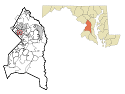
Location of Edmonston, Maryland
|
|||
| Country | |||
| State | |||
| County | |||
| Incorporated | 1924 | ||
| Area | |||
| • Total | 0.42 sq mi (1.09 km2) | ||
| • Land | 0.41 sq mi (1.06 km2) | ||
| • Water | 0.01 sq mi (0.03 km2) | ||
| Elevation | 20 ft (6 m) | ||
| Population
(2020)
|
|||
| • Total | 1,617 | ||
| • Density | 3,963.24/sq mi (1,528.66/km2) | ||
| Time zone | UTC-5 (Eastern (EST)) | ||
| • Summer (DST) | UTC-4 (EDT) | ||
| ZIP code |
20781
|
||
| Area code(s) | 301, 240 | ||
| FIPS code | 24-25425 | ||
| GNIS feature ID | 0597374 | ||
Edmonston is a small town located in Prince George's County, Maryland, in the United States. In 2020, about 1,617 people lived there. It's only about 2.5 miles (4.0 km) away from Washington, D.C.. The town's ZIP code is 20781.
Contents
How the Town Got Its Name
The town of Edmonston likely got its name from Edmonston Road. The road itself was named for the Edmonston family, who owned a lot of land in the area long ago.
Exploring Edmonston's Past
Early Settlers and Community Beginnings
Adam Francis Plummer and his wife Emily Saunders Arnold Plummer were among the first modern settlers. They had lived and worked on the Riversdale Plantation. After the American Civil War, Adam Plummer bought ten acres of land. He worked hard to reunite his family members. He named his new settlement Mt. Rose. This was after his favorite plant, the rose. Adam Plummer was a talented gardener. He also kept a diary during his life. This diary is now a special exhibit. You can see it at the Smithsonian Institution's Anacostia Community Museum.
Two neighborhoods that later became part of Edmonston were planned in 1903. These were called East Hyattsville and Palestine. Many houses were built in these areas. Some of these early homes are still standing today.
Developing Town Services
In the late 1800s, a pumping station in the Palestine area supplied water to Hyattsville. Later, the Washington Suburban Sanitary Commission took over these operations. The first school for the future town of Edmonston was also in Palestine. It was built in 1915.
After World War I, people in East Hyattsville and Palestine wanted better services. They decided to form their own town. In 1924, they officially became the town of Edmonston. They chose this name to have their own identity. At that time, there were a few stores and a post office. Today, only a small grocery store remains. The new town quickly worked on paving streets and adding lights. They also built a concrete bridge over the Anacostia River. They arranged for water and sewer pipes to be installed.
A Unique Mayor in Edmonston's History
In 1927, Kinjiro Matsudaira became the mayor of Edmonston. He was the grandson of an important Japanese family. His election was big news at the time. He was elected mayor again in 1943, during World War II. His father, Tadaatsu, came to the United States to study. He became a successful engineer.
Growth and Modern Challenges
After 1925, more homes were built in Edmonston. A developer named Robert Funkhouser built many small houses. After World War II, a new neighborhood called Edmonston Terrace was built. It had many similar brick houses.
From 2003 to 2006, Edmonston faced problems with floods. The town worked to get a new, modern flood pumping station. This new station cost $6 million. It uses three large Archimedes' screws. This is a special technology to pump water. It's rarely used on such a big scale in the United States.
Edmonston's Green Street Project
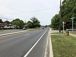
In November 2009, Edmonston started a special project called the "Green Street." This project finished in November 2010. It gained national attention for its new ideas. It combined low impact development with complete street principles.
The Green Street has many cool features:
- LED streetlights that save energy.
- A green power purchase agreement for electricity.
- Elevated crosswalks for safety.
- Traffic calming bump-out raingardens.
- Permeable pavement bike lanes.
These features help capture almost all stormwater runoff. This project has won many awards. It also inspired other towns to adopt similar green street policies.
Neighboring Communities
Edmonston is close to several other towns:
- Bladensburg (to the southeast)
- Riverdale Park (to the north)
- Hyattsville (to the northwest)
Edmonston's Geography
Edmonston is located at 38°57′3″N 76°56′0″W / 38.95083°N 76.93333°W (38.950793, -76.933423). The town covers an area of about 0.40 square miles (1.04 km2). Most of this area is land, with a small part being water.
Population Trends
| Historical population | |||
|---|---|---|---|
| Census | Pop. | %± | |
| 1930 | 717 | — | |
| 1940 | 934 | 30.3% | |
| 1950 | 1,190 | 27.4% | |
| 1960 | 1,197 | 0.6% | |
| 1970 | 1,441 | 20.4% | |
| 1980 | 1,109 | −23.0% | |
| 1990 | 851 | −23.3% | |
| 2000 | 959 | 12.7% | |
| 2010 | 1,445 | 50.7% | |
| 2020 | 1,617 | 11.9% | |
| U.S. Decennial Census | |||
The table above shows how Edmonston's population has changed over the years. In 2010, there were 1,445 people living in the town. The population grew to 1,617 by 2020.
Getting Around Edmonston
The main state highway in Edmonston is Maryland Route 201, also known as Kenilworth Avenue. This road goes south to Washington, D.C.. It also goes north to Interstate 95 and Interstate 495, which is a big highway loop called the Capital Beltway.
Schools in Edmonston
Students in Edmonston attend Prince George's County Public Schools. Here are some of the schools that serve the town:
Elementary Schools
- Riverdale Elementary
- Rogers Heights Elementary School
Middle Schools
- William Wirt Middle School
- Hyattsville Middle School
High School
- Bladensburg High School is the high school for Edmonston students.
See also
 In Spanish: Edmonston para niños


