Edmundston facts for kids
Quick facts for kids
Edmundston
|
||
|---|---|---|
|
City
|
||
 |
||
|
||
| Lua error in Module:Location_map at line 416: Malformed coordinates value. | ||
| Country | Canada | |
| Province | New Brunswick | |
| County | Madawaska | |
| Parish | Madawaska | |
| Established | 1850 | |
| City | April 1, 1952 | |
| Electoral Districts Federal |
Madawaska—Restigouche |
|
| Provincial | Edmundston-Madawaska Centre Madawaska Les Lacs-Edmundston |
|
| Government | ||
| • Type | City Council | |
| Area | ||
| • Land | 106.84 km2 (41.25 sq mi) | |
| • Urban | 17.88 km2 (6.90 sq mi) | |
| • Metro | 1,582.36 km2 (610.95 sq mi) | |
| Highest elevation | 264 m (866 ft) | |
| Lowest elevation | 151 m (495 ft) | |
| Population
(2021)
|
||
| • City | 16,437 | |
| • Density | 153.8/km2 (398/sq mi) | |
| • Metro | 21,154 | |
| • Metro density | 14.0/km2 (36/sq mi) | |
| • Change 2016–21 | ||
| Time zone | UTC-4 (AST) | |
| • Summer (DST) | UTC-3 (ADT) | |
| Postal code(s) |
E3V, E7B
|
|
| Area code(s) |
506
Area exchanges:
253, 733, 735, 736, 737, 739, 740 |
|
| Dwellings | 8,051 | |
| Median Income* | $51,435 CDN | |
| NTS Map | 21N8 Edmundston | |
| GNBC Code | DALZZ | |
Edmundston is a city in New Brunswick, Canada. It was started in 1850. In 2021, about 16,437 people lived there.
On January 1, 2023, Edmundston joined with the village of Rivière-Verte and some other areas. This made the city bigger.
Contents
History of Edmundston
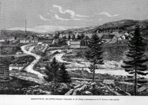
Long ago, this area was a meeting spot for the Maliseet (Wolastoqiyik) Nation. They used it during their travels. Later, a large Maliseet village grew near the waterfalls. This was where the Madawaska and Saint John Rivers meet. Today, the city of Edmundston surrounds a special area for the Maliseet First Nation.
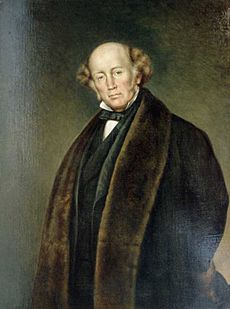
The settlement was first called Petit-Sault, meaning "Little Falls." This name came from the waterfalls where the Madawaska River flows into the Saint John River. In 1851, it was renamed Edmundston. This was to honor Sir Edmund Walker Head. He was an important leader in New Brunswick and Canada.
Edmundston started as a small place for logging. It grew because of its great location.
The "Republic of Madawaska"
The Edmundston area was important during the Aroostook War in 1839. This was a disagreement about borders between the U.S.A. and British North America. A small fort was built here in case of an attack.
A man named John Baker was a key figure in this conflict. He had sawmills on the Saint John River. When the border treaty was signed, his land ended up on the British side. John Baker didn't want to move or accept British rule. So, he declared his area an independent state. He called it the "Republic of Madawaska." He became its leader.
This "Republic" was never officially recognized. But it is still very popular with the local French-speaking people. They call themselves Brayons. Even today, the mayor of Edmundston is called the "President of the Republic of Madawaska." John Baker's wife, Sophie Rice, designed the Republic's "eagle" flag. You can still see this flag in the area.
How Edmundston Grew
In 1998, Edmundston joined with three nearby towns. These were Saint-Basile, Saint-Jacques, and Verret. This made Edmundston a larger city. In 2023, it grew even more. It added Rivière-Verte and other local areas.
Geography of Edmundston
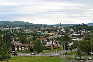
Edmundston is located in the northwestern part of New Brunswick. It sits where the Saint John and Madawaska Rivers meet.
The city is very close to the border with Quebec. It also borders the United States, right across from Madawaska, Maine. A bridge connects Edmundston to Madawaska.
People of Edmundston
In 2021, Edmundston had a population of 16,437 people. The city is mostly French-speaking. About 95% of the people speak French as their first language. This is the highest percentage in any city in New Brunswick.
Edmundston is one of the largest French-speaking cities outside of Quebec in North America. Many people here can also speak English.
Languages Spoken
Most people in Edmundston speak French.
| Language | Population | Pct (%) |
|---|---|---|
| French only | 15,215 | 93.46% |
| English only | 750 | 4.61% |
| Other languages | 215 | 1.32% |
| Both English and French | 100 | 0.61% |
Who Lives in Edmundston?
Most French-speaking people in Edmundston are not Acadians. Their families mostly came from Lower Canada (now Quebec). They settled here between 1820 and 1920. People in Edmundston have a special local accent. It is called "l'accent brayon."
Religion in Edmundston
Most people in Edmundston are Roman Catholics. The city is home to the main church of the region. There are also other Christian churches in the city. A small group of Muslims also live and practice their faith in Edmundston.
Climate in Edmundston
Edmundston has a climate with warm summers and cold winters. The highest temperature ever recorded was 37.2°C (99.0°F) in June 1919. The coldest temperature ever recorded was -43.6°C (-46.5°F) in January 2009.
Economy of Edmundston
Edmundston's economy is mainly focused on the paper industry. The Saint John River was historically used to power mills and transport logs. Today, the river still provides water for making paper.
Forestry is a major industry here. There are several sawmills and paper plants. The biggest is the Twin Rivers pulp mill. This mill works with a paper mill in Madawaska, Maine, across the river. Liquid pulp is sent through a pipeline between the two facilities. The Madawaska mill makes fine-grade papers.
The city's economy relies a lot on trade with the United States. Edmundston and Madawaska are like one big economic area to the people who live there.
Other important businesses include a company that makes illuminated signs and plastics. IPL, a company that makes plastic eating utensils, also has a factory here.
Edmundston is also home to the regional hospital. It has a campus of the French-speaking University of Moncton. There is also a campus of the New Brunswick Community College system.
Arts and Culture in Edmundston
Every June, Edmundston hosts the Festival Jazz et Blues d'Edmundston. This is a fun festival for jazz and blues music.
The city also has the annual Festival Royal in early August. In September, there's the Funk & Bier festival. In October, you can see the amazing Grande Grouille at the New Brunswick Botanical Garden.
The Church of Notre-Dame-des-Sept-Douleurs has a beautiful pipe organ. It is one of the best in Canada.
Fun Places to Visit
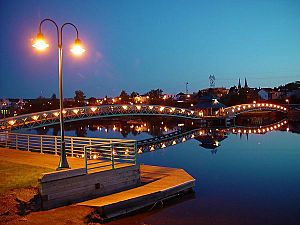
Edmundston has two important historical sites:
- Cathedral of Immaculate Conception: This large church was built in 1924. It mixes Roman and Gothic styles. Its stone front has been fixed up. It can hold over 1,200 people.
- Fortin du Petit-Sault: This small fort was built in 1841. It was made during the border disputes with the United States. The fort was rebuilt in 2000.
Other fun places to visit include de la République Provincial Park. There's also an 18-hole golf course. The downtown area has shops, restaurants, and a hotel. You can also visit the Antique Automobile Museum and the Madawaska Historic Museum.
The New Brunswick Botanical Garden is in Saint-Jacques, a nearby area. It has over 80,000 plants. It is the largest garden of its kind east of Montreal.
Edmundston also has a place for downhill skiing called Mont Farlagne. It has 3 lifts and 14 trails. You can even ski at night on five of the trails.
Sports in Edmundston
Since 2017, Edmundston has been home to the Edmundston Blizzard hockey team. They play in the Maritime Junior A Hockey League. Their home games are at the Centre Jean Daigle.
Transportation
Edmundston is served by New Brunswick Route 2. This is a four-lane highway. On the other side of the Saint John River, you can find U.S. Route 1. There is also a small municipal airport north of the city. The Trans Canada Trail also goes through Edmundston. It is used for walking and biking.
Education
The city has two French-speaking schools for younger students. There is one English-speaking school for all grades. Edmundston also has a French-speaking high school. For older students, there is a community college campus. There is also a university campus linked to the Université de Moncton.
Media
Edmundston has three newspapers: L'Acadie Nouvelle, The Telegraph Journal, and Info Weekend. There are also two local radio stations. You can also get television channels and news from Radio-Canada.
Newspapers from Quebec City also cover events in the Edmundston area.
- Notable people
Images for kids
See also
 In Spanish: Edmundston para niños
 | Bayard Rustin |
 | Jeannette Carter |
 | Jeremiah A. Brown |


