Epps, Louisiana facts for kids
Quick facts for kids
Village of Epps
|
|
|---|---|
|
Village
|
|

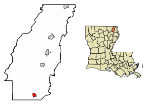
Location of Epps in West Carroll Parish, Louisiana.
|
|

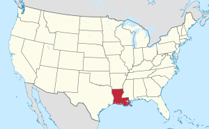
Location of Louisiana in the United States
|
|
| Country | United States |
| State | Louisiana |
| Parish | West Carroll |
| Area | |
| • Total | 0.97 sq mi (2.50 km2) |
| • Land | 0.97 sq mi (2.50 km2) |
| • Water | 0.00 sq mi (0.00 km2) |
| Elevation | 98 ft (30 m) |
| Population
(2020)
|
|
| • Total | 358 |
| • Density | 370.60/sq mi (143.16/km2) |
| Time zone | UTC-6 (CST) |
| • Summer (DST) | UTC-5 (CDT) |
| Area code(s) | 318 |
| FIPS code | 22-24145 |
Epps is a small village located in West Carroll Parish, Louisiana, United States. In 2020, about 358 people lived there.
Contents
History of Epps Village
Early Beginnings and Naming
Not much is known about how Epps first started. People think it began around the 1850s. This was when more steamboats traveled on Bayou Macon, carrying goods like cotton and timber.
The village is believed to be named after Edwin Epps. He was a plantation owner in Avoyelles Parish. Edwin Epps is also known for his connection to the famous abolitionist Solomon Northup.
Major Events and Growth
The Great Mississippi Flood of 1927 was a huge flood. But Epps was not hit as hard as other towns in the Mississippi embayment. In fact, it even served as a Red Cross Relief Camp to help people.
Epps officially became a village in 1939. This means it got its own local government.
Poverty Point: A Historic Site
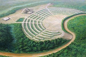
Just five miles northeast of Epps, you can find Poverty Point. This amazing place has ancient mounds built by the Poverty Point culture. These mounds date back to the Late Archaic period.
Poverty Point was named a National Historic Landmark in 1962. This means it's a very important historical place in the U.S. Later, it became a State Historic Site and opened to visitors in 1976. In 1988, the U.S. Congress made it a U.S. National Monument.
There's also the Poverty Point Reservoir State Park nearby. It has a large, man-made lake that covers 2,700 acres. This park is located about five miles south of Epps.
Geography of Epps
Epps is located at 32°36′10″N 91°28′37″W / 32.60278°N 91.47694°W. This is its exact spot on the map.
The United States Census Bureau says that Epps covers about 1.0 square mile (2.5 square kilometers). All of this area is land, with no water.
Population of Epps
The population of Epps has changed over the years. Here's how many people lived there during different census years:
| Historical population | |||
|---|---|---|---|
| Census | Pop. | %± | |
| 1940 | 391 | — | |
| 1950 | 308 | −21.2% | |
| 1960 | 411 | 33.4% | |
| 1970 | 448 | 9.0% | |
| 1980 | 672 | 50.0% | |
| 1990 | 541 | −19.5% | |
| 2000 | 1,153 | 113.1% | |
| 2010 | 854 | −25.9% | |
| 2020 | 358 | −58.1% | |
| U.S. Decennial Census | |||
In 2000, there were 1,153 people living in Epps. There were 209 households, and 156 of these were families. The average household had about 2.89 people. The average family had about 3.41 people.
The median age in the village in 2000 was 30 years old. This means half the people were younger than 30, and half were older. About 17.4% of the population was under 18 years old.
Education in Epps
Public schools in Epps are managed by the West Carroll Parish School Board. Epps High School closed in 2022. It is now Epps Elementary School. Students who are old enough for high school now go to Oak Grove High School.
Notable People from Epps
- Jake Jones was a professional baseball player. He played in major league baseball from 1941 to 1948. Jake Jones was born in Epps.
Images for kids
-
Epps Baptist Church
See also
 In Spanish: Epps (Luisiana) para niños
 | Percy Lavon Julian |
 | Katherine Johnson |
 | George Washington Carver |
 | Annie Easley |


