Bayou Macon facts for kids
Quick facts for kids Bayou Macon |
|
|---|---|

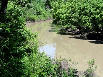
Bayou Macon as seen from Poverty Point Reservoir State Park
|
|

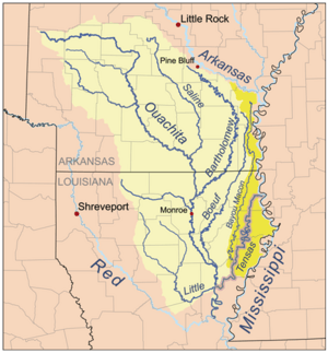
Map of the Tensas River Basin, including Bayou Macon
|
|
| Country | United States |
| States | Arkansas, Louisiana |
| Physical characteristics | |
| Main source | Desha County, Arkansas 33°46′15″N 91°26′15″W / 33.77094°N 91.43762°W |
| River mouth | Confluence with the Tensas River Catahoula Parish, Louisiana 31°54′49″N 91°32′52″W / 31.91349°N 91.54790°W |
| Length | 218 mi (351 km) |
Bayou Macon is a long, slow-moving stream, also known as a bayou, located in the states of Arkansas and Louisiana. It starts in Desha County, Arkansas, and flows south. It runs between the Boeuf River on its west side and the mighty Mississippi River on its east. Eventually, it meets up with Joe's Bayou near Delhi in Richland Parish, Louisiana. Bayou Macon is about 218 miles (351 km) long.
History of Bayou Macon
Civil War Events
The area around Bayou Macon was important during the American Civil War. In May 1863, battles took place here. Soldiers from the 1st Regiment Kansas Volunteer Infantry were involved in fighting in places known as Caledonia and Pin Hook.
Bayou Macon Wildlife Area
Protecting Nature
The Bayou Macon Wildlife Management Area is a special place for nature. It covers 6,919 acres (about 2,800 hectares) in East Carroll Parish. The Louisiana Department of Wildlife and Fisheries bought this land in 1991. They work to protect the animals and plants that live there.

 | James Van Der Zee |
 | Alma Thomas |
 | Ellis Wilson |
 | Margaret Taylor-Burroughs |

