Esker Riada facts for kids
The Esker Riada (which means 'The Road of the Esker' in Irish) is a long chain of natural ridges made of sand and gravel. These ridges stretch right across the middle of Ireland, connecting Dublin in the east to Galway in the west.
Contents
What is the Esker Riada?
The Esker Riada is a collection of many eskers. An esker is a long, winding ridge of sand, gravel, and rocks. These ridges were formed by rivers that flowed under huge glaciers during the last ice age. When the glaciers melted about 10,000 years ago, these riverbeds were left behind as raised paths.
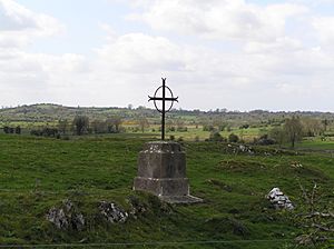
The Esker Riada passes through several counties in Ireland. These include Dublin, Meath, Kildare, Westmeath, Offaly, Leitrim, Longford, Roscommon, and Galway. A big part of the Esker can still be seen in the Teernacreeve area of Westmeath.
Why was the Esker Riada Important in History?
The Esker Riada has been very important for a long time. Its Irish name, 'Eiscir Riada', gives us a clue. 'Eiscir' means 'divide' and 'Riada' means 'road'.
A Natural Highway Through Bogs
Ireland's middle section has many bogs, which are wet and difficult to cross. The Esker Riada, being slightly higher ground, offered a natural, dry path through these bogs. This made it a perfect highway connecting the east and west of Ireland for thousands of years. Its ancient Irish name was 'An tSlí Mhór', which means 'The Great Way'.
Dividing Ireland
Long ago, in the year 123 AD, Ireland was divided into two main parts after a battle near Maynooth. This division happened right along the line of the Esker Riada. The northern part was called 'Leath Cuinn' ('Conn’s Half'), and the southern part was called 'Leath Mogha' ('Mogha’s Half').
Connecting Monasteries
The Slighe Mhór, or 'Great Highway', was also important for connecting famous early Christian settlements. It linked places like Clonard Abbey, Durrow Abbey, and the well-known monastic site of Clonmacnoise. Clonmacnoise was built exactly where the River Shannon crosses the Esker Riada.
Good Land for Farming
Unlike the wet boglands around it, the sandy and gravelly soil of the eskers was well-drained. This made the land along the Esker Riada good for farming, which was very useful for people living there.
The Esker Riada Today
Even now, the Esker Riada continues to be a vital route. The main N6 from Dublin to Galway still follows it very closely. Also, a lot of farming still happens along its length. The Dublin part of the Esker starts near Wood Quay, where the Vikings settled. It then goes southwest through Kilmainham.
Protecting the Esker
Because the eskers are made of sand and gravel, they have been a valuable source of building materials. However, digging up these materials can harm the environment. People are now realizing how important this ridge is, both for its natural beauty and its history.
This has led to more rules about how much sand and gravel can be taken. For example, Offaly County Council has worked to protect the Esker Riada in its development plans. They have even pushed for the Esker Riada to be recognized as a World Heritage Site, which would give it special protection.
 | Misty Copeland |
 | Raven Wilkinson |
 | Debra Austin |
 | Aesha Ash |


