
Ettrick Bay facts for kids
Quick facts for kids Ettrick Bay |
|
|---|---|

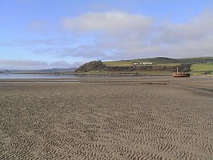
Ettrick Bay from the south, looking north as the bay curves to Kildavanan Point
|
|

Ettrick Bay
Location in Argyll and Bute
|
|
| Location | Isle of Bute, Argyll and Bute Scotland |
| Coordinates | 55°50′39.592″N 5°8′33″W / 55.84433111°N 5.14250°W |
| River sources | Glenmore Burn Ettrick Burn Drumachloy Burn St Colmac Burn |
| Ocean/sea sources | Atlantic Ocean |
| Catchment area | 22.5 kilometres (14.0 mi)2 |
| Basin countries | Scotland |
| Max. length | 1.7 km (1.1 mi) |
| Max. width | 0.960 km (0.597 mi) |
| Average depth | 20 metres (66 ft) |
Ettrick Bay is a beautiful, wide sandy bay on the west coast of the Isle of Bute in Scotland. It's a popular spot for visitors and locals. This bay was even used for practice training before the famous D-Day landings during World War II!
Contents
Exploring Ettrick Bay's Landscape
Ettrick Bay faces the Kyles of Bute. This is a narrow sea channel that separates the northern part of the Isle of Bute from the Cowal peninsula. From the bay, you can enjoy amazing views of the Isle of Arran.
The bay has a lovely sandy beach. It's a favorite place for both tourists and local people. When the tide is low, the water's edge can be as far as 500 metres (1,600 ft) from where it is at high tide. Several small rivers flow into the bay. These include the Glenmore Burn, Ettrick Burn, Drumachloy Burn, and St Colmac Burn.
Points of Interest at the Bay
At the north end of the bay, you'll find rocky areas. This is where Kildavanan Point is located. Close to this point is a special spot known as Macallister's Gun. At the south end of the bay, there's another rocky area called Island McNeil. This forms the outer edge of the bay.
The land around Ettrick Bay is mostly countryside. Farming is the main activity here.
Hills Around the Bay

Windy Hill is the highest point on the Isle of Bute. It stands at 278 metres (912 ft) tall. It's located directly north of Ettrick Bay. Other smaller hills surround the bay, including:
- Eanan Hill to the north east – 166 metres (545 ft)
- Glenabea Hill, behind Eanan Hill – 201 metres (659 ft)
- Kilbride Hill, which is next to Windy Hill on the east side – 256 metres (840 ft)
- Muirton Hill, which is south of Windy Hill – also 256 metres (840 ft)
The hills to the east and south of the bay are not very steep.
About 3.25 miles (5 km) south of Ettrick Bay is a calm bay called St Ninian's Bay. It's named after Saint Ninian, a Christian saint from the 8th century. From Ettrick Bay, you can also see the island of Inchmarnock. It's about 3.25 miles (5 km) away, located at the northern end of the Sound of Bute.
Nearby Towns and Villages
The closest town to Ettrick Bay is Rothesay. It's about 2.5 miles (4 km) to the south west. The small village of Port Bannatyne is located 2 miles (3 km) to the north east. You can find Kames Castle and Wester Kames Castle near Kames Bay, not far from Port Bannatyne.
Historical and Interesting Features

You can find a Bronze Age stone circle at St Colmac Farm. This is located south of the B875 road, about 0.6 miles (1 km) northeast of Ettrick Bay's shore. A Celtic cross, which is often linked to the stone circle, is at the ruined 19th-century church of St Colmac. This church is about 100 metres (330 ft) from the stone circle, to the north west. Even though they are often seen together by tourists, the stone circle and the cross were built thousands of years apart!
Near the bridge over Glenmore Burn, you can see concrete frames. These were built for the British Army to use for practice exercises on Inchmarnock. These frames were like practice landing craft for the D-Day landings.
Gallery
-
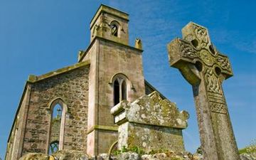
Abandoned St Colmac Church with ancient Celtic Cross
-
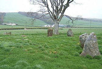
Stone Circle near St Colmac Farm
-
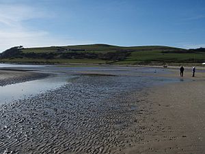
Ettrick Bay
-
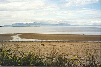
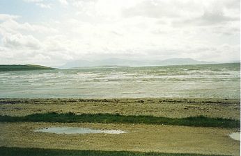
Ettrick Bay looking towards the Isle of Arran
-
Looking towards the north and the point on the Kildavanan Point
-
Looking south over a stormy Ettrick Bay. The island of Arran is visible in the distance
-
This view of Ettrick Bay beach, taken from the cafe car park, shows an abandoned and wrecked fishing boat
-
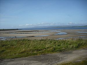
The beach from the car park looking south
-
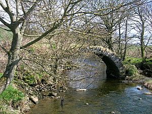
The ancient and ruined Drumachloy Bridge over the Drumachloy Burn
-
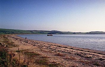
Ettrick Bay looking south
-
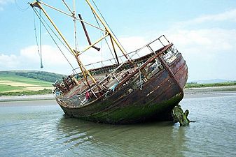
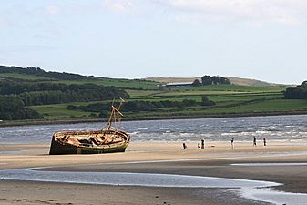
Fishing boat that was wrecked in 1994 and removed in 2007 when it became dangerous after a winter storm. The crew mistook low-lying ground for a channel to the north of the island and foundered


