Feather Headwaters facts for kids

The Feather Headwaters are like the starting point or "source" of the Feather River! This huge area covers about 3,450 square miles (8,935 square kilometers). It is located before the river reaches Lake Oroville.
This big area is split into three main parts, or "watersheds":
- The North Fork Feather Watershed is about 1,090 square miles (2,823 square kilometers).
- The East Branch North Fork Feather Watershed is about 1,010 square miles (2,616 square kilometers).
- The Middle Fork Feather Watershed is about 1,350 square miles (3,496 square kilometers).
Sometimes, water from these headwaters is moved to different places by canals. These include the Palermo Canal and the Hendricks Canal. The Pacific Gas and Electric Company also uses water from the Upper Feather area. They send it to the Hyatt Generating-Pumping Plant to make electricity. This happens when a lot of power is needed.
Contents
North Fork Feather Watershed
The North Fork Feather Watershed is one of the main parts of the Feather Headwaters. It includes the West Branch and North Fork rivers. It also gets water from the East Branch North Fork Feather Watershed.
West Branch Feather River
The West Branch Feather River starts in Butte County. It flows through the Lassen National Forest. This river generally flows from north to south. It ends in the northwest part of Lake Oroville.
Some of the West Branch water is moved away by the Hendricks Canal. This canal can take up to 125 cubic feet (3.5 cubic meters) of water per second. The Magalia 73 Dam also sends water to powerhouses near Lake Oroville.
North Fork Feather River
The North Fork Feather River is the biggest source of water for the Feather River. It has the largest watershed area. It also sends the most water into Lake Oroville.
A part of this river flows through the Feather Canyon. This canyon is famous because the Feather River Route railroad goes through it. The North Fork Bridge was built in 1962. It is near where the river meets Lake Oroville. This bridge is the longest reinforced concrete bridge in the United States.
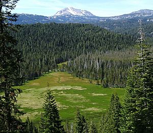
The East Branch North Fork Feather River is the largest river that flows into the North Fork. The very start of the North Fork Feather watershed is near Lassen Peak. This peak is in the Shasta Cascade mountains. It also reaches the east side of Indicator Peak in the northern Sierra Nevada mountains.
East Branch North Fork Feather Watershed
The East Branch Feather Watershed is the middle part of the Feather River's headwaters. It includes the American and Indian valleys.
East Branch North Fork Feather River
The East Branch North Fork Feather River is a river that flows into the North Fork Feather River. It flows past towns like Twain and Belden.
The very beginning of the East Branch is along about 46 miles (74 kilometers) of the Sierra Crest. This area includes Diamond Mountain and Black Mountain.
Middle Fork Feather Watershed
The Middle Fork Feather Watershed includes the Middle Fork Feather River. It also has the Fall River and the South Fork Feather River. The Grizzly Valley is also part of this watershed.
Middle Fork Feather River
The Middle Fork Feather River gets its water from over 41 miles (66 kilometers) of the Sierra Crest. It also gets water from the Sierra Valley Channels. These channels are many smaller rivers that join together in a wetland. This wetland has many irrigation ditches.
From its start, the Middle Fork flows through Mohawk Valley and Long Valley. Then it goes into a deep gorge. Finally, it reaches the middle part of Lake Oroville. The South Branch Middle Fork Feather River is another river that flows into the Middle Fork.
Fall River
The Fall River is a river that flows into Lake Oroville. It drains the southern part of the Middle Fork Watershed. It enters the lake near the North Arm. This river is known as the source of water for Feather Falls. Feather Falls is a beautiful waterfall in the Lake Oroville State Recreation Area.
South Fork Feather River
The South Fork Feather River is another river that flows into Lake Oroville. It has several reservoirs in the southernmost part of the Middle Fork Feather Watershed. One of these is Little Grass Valley Reservoir.
The large area that separates the Feather Headwaters from other river systems is called a drainage divide. This divide runs from northwest to southeast. It separates the Feather Headwaters from:
- The Lower Pit Watershed (to the north).
- The Great Basin Divide near Eagle Lake and Honey Lake (to the north and northeast).
- The northern Sierra Crest (to the northeast and east).
History
The Maidu people lived in the American and Sierra Valleys a long time ago. They had villages in the Big Meadows area, which is now Lake Almanor. They also lived in Indian Valley. The Washoe people hunted in the Sierra and Mohawk Valleys. The Paiute and Washoe people also had settlements in the Long Valley area.
In 1849, the California Gold Rush began. Thousands of gold seekers and settlers came to this region. The American and Indian Valleys were settled in the 1850s. The first settlers arrived in the Sierra Valley in 1852.
Hydroelectric powerhouses started working along the North Fork. The Lime Saddle powerhouse began on August 1, 1906. The Coal Canyon powerhouse started on December 24, 1907.
The Feather River Route railroad was built in 1909. It went through the Feather Canyon along the North Fork and East Branch rivers. It also crossed under the Sierra Nevada mountains through the Spring Garden tunnel. Other important features of the Feather River Route in the Feather Headwaters include the Keddie Wye, Williams Loop, Clio trestle, and Chilcoot Tunnel.
 | Mary Eliza Mahoney |
 | Susie King Taylor |
 | Ida Gray |
 | Eliza Ann Grier |

