
Forestville, Maryland facts for kids
Quick facts for kids
Forestville, Maryland
|
|
|---|---|

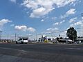
A Royal Farms gas station being constructed along Marlboro Pike in Forestville
|
|

Location of Forestville, Maryland
|
|
| Country | |
| State | |
| County | |
| Area | |
| • Total | 3.93 sq mi (10.17 km2) |
| • Land | 3.93 sq mi (10.17 km2) |
| • Water | 0.00 sq mi (0.00 km2) |
| Elevation | 279 ft (85 m) |
| Population
(2020)
|
|
| • Total | 12,831 |
| • Density | 3,267.38/sq mi (1,261.46/km2) |
| Time zone | UTC−5 (Eastern (EST)) |
| • Summer (DST) | UTC−4 (EDT) |
| ZIP codes |
20747, 20753
|
| Area code(s) | 301, 240 |
| FIPS code | 24-29000 |
| GNIS feature ID | 0597413 |
Forestville is a community in Prince George's County, Maryland, in the United States. It's known as a census-designated place (CDP). This means it's an area that looks like a town but isn't officially governed as one.
In 2020, about 12,831 people lived in Forestville. The community has different types of homes, like apartments and single-family houses. There are also many shopping centers. Most of these buildings were built between the 1930s and 1970s.
Forestville is near other communities like District Heights and Suitland. It's also very close to Joint Base Andrews, a large military base. Many people who work at the base or for the U.S. Census Bureau find Forestville a convenient place to live. The area is easy to reach by major roads like the Capital Beltway. You can also get there using the Suitland Metro Station on the Green Line.
Contents
History of Forestville
Forestville was once called Long Old Fields. This name was used during the War of 1812. On August 23, 1814, American soldiers camped here. They were preparing to fight the British, who were camped nearby. The next day, these forces met in the Battle of Bladensburg.
After the American Civil War ended in 1865, the name of the area changed. Long Old Fields became known as Forestville.
Where is Forestville?
Forestville is located in Maryland. It covers an area of about 4.0 square miles (10.17 square kilometers). All of this area is land.
People of Forestville
In 2020, the population of Forestville was 12,831 people. This was a small increase from 12,353 people in 2010.
| Historical population | |||
|---|---|---|---|
| Census | Pop. | %± | |
| 2010 | 12,353 | — | |
| 2020 | 12,831 | 3.9% | |
| U.S. Decennial Census 2010 2020 |
|||
Most people living in Forestville are African-American. The community is also home to people from many different backgrounds.
Schools in Forestville
Students in Forestville attend public schools run by Prince George's County Public Schools.
Elementary Schools
Several elementary schools serve different parts of Forestville. These include:
- Andrew Jackson Elementary
- William Beanes Elementary
- Longfields Elementary
- North Forestville Elementary
- John Bayne Elementary
Middle Schools
Students in Forestville go to one of these middle schools:
- Andrew Jackson Middle
- Drew-Freeman Middle
- Walker Mill Middle
High Schools
For high school, students are zoned to:
- Dr. Henry A. Wise Jr. High School
- Suitland High School
- Largo High School
There was once a school called Forestville High School (also known as Forestville Military Academy). It was in the area but closed in 2016.
Private Schools
Bishop McNamara High School is a private school located in Forestville. Another private school, Mount Calvary Catholic School, was nearby but closed in 2016.
Famous People from Forestville
Many interesting people have connections to Forestville:
- Nick Charles – A politician who serves as a Maryland State Delegate.
- Tray Chaney – An actor.
- Kevin Dorsey – A former wide receiver in the NFL for teams like the Green Bay Packers.
- NaVorro Bowman – An NFL linebacker.
- Ginuwine – A famous singer.
- Steny Hoyer – A politician who was a Democratic Congressman and House Majority leader. He lived in Forestville in the 1980s.
- Jeff Kinney – The game designer and author of the popular Diary of a Wimpy Kid book series. He grew up in Forestville.
- Kellie Shanygne Williams – An actress.
Images for kids
-
A Royal Farms gas station being built in Forestville.
See also
 In Spanish: Forestville (Maryland) para niños
