Fort Beversreede facts for kids


Fort Beversreede was a trading post built by the Dutch. It existed from around 1633 to 1651. The fort was made of wooden walls, like a fence, and was located near where the Schuylkill River and the Delaware River join. It was an important outpost for the Dutch colony called New Netherland. The main city of this colony was New Amsterdam, which is now Manhattan in New York City.
Contents
Where Was Fort Beversreede?
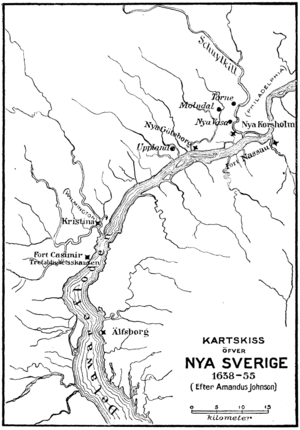
The exact spot where Fort Beversreede stood is not fully known today. A Swedish map from 1655 shows it on the west side of the Schuylkill River. This area is now part of the mainland and was once called Providence Island. It was just south of a creek known as Minquas Creek.
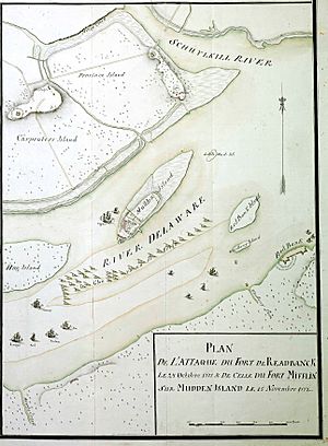
Other historical records suggest it might have been on the east side of the Schuylkill River, across from Minquas Creek. A map from the 1770s, which showed Philadelphia's defenses, also shows a fort on the island, but it doesn't say its name.
Right next to the fort was the end of a very important path called the Great Minquas Path. This trail was about 80 miles (130 km) long. It stretched from the Susquehanna River all the way to the Schuylkill River. This path was the main route for trading animal furs, especially beaver furs, with the Susquehannock people. Because of this, the Dutch called the trail "Beversreede," which means "Beaver Road."
Dutch and Swedish Rivalry
Even though the Dutch built Fort Beversreede, the Delaware Valley region was mostly controlled by the Swedish colony of New Sweden. The Swedes first settled in 1638 at Fort Christina, which is now Wilmington, Delaware. The Swedish colony included some Dutch people, but the only official Dutch presence in the area was across the Delaware River at Fort Nassau. This fort was located near the mouth of Big Timber Creek, south of what is now Gloucester City, New Jersey.
In 1642, some people from the Connecticut Colony tried to settle in the area. However, their homes were burned, and they were forced to leave.
The Swedes also claimed the land at the mouth of the Schuylkill River. They often caused trouble for Fort Beversreede. In 1648, the Swedes built their own small fort directly in front of the Dutch one. They called it Fort Nya Korsholm. This Swedish building was a 30-by-20-foot blockhouse (a strong, small fort). It was said to be only twelve feet away from the gate of the Dutch fort! The Swedes built it to scare the Dutch residents and to stop them from trading furs.
The Fort's End
In 1651, the Dutch decided to leave Fort Beversreede. They also took apart Fort Nassau and moved it to the Christina River. This new location was downstream from the Swedes' Fort Christina. The Dutch brought their forces together at this rebuilt fort, which they renamed Fort Casimir.
It wasn't until 1655 that the Dutch fully took back control of the area. This happened during a military trip led by Peter Stuyvesant, who was the leader of New Netherland. After this, the Dutch set up a new regional capital at New Amstel.
What Remains Today?
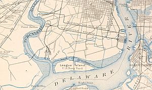
Today, there are no parts left of either Fort Beversreede or Fort Nya Korsholm. Nearby, Mud Island later became the site of Fort Mifflin in 1771. Over time, the area has changed a lot. The Schuylkill River's channel was made wider, and new land was created. Many roads and industrial buildings were also built.
However, the general area where the forts were located is probably south of the mouth of Mingo Creek and north of the George C. Platt Bridge.
See also
 In Spanish: Fort Beversreede para niños
 | John T. Biggers |
 | Thomas Blackshear |
 | Mark Bradford |
 | Beverly Buchanan |


