Fritz Cove facts for kids
Quick facts for kids Fritz Cove |
|
|---|---|
| Location | Stephens Passage, Juneau, Alaska |
| Coordinates | 58°19′41″N 134°38′30″W / 58.32806°N 134.64167°W |
| River sources | Cove Creek, Elevenmile Creek, Fish Creek |
| Basin countries | United States |
| Max. depth | 30 fathoms (55 m) |
| Islands | Spuhn Island |
Fritz Cove is a beautiful bay located on the northwest side of Douglas Island in Juneau, Alaska, United States. It's part of Stephens Passage and is about 8 miles (13 km) northwest of Juneau city.
For a long time, Fritz Cove has been important to the Alaska Natives, especially the Auke people. They used the cove for fishing. There was even a summer camp called Aangoox̱a Yé right where Fish Creek meets the bay. The famous Scottish-American naturalist John Muir also camped at the bay on November 10, 1879.
History of Fritz Cove
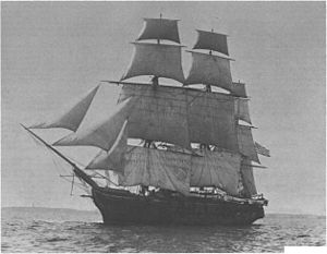
The area around Fritz Cove was first explored and mapped by the USS Jamestown in 1880. Lieutenant F. M. Symonds, who was part of the ship's crew, named the bay after his son. The name "Fritz Cove" was officially published by the U.S. Coast and Geodetic Survey in 1881. Later, the United States Geological Survey collected more information about the area between 1976 and 1981. The name was added to the Geographic Names Information System on March 31, 1981.
Geography and Waterways
In 1960, Fritz Cove became connected to Gastineau Channel. This happened because the United States Army Corps of Engineers worked to dig a new path for boats to travel through.
Several streams flow into Fritz Cove, bringing fresh water from the land. These include Cove Creek, Elevenmile Creek, and Fish Creek. Inside the bay, you'll find Spuhn Island. The water in Fritz Cove can be quite deep, ranging from about 8 to 30 fathoms (which is about 15 to 55 meters).
Wildlife in Fritz Cove
Fritz Cove is home to many different kinds of animals, especially in its waters. You can find various types of crabs here, like Dungeness crabs and Tanner crabs. King salmon, a popular fish, also live in the cove. Scientists have been studying the molting process of male Tanner crabs in the cove since the 1970s.
Besides fish and crabs, many birds also visit or live in the area. These include scoters, grebes, mergansers, and marbled murrelets. It's a great place to observe different kinds of wildlife.
 | May Edward Chinn |
 | Rebecca Cole |
 | Alexa Canady |
 | Dorothy Lavinia Brown |


