Furnace Brook Parkway facts for kids
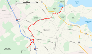
Map with Furnace Brook Parkway highlighted in red.
|
|
| Maintained by | Department of Conservation and Recreation |
|---|---|
| Length | 3.4 mi (5.5 km) |
| Location | Quincy, Norfolk County, Massachusetts |
| West end | |
| Major junctions |
|
| East end | Quincy Shore Drive in Quincy |
| Construction | |
| Completion | 1904-1916 |
|
Furnace Brook Parkway
|
|
 |
|
| Location | Quincy, Massachusetts |
| Built | 1904 |
| Architect | Charles Eliot Olmsted Brothers |
| MPS | Metropolitan Park System of Greater Boston MPS |
| NRHP reference No. | 04000248 |
| Added to NRHP | March 18, 2004 |
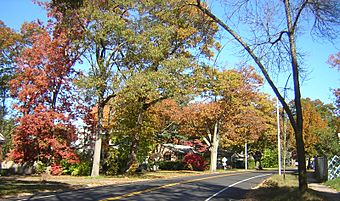
Furnace Brook Parkway is a special road in Quincy, Massachusetts. It's like a green highway that connects two big parks: the Blue Hills Reservation and the Quincy Shore Reservation. This parkway is part of a larger system of parks and roads around Boston.
The road is owned and kept up by the Massachusetts Department of Conservation and Recreation (DCR). It goes through land that used to belong to important families, like those of former presidents John Adams and John Quincy Adams. You can see several historic places along the way!
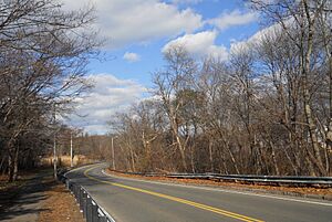
The parkway follows a stream called Furnace Brook. It goes from the southwest to the northeast through Quincy, crossing the brook and a nearby water area called Blacks Creek. For most of its length, it has two lanes. There's a big traffic circle (sometimes called a "rotary" in New England) where it meets Interstate 93.
The parkway was started in 1904 and finished in 1916. Because of its history and design, it was added to the National Register of Historic Places in 2004.
History of Furnace Brook Parkway
Why the Name "Furnace Brook"?
The parkway gets its name from Furnace Brook, a stream that starts in the Blue Hills and flows through Quincy. This brook was named in the 1600s because it was close to the Winthrop Iron Furnace. This was the very first iron-making furnace in what would become the United States! It started in 1644.
How the Parkway Was Planned
The idea for using the land along Furnace Brook came from a landscape architect named Charles Eliot. He learned from Frederick Law Olmsted, who helped design Central Park in New York City. Eliot and Olmsted also worked on Boston's "Emerald Necklace," which is a series of connected parks and waterways.
Eliot wanted to expand this park system to areas around Boston, including the Blue Hills and Quincy Shore. He saw Furnace Brook as a key part of this plan, suggesting a parkway to link the Blue Hills and Quincy Shore parks.
Building the Parkway
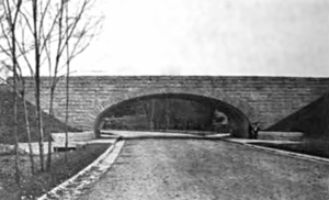
Money for the parkway was approved in 1901. Construction started in 1904. An important part of the project was building a strong bridge made of granite and concrete. This bridge carried the Granite Branch railroad over the new parkway. It was finished in 1906.
By 1908, most of the road from Blue Hills to Adams Street was built. Also, much of the land needed for the rest of the parkway was bought.
Finishing the Road
More land was bought, and construction continued for several years. New buildings, like homes, started to appear along the route. A stone and concrete bridge was built over Blacks Creek starting in 1915. The entire Furnace Brook Parkway was finished and officially opened to the public on November 18, 1916.
Changes Over Time
When the parkway first opened, the speed limit was 20 miles per hour. Today, it's 30 miles per hour. Also, there have always been rules against putting up advertising signs along the road.
The parkway's path has mostly stayed the same since 1916. However, a big change happened in the 1950s when the Interstate Highway System was built. Part of Interstate 93 (called the Southeast Expressway) was built over the old railroad line. The old Granite Branch railroad bridge was taken down. A large traffic circle and ramps were built to connect the parkway with the new highway.
Exploring Furnace Brook Parkway
From Blue Hills to Adams Street
Furnace Brook Parkway starts at the entrance to the Blue Hills Reservation in West Quincy. The gates here are open during the day. From this point, the parkway goes east and northeast.
It soon meets Willard Street and enters the Furnace Brook Rotary, which is a big traffic circle. Here, you can get on or off Interstate 93. After passing under the highway, the parkway continues.
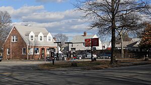
Beyond the rotary, the parkway goes through a short area with some shops. It then swings northwest. Near Cross Street, it passes very close to the historic Winthrop Iron Furnace, which is where the parkway gets its name. Between Cross and Quarry Streets, one side of the road has open land with the brook, while the other side has houses. From Quarry Street to Adams Street, both sides of the road have homes.
Between Adams and Hancock Streets
From Adams Street to Willow Avenue, the north side of the parkway is the Furnace Brook Golf Course. The south side has houses. The Charles A. Bernazzani Elementary School is also located within the golf course area. In this section, the brook actually goes under the parkway!
From Willow Avenue to Newport Avenue, the north side has more houses. The south side has a nursing home and a big part of the Adams National Historical Park. This park includes the Old House, which was the home of the famous Adams Family for many years.
Further along, the parkway goes under the MBTA Red Line and other commuter train lines. In this area, there are houses on the north side and Furnace Brook on the south.
From Hancock Street to Quincy Bay
At the corner of Hancock Street, you'll see the Quincy National Guard Armory. South of the armory is the Dorothy Quincy Homestead, a very old and important historic house.
In this section, the parkway crosses Blacks Creek, where Furnace Brook flows into it. On the north side, there's Merrymount Park and the Blacks Creek water area. The south side has more houses.
The last part of the parkway goes through the northwest edge of Merrymount. This is the place where Quincy was first settled by Europeans in 1625. As you drive here, you get a wide view of Quincy Bay and the Boston Harbor Islands. Furnace Brook Parkway ends when it meets Quincy Shore Drive.
Major Intersections
The entire route is in Quincy, Norfolk County.
| Mile | Roads intersected | Notes | ||
|---|---|---|---|---|
| 0.0 | 0.0 | Wampatuck Road west | Leads to Blue Hills Reservation | |
| 0.5 | 0.80 | Traffic circle; exit 8 on I-93 / US 1 / MA 3 | ||
| 2.9 | 4.7 | |||
| 3.4 | 5.5 | Quincy Shore Drive | ||
| 1.000 mi = 1.609 km; 1.000 km = 0.621 mi | ||||
 | Kyle Baker |
 | Joseph Yoakum |
 | Laura Wheeler Waring |
 | Henry Ossawa Tanner |


