Galatia, Kansas facts for kids
Quick facts for kids
Galatia, Kansas
|
|
|---|---|

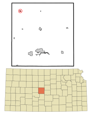
Location within Barton County and Kansas
|
|

|
|
| Country | United States |
| State | Kansas |
| County | Barton |
| Founded | 1885 |
| Incorporated | 1921 |
| Named for | Galatia, Illinois |
| Area | |
| • Total | 0.35 sq mi (0.92 km2) |
| • Land | 0.35 sq mi (0.92 km2) |
| • Water | 0.00 sq mi (0.00 km2) |
| Elevation | 1,998 ft (609 m) |
| Population
(2020)
|
|
| • Total | 45 |
| • Density | 129/sq mi (48.9/km2) |
| Time zone | UTC-6 (CST) |
| • Summer (DST) | UTC-5 (CDT) |
| ZIP code |
67564
|
| Area code | 620 |
| FIPS code | 20-25050 |
| GNIS ID | 475404 |
Galatia is a small city located in Barton County, Kansas, in the United States. In 2020, the city had a population of 45 people.
Contents
History of Galatia
Galatia was founded in 1885 by a settler named David C. Barrows. He planned out the town's first layout. It was first called Four Corners. Later, another settler, Henry G. Weber, renamed it Galatia. He chose this name because it was the same as his hometown in Galatia, Illinois.
The very first building built in Galatia was a United Brethren church. A post office opened in Galatia in 1889.
Growth and Decline of Galatia
The town started to grow more when the Atchison, Topeka and Santa Fe Railway built a train line to Galatia in 1919. This new railway helped the town's businesses. Galatia soon had three places to store grain, a bank, a lumberyard, and three general stores.
By 1921, the population of Galatia had grown to 202 people. However, after this peak, the number of people living in Galatia began to get smaller. The post office in Galatia eventually closed in 1966.
Geography of Galatia
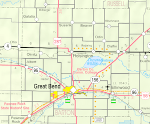
Galatia is located in the northwestern part of Barton County, which is in central Kansas. It is about 22 miles (35 km) north-northwest of Great Bend, which is the main city of the county. Galatia is also about 110 miles (177 km) northwest of Wichita.
The city is located about 6 miles (10 km) west of U.S. Route 281 and 7 miles (11 km) north of Kansas Highway 4. Galatia is in the Smoky Hills region of the Great Plains. It is also about 2 miles (3 km) west of Landon Creek, which flows into the Smoky Hill River.
The United States Census Bureau says that Galatia covers a total area of 0.38 square miles (0.98 square kilometers). All of this area is land.
Population Changes in Galatia
The number of people living in Galatia has changed a lot over the years. Here's a look at how the population has changed:
| Historical population | |||
|---|---|---|---|
| Census | Pop. | %± | |
| 1930 | 194 | — | |
| 1940 | 150 | −22.7% | |
| 1950 | 89 | −40.7% | |
| 1960 | 73 | −18.0% | |
| 1970 | 78 | 6.8% | |
| 1980 | 69 | −11.5% | |
| 1990 | 47 | −31.9% | |
| 2000 | 61 | 29.8% | |
| 2010 | 39 | −36.1% | |
| 2020 | 45 | 15.4% | |
| U.S. Decennial Census | |||
Galatia's Population in 2020
The 2020 United States census counted 45 people living in Galatia. There were 21 households, which means 21 different homes where people lived. About 91% of the people were white. A small number of people were from other races or had two or more races. About 7% of the population was Hispanic or Latino.
About 13% of the people were under 18 years old. The largest group, about 36%, was 65 years old or older. The average age in Galatia was 55.5 years.
Galatia's Population in 2010
In the 2010 United States census, there were 39 people living in Galatia. All of them were white. About 8% of the population was Hispanic or Latino.
There were 20 households in the city. About half of these households were married couples living together. The average age in Galatia in 2010 was 56.3 years. Most residents were between 45 and 64 years old, or 65 and older.
Education in Galatia
Students in Galatia attend public schools that are part of the Hoisington USD 431 school district. This district is based in the nearby city of Hoisington.
Galatia used to have its own high school, called Galatia High School. Its mascot was the Bluejays. However, this high school closed down when school districts were combined.
Media and News
Galatia is part of the Wichita-Hutchinson, Kansas television market. This means that people in Galatia watch television channels that serve the Wichita and Hutchinson areas.
Transportation in Galatia
There are paved county roads that help people get around Galatia. NW 190 Road runs east and west through the city. NW 100 Avenue runs north and south.
In the past, the Atchison, Topeka and Santa Fe Railway had a train line that went through Galatia. This line was used for moving goods. However, this train line is no longer in use.
See also
 In Spanish: Galatia (Kansas) para niños
 | Delilah Pierce |
 | Gordon Parks |
 | Augusta Savage |
 | Charles Ethan Porter |

