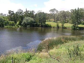
Gara River (Australia) facts for kids
Quick facts for kids Gara River |
|
|---|---|

Blue Hole in the Gara River, near Armidale
|
|
| Other name(s) | Gyra River, Ryanda Creek, Falconer Creek, Malpas Creek |
| Country | Australia |
| State | New South Wales |
| Region | New England Tablelands (IBRA), Northern Tablelands |
| Local government areas | Guyra, Armidale Dumaresq |
| Physical characteristics | |
| Main source | Ben Lomond Range, Great Dividing Range near Llangothlin 1,280 m (4,200 ft) |
| River mouth | confluence with the Macleay River Salisbury Waters within Oxley Wild Rivers National Park, near Armidale 388 m (1,273 ft) |
| Length | 91 km (57 mi) |
| Basin features | |
| River system | Macleay River |
| Tributaries |
|
| National park | Oxley Wild Rivers NP |
The Gara River is a cool waterway in the Northern Tablelands region of New South Wales, Australia. It's a "perennial river," which means it flows all year round, not just after rain. This river is a "tributary" of the much larger Macleay River, meaning it flows into it.
Where Does the Gara River Start and End?
The Gara River begins high up in the mountains, where the southern parts of the Great Dividing Range meet the Ben Lomond Range. This is close to a town called Llangothlin.
From its starting point, the river flows mostly south and then southeast. Along its journey, four smaller streams join it. These smaller streams are called "tributaries."
The Gara River eventually reaches a place called Salisbury Waters, which is inside the beautiful Oxley Wild Rivers National Park. Here, it joins with the Macleay River. This meeting point is called a "confluence." It happens below Blue Nobby Mountain, southeast of Armidale.
How Long and High is the Gara River?
The Gara River is about 91 kilometers (56 miles) long. It starts at a high elevation of 1,280 meters (4,199 feet) above sea level. By the time it reaches the Macleay River, it has dropped significantly to an elevation of 388 meters (1,273 feet). This means the river descends a total of 892 meters (2,927 feet) from its source to its mouth.
Along its path, the river's flow is controlled by two important structures: Guyra Dam and Malpas Reservoir. These are like big walls that hold back water, creating lakes.
In its lower parts, the Gara River flows across the Waterfall Way, which is a scenic road.
 | Sharif Bey |
 | Hale Woodruff |
 | Richmond Barthé |
 | Purvis Young |

