Garry Lake facts for kids
Quick facts for kids Garry Lake |
|
|---|---|
 |
|
| Location | Kivalliq Region, Nunavut |
| Coordinates | 65°53′N 99°51′W / 65.883°N 99.850°W |
| Native name | Hanningajuq Error {{native name checker}}: parameter value is malformed (help) |
| Primary inflows | Lake Pelly |
| Primary outflows | Back River |
| Basin countries | Canada |
| Max. length | 97 km (60 mi) |
| Max. width | 61 km (38 mi) |
| Surface area | 976 km2 (377 sq mi) |
| Average depth | 6.1 m (20 ft) |
| Max. depth | 9.1 m (30 ft) |
| Surface elevation | 148 m (486 ft) |
| Islands | many |
| Settlements | uninhabited |
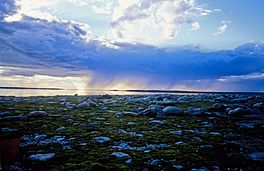
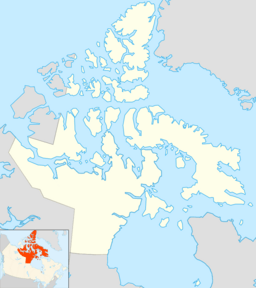
Garry Lake (sometimes called Garry Lakes) is a big lake in northern Canada. It is located in the Kivalliq Region of Nunavut. The local Inuktitut name for the lake is Hanningajuq. This means "sideways" or "crooked".
Garry Lake is part of the Back River system. Water flows into it from Lake Pelly. Then, the Back River carries water away to the east. The lake has three main parts: Upper Garry Lake, Garry Lake, and Lower Garry Lake. These parts are separated by small waterfalls called rapids. Garry Lake is far away from any towns or cities.
Contents
Where is Garry Lake?
Garry Lake is found in a flat area. The land around it has lots of sedge and grass meadows. These grow along the lake shores. The ground is made of sand, gravel, and fine dirt left behind by glaciers. This area is part of a very old rock formation. It is called the Churchill craton—Rae craton geological province.
Animals of Garry Lake
Garry Lake is an important place for birds. Many Canada geese come here in late summer. They come to moult, which means they lose their old feathers and grow new ones. Because of this, the Canadian Wildlife Service has named the area a special habitat. It is a "Key Migratory Bird Terrestrial Habitat site." This means it is a very important place for birds that travel long distances.
The Hanningajurmiut People
The word Hanningajuq is used for both Garry Lake and the Christian cross in Inuktitut. Garry Lake was once home to a group of Inuit people. They called themselves Hanningajurmiut, Hanningaruqmiut, or Hanningajulinmiut. These names mean "the people of the place that lies across."
Inuit people living to the north called them Ualininmiut. This means "people from the area of which the sun follows east to west." The way the Hanningajurmiut spoke Inuktitut was similar to the Utkuhiksalik dialect. This is spoken by the Utkuhiksalingmiut people.
Like other Caribou Inuit, the Hanningajurmiut lived by following Arctic animals. They hunted barren-ground caribou from the Beverly herd. They also fished for whitefish and lake trout. In winter, they lived in igloos. In summer, they used tents made from caribou skin.
A Time of Change
Between 1948 and 1955, the Hanningajurmiut could trade at a fur trader's outpost. This outpost belonged to Stephen Angulalik. It was located at a place called Atanikittuq at Sherman Inlet. In 1949, a Roman Catholic mission post was set up on an island in Garry Lake. A cabin from this mission still stands today.
In 1958, the Hanningajurmiut faced a very difficult time. The caribou, which they relied on for food, did not come to their usual hunting grounds. Because of this, many people became very sick. To help the survivors, the government moved them to a place called Baker Lake. Most of the Hanningajurmiut never moved back to Garry Lake permanently.
Minerals Found Here
In 1981, a company called Kidd Creek Minerals found some special rocks. These rocks contained uranium. They were found in a line along the north shore of Garry Lake. This line of rocks stretched for about 1.5 km (0.93 mi).
Later, in 2007, another company, Uravan Minerals Inc., explored the area. They made plans to drill and search for more uranium in 2008.
 | Victor J. Glover |
 | Yvonne Cagle |
 | Jeanette Epps |
 | Bernard A. Harris Jr. |


