Gas, Kansas facts for kids
Quick facts for kids
Gas, Kansas
|
|
|---|---|

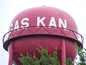
"Gas Kan"- shaped Watertower in Gas (2012)
|
|
| Motto(s):
"Don't Pass Gas, Stop and Enjoy It"
|
|

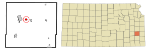
Location within Allen County and Kansas
|
|

|
|
| Country | United States |
| State | Kansas |
| County | Allen |
| Township | Elm |
| Founded | 1898 |
| Incorporated | 1901 |
| Named for | Natural gas |
| Area | |
| • Total | 0.72 sq mi (1.87 km2) |
| • Land | 0.72 sq mi (1.86 km2) |
| • Water | 0.00 sq mi (0.00 km2) |
| Elevation | 1,020 ft (310 m) |
| Population
(2020)
|
|
| • Total | 475 |
| • Density | 660/sq mi (254.0/km2) |
| Time zone | UTC-6 (CST) |
| • Summer (DST) | UTC-5 (CDT) |
| ZIP code |
66742
|
| Area code | 620 |
| FIPS code | 20-25975 |
| GNIS ID | 2394865 |
Gas is a small city in Allen County, Kansas, United States. In 2020, about 475 people lived there. The city was named for the large amounts of natural gas found in the area.
Contents
History of Gas
How Gas City Began
The city of Gas started in the summer of 1898. This was after a lot of natural gas was discovered in Elm Township. A man named E.K. Taylor sold some of his farm land. Companies that processed metal bought the land.
Growth of the City
In October 1898, Taylor divided the rest of his land into smaller pieces for homes and businesses. This was the true start of "Gas City." The town grew very quickly. This was because the cheap natural gas attracted many large factories.
Life in Gas in the Early 1900s
By 1910, Gas had a population of 1,281 people. The city had many important services. These included a bank, two newspapers (one daily, one weekly), and an opera house. It also had a post office that opened in 1899. Mail was delivered to nearby areas from this post office. There were also good stores, telegraph, and express offices.
Geography of Gas
Where is Gas Located?
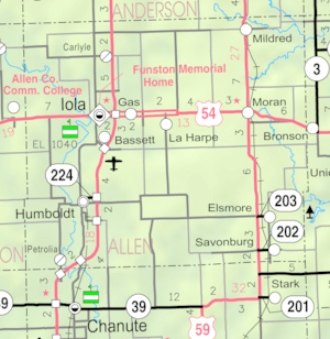
Gas is located in Elm Township, Kansas. It is along U.S. Route 54. The city is about three miles (5 km) east of Iola. Iola is the main city in Allen County. Gas is also about two and a half miles west of La Harpe.
Roads and Highways
The meeting point of U.S. Routes 54 and 169 is about two miles (3 km) west of Gas. This makes it easy to travel to and from the city.
Size of the City
According to the United States Census Bureau, the city of Gas covers an area of about 0.73 square miles (1.89 square kilometers). All of this area is land.
Population and People
| Historical population | |||
|---|---|---|---|
| Census | Pop. | %± | |
| 1910 | 1,281 | — | |
| 1920 | 367 | −71.4% | |
| 1930 | 326 | −11.2% | |
| 1940 | 357 | 9.5% | |
| 1950 | 294 | −17.6% | |
| 1960 | 342 | 16.3% | |
| 1970 | 438 | 28.1% | |
| 1980 | 543 | 24.0% | |
| 1990 | 505 | −7.0% | |
| 2000 | 556 | 10.1% | |
| 2010 | 564 | 1.4% | |
| 2020 | 475 | −15.8% | |
| U.S. Decennial Census | |||
Population in 2020
The 2020 United States census counted 475 people living in Gas. There were 193 households, which are groups of people living together. About 124 of these were families.
Most of the people in Gas were white, making up about 89.89% of the population. A small number of people were African American, Native American, or Asian. About 5.26% of the population identified as being from two or more races.
Age Groups in Gas
In 2020, about 24.2% of the people in Gas were under 18 years old. About 22.3% were 65 years or older. The average age in the city was 41.1 years. This means about half the population was younger than 41.1 and half was older.
Population in 2010
In 2010, the city of Gas had 564 people. There were 216 households. About 33.3% of these households had children under 18 living with them.
The average household size was about 2.61 people. The average family size was about 3.03 people. The population density was about 772.6 people per square mile.
See also
 In Spanish: Gas (Kansas) para niños
 | Emma Amos |
 | Edward Mitchell Bannister |
 | Larry D. Alexander |
 | Ernie Barnes |

