
Genoa, Nevada facts for kids
Quick facts for kids
Genoa, Nevada
|
|
|---|---|
 |
|

Genoa, Nevada
Location in Nevada
|
|
| Country | United States |
| State | Nevada |
| County | Douglas |
| Area | |
| • Total | 9.19 sq mi (23.79 km2) |
| • Land | 9.19 sq mi (23.79 km2) |
| • Water | 0.00 sq mi (0.00 km2) |
| Elevation | 4,807 ft (1,465 m) |
| Population
(2020)
|
|
| • Total | 1,343 |
| • Density | 146.18/sq mi (56.44/km2) |
| Time zone | UTC-8 (Pacific (PST)) |
| • Summer (DST) | UTC-7 (PDT) |
| ZIP code |
89411
|
| Area code(s) | 775 |
| GNIS feature ID | 859807 |
Genoa (pronounced "juh-NOH-uh") is a small town in Douglas County, Nevada, United States. It was founded in 1851 and was the very first settlement in what later became the Nevada Territory.
Genoa is located in the Carson River Valley, about 42 miles (68 km) south of Reno, Nevada. In 2020, about 1,343 people lived there. It is also home to the oldest bar in the state of Nevada, which opened way back in 1853!
Contents
History of Genoa
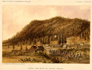
Genoa was first settled by Mormon pioneers in 1850. At that time, the area was part of Mexican territory. The settlement started as a trading post called Mormon Station. It was a helpful stop for travelers on the Carson Route of the California Trail.
In June 1850, H.S. Beatie and other Mormons built a simple log enclosure and corral. This was their trading post near a small stream. Travelers could buy clothes, food, and other supplies there. The post was left empty later that year.
By 1851, John Reese arrived and set up a permanent trading post. He brought horses, cattle, and many supplies. By 1852, many migrants were passing through, and the settlement grew. A post office, a blacksmith shop, and sawmills were built.
In 1856, the community's name was changed to Genoa. It was named after a famous city in Italy. Most of the original Mormon settlers left in 1857. They were called back by Brigham Young, a leader of the Mormon church. This happened because of a conflict called the Utah War.
The village of Genoa was the first temporary capital city of the new Nevada Territory in 1861. Later that year, the capital moved to Carson City.

Nevada Territory's first newspaper, the Territorial Enterprise, started in Genoa in 1858. However, it moved to Virginia City, Nevada two years later. This happened after silver was discovered nearby, leading to the "Comstock Lode" mining boom. Genoa was also the site of Nevada's first cattle ranch.
A big fire in 1910 destroyed much of Genoa, including the original fort and hotel. But a new version of the fort was built in 1947.
Every year since 1919, Genoa has a special event called the Candy Dance. People sell candy, food, and crafts to raise money for the town government. The Candy Dance usually takes place on the last weekend of September. Many early settlers, including Snowshoe Thompson, are buried in the Genoa graveyard.
About a mile south of Genoa is David Walley's Resort. It is famous for its natural hot springs and spa. It was first built in 1862 and was known as Walley's Hot Springs. In 1934, a well-known criminal named Baby Face Nelson briefly hid out at Walley's Hot Springs.
Genoa has also been a filming location for movies. Scenes from the 1973 movie Charley Varrick were filmed there. The village was also the set for the 1990 movie Misery. For Misery, the town was made to look bigger with extra buildings, which were removed after filming.
Genoa Historic District
|
Genoa Historic District
|
|

Genoa Courthouse Museum
|
|
| Nearest city | Minden, Nevada |
|---|---|
| Area | 129.5 acres (52.4 ha) |
| Architectural style | Late Victorian |
| NRHP reference No. | 75001108 |
| Added to NRHP | April 16, 1975 |
The Genoa Historic District is a special area in Genoa. It is about seven miles north of Minden, Nevada. This historic area is 129.5 acres (52.4 hectares) big. It was added to the U.S. National Register of Historic Places in 1975.
This district was once known as Mormon Station. It features buildings with a style called Late Victorian architecture. It includes a courthouse and city hall, along with 29 other important buildings.
Geography and Climate

Genoa is located on the western edge of the Carson Valley. It is about 7 miles (11 km) northwest of Minden, Nevada, which is the county seat of Douglas County. Nevada State Route 206 runs through Genoa.
According to the United States Census Bureau, the area of Genoa is about 9.2 square miles (23.8 square kilometers). All of this area is land.
Genoa's Climate
Genoa has a climate often called "Mediterranean." This means it has dry summers.
| Climate data for Genoa, Nevada | |||||||||||||
|---|---|---|---|---|---|---|---|---|---|---|---|---|---|
| Month | Jan | Feb | Mar | Apr | May | Jun | Jul | Aug | Sep | Oct | Nov | Dec | Year |
| Mean daily maximum °F (°C) | 37 (3) |
38 (3) |
44 (7) |
49 (9) |
58 (14) |
67 (19) |
76 (24) |
75 (24) |
68 (20) |
57 (14) |
45 (7) |
37 (3) |
54 (12) |
| Mean daily minimum °F (°C) | 21 (−6) |
21 (−6) |
24 (−4) |
28 (−2) |
34 (1) |
41 (5) |
48 (9) |
47 (8) |
42 (6) |
35 (2) |
26 (−3) |
21 (−6) |
32 (0) |
| Average precipitation inches (mm) | 3.6 (91) |
3.4 (86) |
2.9 (74) |
1.4 (36) |
1 (25) |
0.7 (18) |
0.2 (5.1) |
0.6 (15) |
0.6 (15) |
1.2 (30) |
1.6 (41) |
3.5 (89) |
20.8 (530) |
| Source: Weatherbase | |||||||||||||
Population
| Historical population | |||
|---|---|---|---|
| Census | Pop. | %± | |
| 2020 | 1,343 | — | |
| U.S. Decennial Census | |||
In 2020, the population of Genoa was 1,343 people.
See also
 In Spanish: Genoa (Nevada) para niños
