Geography of Bridgeport, Connecticut facts for kids
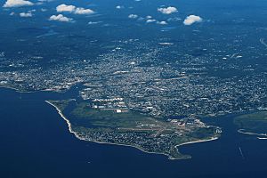
Bridgeport, Connecticut, is a big city in Connecticut. It's right on the Long Island Sound, where the Pequonnock River flows into it.
Contents
Exploring Bridgeport's Landscape
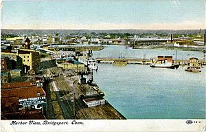
Bridgeport Harbor is a large natural port on Long Island Sound. It's formed by the Pequonnock River and other smaller waterways. East Bridgeport, also called the East Side, is a piece of land between the river and Yellow Mill Pond. This area used to have many big factories.
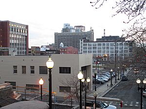
On the other side of Yellow Mill Pond is the East End, which includes Pleasure Beach. West of the harbor, you'll find Downtown Bridgeport along the river. The South End is by the lower harbor and Long Island Sound. The West Side is between Downtown and Fairfield, Connecticut. The North End stretches from Downtown to Trumbull, Connecticut. Many old factories are along the Metro North/New Haven Railroad line. The city is surrounded by hills up to 300 feet high in some northern areas.
Bridgeport is known as the "Park City" because it has two main parks. Beardsley Park is in the northeast part of the city. It's home to Beardsley Zoo, Connecticut's only zoo! This park is next to Bunnell's Pond, a 33-acre lake.
Seaside Park is west of the harbor entrance, along the Sound. It has statues honoring famous people. One is Elias Howe, who invented the sewing machine and built a factory here in 1863. Another is P.T. Barnum, the famous showman, who lived in Bridgeport after 1846. He helped develop the East Side, Mountain Grove Cemetery, and Seaside Park. Seaside Park also has a monument for soldiers and sailors.
Near Seaside Park, you'll find Cedar Creek. This waterway is like a canal and separates Black Rock from Seaside Park. Black Rock Harbor is at the mouth of this creek.
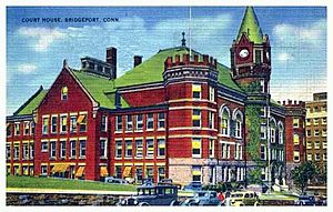
The main public buildings in Bridgeport include two hospitals (St. Vincent's Medical Center and Bridgeport Hospital), the Barnum Museum, the Klein Memorial Auditorium, City Hall, the Fairfield County Courthouse, and the Main Post Office.
Bridgeport's Waterways: Bays and Creeks
- Bridgeport Harbor is one of Connecticut's three major ports. It's where Johnson's Creek, Yellow Mill Pond, and the Pequonnock River meet. Long ago, it was called "Newfield Harbor." It's very large because, before the last ice age, it was the mouth of the Housatonic River!
- Lewis Gut is a narrow tidal channel. It separates the Great Meadows marsh from Long Beach/Pleasure Beach. It's named after Benjamin Lewis, who grew oysters here in the 1800s.
- Johnson's Creek is where Bruce Brook flows into the city's eastern edge. It's named after the Johnson family, who owned large farms nearby. A mill was built here in 1639.
- Walker's Creek (also known as Power House Channel) used to be a tidal outlet from a salt marsh. This marsh was later filled in to create Newfield and Jessup Parks.
- Yellow Mill Pond is where Old Mill Brook flows into the harbor. In 1792, a dam was built here for a large, four-story yellow mill. The mill burned down in 1884.
- Berkshire Mill Pond was another mill site where the Pequonnock River and Island Brook meet. A dam was built here in 1786. Much of this pond was filled in the 1940s and 50s for a shopping center and drive-in movie theaters.
- Black Rock Harbor is in the western part of the city, between Seaside Park and Black Rock. In the past, it was considered the deepest and best port in Connecticut, west of New London.
- Cedar Creek is a waterway in the city's West End that connects to Black Rock Harbor. In the late 1800s, P.T. Barnum helped turn this area into a canal to create a new factory district.
- Burr Creek was an arm of Cedar Creek. It was filled in during the 1940s to build apartment complexes like P.T. Barnum and Evergreen.
- Ash Creek forms the western edge of the Black Rock neighborhood and separates it from Fairfield. It was once known as the "Uncoway River." The name "Ash Creek" likely comes from the red ash trees that grow along its banks.
- Bridgeport Bight is the name for the part of Long Island Sound off the city's coast. In the past, these waters had the largest natural oyster beds on the East Coast, north of the Chesapeake Bay. This led to a big oyster industry in Bridgeport in the 1800s and early 1900s.
Islands Near Bridgeport
- Fayerweather Island is a 71⁄2-acre wooded island in Long Island Sound. It's connected to Seaside Park by a seawall. The Black Rock Harbor Light is on this island.
- Pleasure Beach (also called Steeplechase Island) is a 71-acre island in Long Island Sound. It's south of the city's East End and connected to Stratford, Connecticut by a sandspit.
- Great Marsh Island is a 14-acre island near the mouth of Ash Creek in the Black Rock area.
- South Island (also known as 'Lovers Island') is a half-acre island in Bunnell's Pond. It was created by dredging in the 1800s and is connected to the mainland by a stone bridge.
Lakes and Ponds in Bridgeport
- Lake Forest (also called Island Brook Reservoir) was created in 1866 by damming Island Brook to supply water to the city. It's 71.4 acres.
- Charcoal Pond (also called Island Brook Lagoon) is just below Lake Forest. It was created at the same time to filter the city's drinking water. It covers 4.5 acres.
- Bunnell's Pond was created in 1828 by damming the Pequonnock River. It provided water power for a woolen mill. It became the first source of municipal drinking water in 1854. It covers 33.4 acres.
- Lake Success came into being in 1906 as part of "Powder Park." This 422-acre forested area (now 'Remington Woods') was used to store gunpowder safely away from homes. The 25-acre lake holds the water of Old Mill Brook.
- Stillman's Pond was made in 1812 by damming Old Mill Brook to power a mill. The dam and seven-acre pond were changed when the Remington Arms Company built a rifle plant nearby in 1915.
- Pembroke Lake was created by P.T. Barnum in 1862. He built a dam across Yellow Mill Pond, turning it into a freshwater lake for his "Lake Village" development. Much of this lake has since been filled in.
- Bruce Pond was created in 1889 by damming Bruce Brook at the Bridgeport-Stratford line. It was mainly used to cut ice in winter for iceboxes.
- Asylum Pond was dug in the late 1860s to water cattle on the Town Poor Farm.
- Lily Pond was one of two ponds dug in 1849 to help drain marshy ground when Mountain Grove Cemetery was created.
- Mirror Lake (also called Mummy or Mummichaug Pond) was created in 1872 with the expansion of Seaside Park. It helps drain a low-lying part of the park.
- Horse Tavern Reservoir, also known as Frenchtown Reservoir, is now a dry lake bed in Elton Rogers Park.
Rivers and Streams of Bridgeport
- The Pequonnock River is Bridgeport's most important waterway, stretching 16.7 miles. It starts in Monroe and flows south toward Long Island Sound. It forms Bunnell's Pond and becomes a tidal saltwater estuary further south.
- The Rooster River is in the western part of the city and forms part of the border with Fairfield. It flows into a salt marsh and becomes Ash Creek.
- Island Brook flows through the North End of Bridgeport, starting in Trumbull. It forms Lake Forest and Charcoal Pond.
- Old Mill Brook is formed by two streams from Trumbull. It flows into Success Lake, Stillman's Pond, and Pembroke Lake. It gets its name from a water-powered gristmill built in 1652.
- Bruce Brook starts in Stratford and forms part of Bridgeport's border with Stratford. It flows into Bruce Pond and then Johnson's Creek.
Parks in the "Park City"
Bridgeport is known as the "Park City" and has many parks for everyone to enjoy:
- Alice Street Lot, on Alice Street
- Baldwin Plaza, on Broad Street
- Beardsley Park, a beautiful rural landscape designed by Frederick Law Olmsted in 1878
- B.J. Brown Park, also known as Beechwood Park
- Bull's Head Park, next to the Thomas Merton Center
- Cal Ripken Field, a baseball field named after the famous player
- Clinton Park Militia Grounds, a historic one-acre site
- Ellsworth Field, on Ellsworth and Brewster Streets
- Fairchild Memorial Park, an old-growth forest
- Freedom Field, at Luis Muñoz Marín School
- Glenwood Park, with tennis courts and the Wonderland of Ice
- Gold Park, in Downtown Bridgeport
- Goosetown Park (aka Goosetown Green)
- Hedges Field, home of the Warren Harding High School Presidents
- Jessup Park, with tennis courts
- James Brown Park (Waterview Park)
- Johnson Oak Park (now Tisdale Elementary School)
- Kennedy Stadium, home of the Central High School Hilltoppers
- Knowlton Park
- Lafayette Park (aka Nanny Goat Park)
- Longfellow Park
- Marina Park
- McLevy Green, the city's oldest "urban" park (1806)
- Newfield/Jessup Park, with a playground
- Old Mill Green (aka Pembroke Park), a Colonial common from 1717
- Pleasure Beach, a natural beach accessible by ferry in summer
- Perry J. Pilotti Field, a baseball field in Veterans Memorial Park
- Puglio Park, home to the North Branch Library
- Roberto Clemente Field, a baseball field at Seaside Park
- Elton Rogers Park, a nature preserve
- Russo Park
- Seaside Park, America's 'First waterfront rural park,' designed by the creators of New York's Central Park. It has fields, fishing, picnic areas, playgrounds, a beach, and a boat launch.
- Saint Mary's-By-the-Sea, a waterfront promenade
- Success Park
- Svihra Park
- Upchurch Park
- Wood Park
- Veteran's Memorial Park, a woodland nature preserve
- Washington Park, an 1851 formal square with a historic bandstand
- Waterfront Park, built on wooden piers Downtown
- Went Field Park, a play area and baseball/softball field, once Barnum's Circus winter quarters
- West Side 2 Park
- W.L. Phillips Park, with a baseball diamond, basketball courts, and playground
Bridgeport's Neighborhoods
Bridgeport has eight main areas, many of which are divided into smaller neighborhoods:
- Downtown Bridgeport was the first seaport village, called "Newfield," which started in the 1760s. It became an important trading center. In 1800, "Newfield" was renamed "Bridgeport." Downtown is bordered by the Pequonnock River and Bridgeport Harbor to the east.
- The East Side, known in the 1800s as East Bridgeport, is between Yellow Mill Pond and the Pequonnock River. The southern part was once "Newpasture Point." The area north of the railroad tracks was called "Pembroke City." Further north, the "Beardsley Park Slope" was laid out in the early 1900s. The northernmost part, near the Trumbull line, was known as "Briarwood." More recently, "Treeland" has become a common name for this area. Together, Briarwood and Treeland make up the Upper East Side.
- The East End is east of Yellow Mill Pond. This area was added to Bridgeport from Stratford in 1889. It includes "Newfield," "East End Proper," "Old Mill Hill," and "Success." "Success" is a Native American name used since the 1600s.
- The South End is south of State Street and next to Downtown. It includes the area around the University of Bridgeport campus, which was once an exclusive residential district called "Marina Park." The area around Main and Whiting Streets was historically a village of free people of color, first called "Ethiope" and later "Liberia." Today, it's known as Little Liberia.
- The Hollow is a mix of several old communities. "Golden Hill" was a wealthy neighborhood. "Sterling Hill" was an Irish settlement in the early 1800s. The area north of Harral Avenue, called "Hollow Proper," was known as "Golden Valley" in the 1800s. "Bull's Head" is still known today, named after a tavern where cattle drovers used to stop. "Island Brook" is an area south of North Avenue.
- The West End was also added from a neighboring town, Fairfield, in 1870. It covers the city between Park Avenue and the Rooster River, except for Black Rock. The area east of Clinton Avenue was known as the "West Side," and west of it was the "West End Proper." "Beach's Woods" was an elite development started in 1914. "Hunktown" was a working-class area with many Hungarian-American residents. "Brooklawn" was originally part of Fairfield.
- Black Rock is a piece of land that sticks out southwest from the West End. It was part of Fairfield until 1870. Before the Civil War, it was an important seaport and shipbuilding center. The historic village became the city's first historic district. The tip of the peninsula was called "Grover's Hill" but was renamed St. Mary's by-the-Sea in 1926.
- The North End is bordered by Park and North Avenues, the Trumbull town line, and the Pequonnock River. "Rocky Hill" (now Sylvan Crest) and "Chopsey Hill" (also known as "Whiskey Hill" during Prohibition) are two hills here. "Cow Hill" and "Ox Hill" are other historic names for areas. The "Old North End" is south of Cow Hill. "Toilsome Hill" and "Chestnut Hill" are also in the North End. Finally, Lake Forest and Charcoal Pond are areas developed around old reservoirs.
Bridgeport's Climate and Weather
Bridgeport has a temperate climate (Cfa), meaning it has long, hot summers and cool to cold winters. Rain falls pretty evenly throughout the year. Bridgeport is in a transition zone between the colder climates of northern U.S. and Canada, and the warmer climates of the southern U.S.
The warm season in Bridgeport lasts from mid-April to early November. Thunderstorms are common in the hottest months (June, July, August, September), even on sunny days. The cool season is from late November to mid-March. Winter weather can change a lot, from sunny days to cold, windy conditions with snow. Like other coastal areas, some winter precipitation in Bridgeport is rain or a mix of rain and wet snow. Bridgeport gets about 34 inches (85 cm) of snow each year. Inland areas like Hartford and Albany get more, around 45–60 inches (110–150 cm).
Even though it's not common, tropical cyclones (hurricanes and tropical storms) have hit Connecticut and the Bridgeport area. Hurricanes have made landfall here in 1903, 1938, 1944, 1954 (Carol), 1960 (Donna), Hurricane Gloria in 1985, and Hurricane Sandy in 2012.
Bridgeport is in USDA garden zone 7a. This means it has about 92 days a year with freezing temperatures. Coastal Connecticut has a long growing season, averaging 210 days from April 8 to November 5. This allows some plants that usually grow in warmer areas, like Southern Magnolias and Needle Palms, to grow here.
The average monthly temperature ranges from 31.4 °F (−0.3 °C) in January to 75.7 °F (24.3 °C) in July. The coldest temperature ever recorded was −7 °F (−22 °C) on January 22, 1984. The hottest was 103 °F (39 °C) on July 22 in 1957 and 2011.
Bridgeport gets about 44.9 inches (1,140 mm) of rain each year. March and April are usually the wettest months. The average snowfall is 33.6 inches (85 cm), mostly from December to March. Snow doesn't usually stay on the ground for long, with an average of 33 days per winter having at least 1 inch (2.5 cm) of snow.
| Climate data for Bridgeport, Connecticut (Sikorsky Airport), 1991–2020 normals, extremes 1948–present | |||||||||||||
|---|---|---|---|---|---|---|---|---|---|---|---|---|---|
| Month | Jan | Feb | Mar | Apr | May | Jun | Jul | Aug | Sep | Oct | Nov | Dec | Year |
| Record high °F (°C) | 69 (21) |
67 (19) |
84 (29) |
91 (33) |
97 (36) |
97 (36) |
103 (39) |
100 (38) |
99 (37) |
89 (32) |
78 (26) |
76 (24) |
103 (39) |
| Mean maximum °F (°C) | 57 (14) |
55 (13) |
65 (18) |
76 (24) |
85 (29) |
91 (33) |
94 (34) |
92 (33) |
86 (30) |
78 (26) |
68 (20) |
60 (16) |
95 (35) |
| Mean daily maximum °F (°C) | 38.4 (3.6) |
40.5 (4.7) |
47.4 (8.6) |
58.3 (14.6) |
68.4 (20.2) |
77.7 (25.4) |
83.4 (28.6) |
81.9 (27.7) |
75.4 (24.1) |
64.4 (18.0) |
53.6 (12.0) |
43.8 (6.6) |
61.1 (16.2) |
| Daily mean °F (°C) | 31.4 (−0.3) |
33.1 (0.6) |
39.3 (4.1) |
50.0 (10.0) |
60.0 (15.6) |
69.6 (20.9) |
75.7 (24.3) |
74.5 (23.6) |
67.6 (19.8) |
56.4 (13.6) |
46.0 (7.8) |
37.0 (2.8) |
53.4 (11.9) |
| Mean daily minimum °F (°C) | 24.4 (−4.2) |
25.7 (−3.5) |
32.3 (0.2) |
41.7 (5.4) |
51.7 (10.9) |
61.5 (16.4) |
67.9 (19.9) |
67.0 (19.4) |
59.8 (15.4) |
48.3 (9.1) |
38.4 (3.6) |
30.2 (−1.0) |
45.7 (7.6) |
| Mean minimum °F (°C) | 7 (−14) |
10 (−12) |
18 (−8) |
30 (−1) |
41 (5) |
50 (10) |
59 (15) |
57 (14) |
46 (8) |
34 (1) |
24 (−4) |
16 (−9) |
5 (−15) |
| Record low °F (°C) | −7 (−22) |
−6 (−21) |
4 (−16) |
18 (−8) |
31 (−1) |
41 (5) |
49 (9) |
44 (7) |
36 (2) |
26 (−3) |
13 (−11) |
−4 (−20) |
−7 (−22) |
| Average precipitation inches (mm) | 3.18 (81) |
3.12 (79) |
4.09 (104) |
4.16 (106) |
3.58 (91) |
3.77 (96) |
3.32 (84) |
3.98 (101) |
3.96 (101) |
3.84 (98) |
3.11 (79) |
3.98 (101) |
44.09 (1,121) |
| Average snowfall inches (cm) | 8.5 (22) |
10.7 (27) |
7.0 (18) |
0.9 (2.3) |
0 (0) |
0 (0) |
0 (0) |
0 (0) |
0 (0) |
0.1 (0.25) |
0.9 (2.3) |
5.5 (14) |
33.6 (85.85) |
| Average precipitation days (≥ 0.01 inch) | 11.2 | 10.4 | 11.2 | 11.4 | 12.12 | 11.2 | 8.9 | 9.2 | 8.2 | 9.9 | 9.4 | 11.5 | 124.62 |
| Average snowy days (≥ 0.1 inch) | 4.5 | 4.2 | 2.6 | 0.3 | 0 | 0 | 0 | 0 | 0 | 0.1 | 0.4 | 2.9 | 15 |
| Source: NOAA | |||||||||||||


