
Geography of Iran facts for kids
The Geography of Iran is all about its land, which has lots of mountains, rivers, and flat areas called plains. Iran is a country in Southwest Asia. It shares borders with the Gulf of Oman, the Persian Gulf, and the Caspian Sea. It is located between Iraq and Pakistan. Iran is known for being one of the world's most mountainous countries.
Iran is a very large country, covering about 1,648,000 square kilometers. This makes it the sixteenth largest country in the world. To the north, Iran borders Armenia, Azerbaijan, and Turkmenistan. These northern borders are more than 2,000 kilometers long. About 650 kilometers of this border is water along the southern shore of the Caspian Sea.
Iran's western borders are with Turkey in the north and Iraq in the south. The border with Iraq ends at the Shatt al Arab river, which Iranians call the Arvand Rud. The southern border of Iran is formed by the Persian Gulf and the Gulf of Oman, stretching for 1,770 kilometers. To the east, Iran borders Afghanistan in the north and Pakistan in the south. The distance from Iran's northwest border with Azerbaijan to its southeast border with Pakistan is about 2,333 kilometers.
Images for kids
-
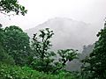
Northern Jungles/Rain forest of Iran
-
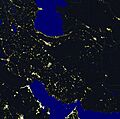
Iran at night
-
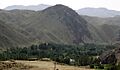
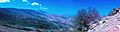
The Iranian landscape is mostly mountainous, with green areas. This picture was taken in the southern Alborz mountains.
-
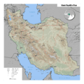
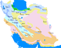
Locator map of Iran
-
Mount Damavand. Photo by Klaus Thymann, 2014.
-
Iran climate map showing locations of province capitals
-
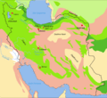
Map of biotopes of Iran
-
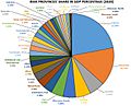
Iranian provinces' contribution to GDP. Tehran has 45% of Iran's industries.
-
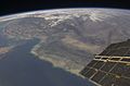
Satellite view of southern Pakistan, Iran and the Gulf of Oman
-
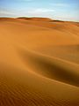
Maranjab dunes, Kavir desert, Kashan
-
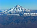
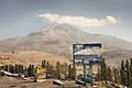
Aerial view of Mount Damavand, Mazandaran
-
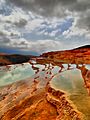
Badab-e Surt, Mazandaran
-

Zayanderud and Khajoo Bridge over it in Isfahan
-
Kabir Kuh ranges, part of Zagros Mountains in Ilam province
_4.jpg)


See also
 In Spanish: Geografía de Irán para niños
