Geography of the British Indian Ocean Territory facts for kids
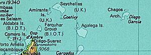
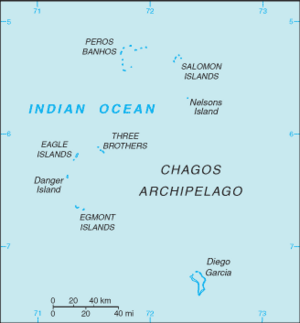
The British Indian Ocean Territory (BIOT) is a group of 55 islands in the Indian Ocean. It is located south of India, about halfway between Africa and Indonesia. The islands form a curved shape, open to the east. The biggest island, Diego Garcia, is at the southern end. It covers about 60 square kilometers, which is almost three-quarters of all the land in the territory. Diego Garcia is the only island where people live. It is home to a joint UK-US naval base. Other islands in the group include Danger Island, Three Brothers Islands, Nelson Island, and Peros Banhos. There are also island groups like the Egmont Islands, Eagle Islands, and the Salomon Islands.
Exploring the Islands: Physical Geography
BIOT is a group of 55 islands. The UK took control of these islands in 1965. They are in the Indian Ocean, close to the Equator. The territory is roughly halfway between Africa and Indonesia. It is about 1,000 miles southwest of India. It is also about 1,600 km from South India and 600 km south of the Maldives.
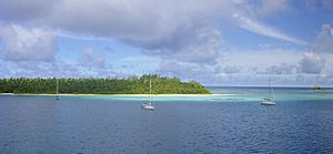
The Chagos Islands are made of coral atolls. This means they are ring-shaped islands formed from coral reefs. They sit on top of underwater volcanic mountains. The land is mostly flat and low. Most areas are not more than 2 meters above sea level. The climate is tropical, meaning it's hot and humid. Trade winds help to keep it from getting too hot. The islands are also safe from cyclones.
A Special Marine Reserve
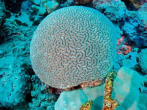
The lagoons around the atolls are like large, shallow lakes. For example, one lagoon is about 120 square kilometers. The deepest part of this lagoon is about 25 meters. The coral reefs around the islands are between 100 and 200 meters wide. They are very shallow, about 1 meter deep on the ocean side.
In 2010, the entire territory was declared a marine reserve. This means a huge area of ocean, about 545,000 square kilometers, is protected. It is called the Chagos Marine Protected Area. This area is special because it has a "pristine ocean ecosystem." It holds 16% of the world's fully protected coral reefs. Fishing is not allowed in this reserve. Diego Garcia is also a special wetland site, known as a Ramsar site.
Different Island Shapes
Of the 55 islands in the Chagos Archipelago, Diego Garcia is the biggest. Other important islands are the Egmont Islands, Danger Island, Aigle (Eagle) Islands, Three Brothers, Nelson Island, Salomon Islands, and Peros Banhos. Peros Banhos is at the northern end of the Chagos Archipelago.
Diego Garcia: The Largest Island
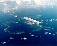
The coral atoll of Diego Garcia is far from other lands. It is about 1,970 km east of Africa (Tanzania). It is also about 967 km south-southwest of India. And it is about 2,550 km west-northwest of Australia. Diego Garcia is at the very southern tip of the Chagos-Laccadive Ridge. This is a huge underwater mountain range in the Indian Ocean.
The total area of the atoll is about 169.6 square kilometers. At the entrance to the lagoon, there are three small islands: East Island, Middle Island, and West Island. Some parts of the atoll have marshes and wetlands. The island also has untouched tropical forests.
Peros Banhos Atoll: A Group of Islands
The Peros Banhos Islands are the largest group on the Chagos Bank. They have 27 islands scattered around a huge lagoon. This lagoon is about 12 km around and covers about 310 square km of water. The islands are separated by deep channels. Before 1965, about 400 islanders lived here. Most of them lived on Île du Coin.
Salomon Atoll: A Smaller Cluster
About 25 km east of Peros Banhos Atoll is the smaller Salomon group. It has eleven islands grouped around a lagoon that is 8 km long and 5 km wide. Before people were moved from here, six of these islands were home to about 250 islanders. Île Boddam was the main village. Île Takamaka was known for boatbuilding.
Other Islands: Nelson, Three Brothers, Eagle, and Danger
Between Diego Garcia in the south and the Peros Banhos and Salomon Atolls in the north, are other coral islands. These are spread out over the Great Chagos Bank. This area has atolls, reefs, and shallow waters. Uninhabited Île Nelson is 35 km south of Salomon Atoll. About 100 km southwest of Nelson are the three islands of Trois Frères. These were briefly inhabited in the 1800s. Further west is Île d'Aigle, where people lived until 1935.
Île Danger is 20 km south of Île d'Aigle. No one has ever lived on Danger Island. It is 2 km long and flat, about 400 meters wide. It is covered with tall coconut trees and shrubs.
Six Îles, or Egmont Atoll
Finally, Six Îles Atoll (also called Egmont) is about 5 km south of Danger Island. People lived here for short times in the mid-1800s until 1935. Besides the six named islands, there is also a seventh unnamed island. The atoll is shaped like a "U". It is a narrow strip of land, from 30 meters to 3 km wide at its northern end. The total land area is about 2,430 hectares. A reef surrounds the atoll. There are two openings to the ocean. It almost completely surrounds a large lagoon. The lagoon itself is 20 km long and more than 10 km wide.
People and History: Human Geography
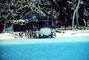
In the late 1700s, coconut palm farms were started on the islands. People were brought from Africa as slave laborers to produce copra (dried coconut meat). A small population lived in the islands. They were descendants of Mauritian workers who came for the copra industry.
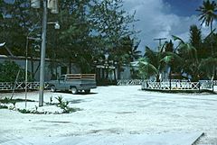
In 1966, an agreement was made between Britain and the United States. The US built a military base on Diego Garcia. Because of this, all the local people, known as Chagossians, were moved away. About 1,200 people from Diego Garcia, Ile du Coin, and Île Boddam were moved to Mauritius. Others went to the Seychelles.
In 2000, the Chagossians won a court case that said they had the right to live on the islands again. The next year, they received UK citizenship. However, a court decision in 2008 stopped them from returning. More issues came up after the marine reserve was created in 2010. If the islanders returned, their traditional way of life, which included fishing, would be limited.
 | James B. Knighten |
 | Azellia White |
 | Willa Brown |


