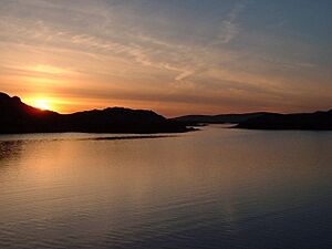
Gighay facts for kids
| Gaelic name | Gioghaigh |
|---|---|
| Meaning of name | Old Norse: Gydha's island |
| OS grid reference | NF764049 |
| Coordinates | 57°01′N 7°20′W / 57.02°N 7.33°W |
| Physical geography | |
| Island group | Uists and Barra |
| Area | 96 ha (240 acres) |
| Area rank | 152 |
| Highest elevation | Mullach a' Charnain 95 m (312 ft) |
| Administration | |
| Sovereign state | United Kingdom |
| Country | Scotland |
| Council area | Na h-Eileanan Siar |
| Demographics | |
| Population | 0 |
Gighay (which is Gioghaigh in Scottish Gaelic) is an island in Scotland. It is a small island located off the northeast coast of Barra. Gighay is one of ten islands found in the Sound of Barra. This area is very important for protecting nature in the Outer Hebrides of Scotland.
Where is Gighay Island?
Gighay is located in the Sound of Barra. It sits between the islands of Barra and Eriskay. The island is about 4 kilometers (2.5 miles) southwest of another island called Fuday. Gighay is part of a group of islands that stretch between South Uist and Barra. It is very close to its neighbor, Hellisay, and they share a small harbor.
What is Gighay Like?
Gighay is an uninhabited island, meaning no people live there. The island is mostly made of a type of rock called gneiss. Gneiss is a common rock that has stripes or bands. Gighay also has veins of quartz, which is a very hard mineral.
The island covers an area of about 96 hectares (237 acres). It rises steeply from the sea. The highest point on Gighay is Mullach a' Charnain, which is about 95 meters (312 feet) high.
Who Owns Gighay?
Gighay Island is owned by the Scottish Government. This means the government of Scotland is responsible for the island.
See also
 In Spanish: Gighay para niños
 | Isaac Myers |
 | D. Hamilton Jackson |
 | A. Philip Randolph |


