Gilman City, Missouri facts for kids
Quick facts for kids
Gilman City, Missouri
|
|
|---|---|

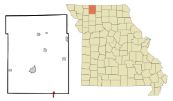
Location of Gilman City, Missouri
|
|
| Country | United States |
| State | Missouri |
| Counties | Harrison, Daviess |
| Area | |
| • Total | 0.84 sq mi (2.18 km2) |
| • Land | 0.84 sq mi (2.18 km2) |
| • Water | 0.00 sq mi (0.00 km2) |
| Elevation | 981 ft (299 m) |
| Population
(2020)
|
|
| • Total | 329 |
| • Density | 391.20/sq mi (151.04/km2) |
| Time zone | UTC-6 (Central (CST)) |
| • Summer (DST) | UTC-5 (CDT) |
| ZIP code |
64642
|
| Area code(s) | 660 |
| FIPS code | 29-27064 |
| GNIS feature ID | 2394901 |
Gilman City is a small city located in the state of Missouri, in the United States. It is mostly in Harrison County, but a small part extends into Daviess County. In 2020, about 329 people lived there.
Contents
History of Gilman City
Gilman City was officially created in 1897. This happened when a railroad line was built to reach that spot. A post office, where people send and receive mail, also opened in Gilman City that same year.
The city was named after Theodore Gilman. He was a banker who worked with railroads. For a while, the city grew bigger and bigger. However, when the railroad was eventually removed, the town started to become smaller.
Geography of Gilman City
Gilman City is located in the northern part of Missouri. You can find it along Missouri Route 146. It is about 11 miles (18 km) southeast of a city called Bethany. It is also about 16 miles (26 km) northwest of Trenton, Missouri. Another nearby community, Melbourne, is about 4.5 miles (7.2 km) to the east.
The United States Census Bureau says that Gilman City covers a total area of 0.84 square miles (2.18 square kilometers). All of this area is land, meaning there are no large lakes or rivers within the city limits.
People of Gilman City
| Historical population | |||
|---|---|---|---|
| Census | Pop. | %± | |
| 1900 | 447 | — | |
| 1910 | 537 | 20.1% | |
| 1920 | 618 | 15.1% | |
| 1930 | 535 | −13.4% | |
| 1940 | 555 | 3.7% | |
| 1950 | 450 | −18.9% | |
| 1960 | 379 | −15.8% | |
| 1970 | 376 | −0.8% | |
| 1980 | 414 | 10.1% | |
| 1990 | 393 | −5.1% | |
| 2000 | 380 | −3.3% | |
| 2010 | 383 | 0.8% | |
| 2020 | 329 | −14.1% | |
| U.S. Decennial Census | |||
2010 Census Information
In 2010, the census counted 383 people living in Gilman City. There were 156 homes, and 108 of these were families. The city had about 456 people per square mile (176 people per square kilometer).
Most of the people living in Gilman City were White (99.5%). A very small number (0.8%) were Hispanic or Latino.
About 36% of the homes had children under 18 living there. More than half (53%) were married couples. About 26% of all homes had just one person living in them. The average home had about 2.46 people.
The average age of people in the city was 35.6 years old.
- About 26% of residents were under 18.
- About 10% were between 18 and 24.
- About 24% were between 25 and 44.
- About 25% were between 45 and 64.
- About 15% were 65 or older.
The city had slightly more females (51.2%) than males (48.8%).
See also

- In Spanish: Gilman City (Misuri) para niños
 | Jewel Prestage |
 | Ella Baker |
 | Fannie Lou Hamer |

