Gladstone, North Dakota facts for kids
Quick facts for kids
Gladstone, North Dakota
|
|
|---|---|

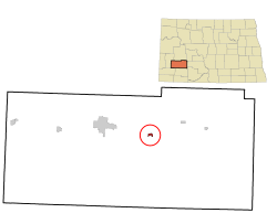
Location of Gladstone, North Dakota
|
|
| Country | United States |
| State | North Dakota |
| County | Stark |
| Founded | 1882 |
| Area | |
| • Total | 0.37 sq mi (0.97 km2) |
| • Land | 0.36 sq mi (0.94 km2) |
| • Water | 0.01 sq mi (0.02 km2) |
| Elevation | 2,297 ft (700 m) |
| Population
(2020)
|
|
| • Total | 271 |
| • Estimate
(2022)
|
270 |
| • Density | 746.56/sq mi (287.96/km2) |
| Time zone | UTC-7 (Mountain (MST)) |
| • Summer (DST) | UTC-6 (MDT) |
| ZIP code |
58630
|
| Area code(s) | 701 |
| FIPS code | 38-30460 |
| GNIS feature ID | 1036055 |
Gladstone is a small city located in Stark County, North Dakota, in the United States. In 2020, about 271 people lived there. It's also part of the larger Dickinson area.
Contents
History of Gladstone
Gladstone was started in 1882 by a group of settlers from Ripon, Wisconsin. The group's leader was James Gray Campbell. About 150 pioneers joined him to build the new city.
The city was named after William Ewart Gladstone, who was the Prime Minister of Great Britain at the time. The settlers used natural resources they found nearby. This included coal from underground, clay for making bricks, and special sand called agate sand. This sand was useful for railroad companies. The settlers also raised strong horses.
Geography of Gladstone
Gladstone is a small city in terms of its size. According to the United States Census Bureau, the city covers about 0.97 square kilometers (0.35 square miles). Most of this area is land, about 0.94 square kilometers (0.34 square miles). A very small part, about 0.02 square kilometers (0.01 square miles), is water.
Gladstone Population Information
| Historical population | |||
|---|---|---|---|
| Census | Pop. | %± | |
| 1940 | 278 | — | |
| 1950 | 224 | −19.4% | |
| 1960 | 185 | −17.4% | |
| 1970 | 222 | 20.0% | |
| 1980 | 317 | 42.8% | |
| 1990 | 224 | −29.3% | |
| 2000 | 248 | 10.7% | |
| 2010 | 239 | −3.6% | |
| 2020 | 271 | 13.4% | |
| 2022 (est.) | 270 | 13.0% | |
| U.S. Decennial Census 2020 Census |
|||
2010 Census Details
In 2010, a count of the population (called a census) showed that 239 people lived in Gladstone. These people lived in 99 different homes, and 62 of these were families.
The city's population density was about 703 people per square mile (271 people per square kilometer). There were 113 housing units, meaning places where people could live.
Most of the people in Gladstone were White (96.2%). A small number were Asian (0.4%), from other backgrounds (0.8%), or from two or more backgrounds (2.5%). About 1.3% of the population identified as Hispanic or Latino.
In the homes, about 30% had children under 18 living there. Nearly half (49.5%) were married couples living together. Some homes had a female head of the household without a husband (8.1%), or a male head of the household without a wife (5.1%). About 25% of all homes were individuals living alone.
The average age of people in Gladstone was 43.4 years old. About 23.4% of residents were under 18. People aged 45 to 64 made up the largest group (31.5%). The city had slightly more males (52.7%) than females (47.3%).
See also

- In Spanish: Gladstone (Dakota del Norte) para niños

