
Good Thunder, Minnesota facts for kids
Quick facts for kids
Good Thunder, Minnesota
|
|
|---|---|

Water tower
|
|

Location of Good Thunder, Minnesota
|
|
| Country | United States |
| State | Minnesota |
| County | Blue Earth |
| Platted | April 1871 |
| Incorporated | March 2, 1893 |
| Government | |
| • Type | Mayor – Council |
| Area | |
| • Total | 0.63 sq mi (1.62 km2) |
| • Land | 0.63 sq mi (1.62 km2) |
| • Water | 0.00 sq mi (0.00 km2) |
| Elevation | 1,004 ft (306 m) |
| Population
(2020)
|
|
| • Total | 560 |
| • Estimate
(2022)
|
566 |
| • Density | 893.14/sq mi (344.99/km2) |
| Time zone | UTC−6 (Central (CST)) |
| • Summer (DST) | UTC−5 (CDT) |
| ZIP Code |
56037
|
| Area code(s) | 507 |
| FIPS code | 27-24506 |
| GNIS feature ID | 2394927 |
| Sales tax | 7.375% |
Good Thunder is a small city in Blue Earth County, Minnesota, United States. It is located along the Maple River. In 2020, about 560 people lived there.
Contents
History of Good Thunder

The land where Good Thunder is now was once part of the Winnebago Reservation. This was from 1855 to 1859.
In 1870, a man named John Graham opened a hotel here. The town started to grow when the railroad arrived. It became a place where farmers could buy and sell goods.
Good Thunder was officially planned out in April 1871. It was named after a Winnebago chief. The chief was also known as Wakuntchapinka. Chief Good Thunder was well-known to the first white settlers. He had also become a Christian.
The town became an official city on March 2, 1893.
Geography of Good Thunder
Good Thunder is a small city. It covers about 0.64 square miles (1.62 square kilometers) of land. There is no water area within the city limits.
Some of the main roads in Good Thunder include former State Highway 66. Also, County Roads 1 and 10 pass through the community.
Population Facts
| Historical population | |||
|---|---|---|---|
| Census | Pop. | %± | |
| 1880 | 149 | — | |
| 1900 | 505 | — | |
| 1910 | 419 | −17.0% | |
| 1920 | 464 | 10.7% | |
| 1930 | 452 | −2.6% | |
| 1940 | 457 | 1.1% | |
| 1950 | 476 | 4.2% | |
| 1960 | 468 | −1.7% | |
| 1970 | 489 | 4.5% | |
| 1980 | 560 | 14.5% | |
| 1990 | 561 | 0.2% | |
| 2000 | 592 | 5.5% | |
| 2010 | 583 | −1.5% | |
| 2020 | 560 | −3.9% | |
| 2022 (est.) | 566 | −2.9% | |
| U.S. Decennial Census 2020 Census |
|||
Good Thunder is part of the larger Mankato–North Mankato area. This is known as a Metropolitan Statistical Area.
2010 Census Information
In 2010, there were 583 people living in Good Thunder. These people lived in 227 households. About 155 of these were families.
The city had about 910 people per square mile. Most of the people living in Good Thunder were White. A small number were African American or Native American. Some people were of Hispanic or Latino background.
The average age of people in the city was 34 years old. About 27% of residents were under 18. About 10% were 65 years or older. The number of males and females was almost equal.
Gallery
- Good Thunder, Minnesota
-
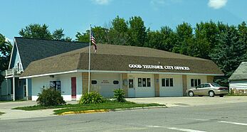
Good Thunder City Offices
-
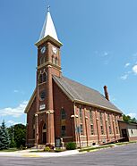
St. John Lutheran Church
-
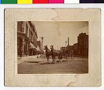
Hilke in Good Thunder in 1908


See also
 In Spanish: Good Thunder (Minnesota) para niños
