Granite Wash Mountains facts for kids
Quick facts for kids Granite Wash Mountains |
|
|---|---|
 |
|
| Highest point | |
| Peak | Salome Peak (Granite Wash Mountains) |
| Elevation | 3,991 ft (1,216 m) |
| Dimensions | |
| Length | 8 mi (13 km) NW-SE-(water–divide) |
| Width | 5 mi (8.0 km) |
| Geography | |
| Country | United States |
| State | Arizona |
| Region | Bouse & Centennial Wash (Maria fold and thrust belt) ((northwest)-Sonoran Desert) |
| District | La Paz County, Arizona, USA |
| Settlement | McVay, AZ–Bouse, AZ (Salome, AZ, Harcuvar, AZ, Hope, AZ) |
| Range coordinates | 33°50′23″N 113°42′43″W / 33.83972°N 113.71194°W |
| Borders on | Harcuvar Mountains-NE-(attached) Little Harquahala Mountains-SE Ranegras Plain–Bouse Wash-NW & W |
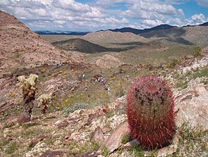
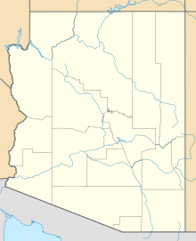
The Granite Wash Mountains are a small, dry mountain range in western Arizona. They are located in the southeastern part of La Paz County. These mountains are next to the Little Harquahala Mountains to the southeast. Both ranges help form a natural boundary that separates where water flows. This boundary is called a water divide.
This water divide separates two desert washes, which are like dry riverbeds. One wash flows northwest towards the Colorado River. The other wash flows southeast towards the Gila River.
About the Granite Wash Mountains
The Granite Wash Mountains stretch from the northwest to the southeast. They are part of a larger area with many mountains, plains, and valleys. This area is known as the Maria fold and thrust belt. It's a special region where the Earth's crust has been pushed and folded over millions of years.
The Granite Wash Mountains are connected to the southwest end of the Harcuvar Mountains. The Harcuvar Mountains are one of three main mountain ranges in this folded area. The Granite Wash Mountains are also on the same water divide as the Little Harquahala Mountains.
This mountain range helps direct the flow of water. To the east, the mountains make the Centennial Wash turn from flowing southwest to flowing southeast. This wash eventually reaches the Gila River. To the west, the Bouse Wash flows northwest towards the Colorado River.
Important Peaks and Landforms
The highest point in the Granite Wash Mountains is Salome Peak. It stands at about 3,991 feet (1,216 meters) tall. Salome Peak is located right in the middle of the mountain range.
Another important feature is Granite Wash Pass. This pass is found at the northwest end of the Little Harquahala Mountains. The towns of Hope and Harcuvar are nearby. The pass is important because it's where the Arizona and California Railroad line runs. U.S. Route 60 in Arizona also goes through this pass. This route connects Brenda (near Interstate 10 in Arizona) to towns like Aguila and Wickenburg.
The Bouse Wash and Centennial Wash
The Granite Wash Mountains and the Little Harquahala Mountains sit on a natural water divide. This divide separates the flow of two important desert washes.
The Bouse Wash flows to the northwest. It eventually empties into the Colorado River. The Centennial Wash (Maricopa County) is to the east. It flows southeast until it meets the Gila River near the Gila Bend Mountains. These washes are usually dry but can fill with water during heavy rains.
 | Sharif Bey |
 | Hale Woodruff |
 | Richmond Barthé |
 | Purvis Young |


