Little Harquahala Mountains facts for kids
Quick facts for kids Little Harquahala Mountains |
|
|---|---|
| Highest point | |
| Peak | Martin Peak |
| Elevation | 2,333 ft (711 m) |
| Dimensions | |
| Length | 13 mi (21 km) NW-SE |
| Width | 6 mi (9.7 km) |
| Geography | |
| Country | United States |
| Settlements | Salome, Harcuvar and Hope |
| Range coordinates | 33°41′21″N 113°36′09″W / 33.6893°N 113.6026°W |
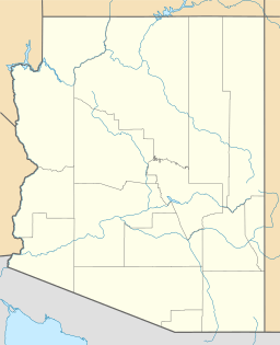
The Little Harquahala Mountains are a small mountain range in western-central Arizona. You can find them in the southeastern part of La Paz County. These mountains are not very tall and are located in a dry, desert area.
The range stretches from the northwest to the southeast. It is part of a larger area called the Maria fold and thrust belt. This region has about 30 different landforms, including plains, valleys, and other mountain ranges.
Contents
Exploring the Little Harquahala Mountains
The Little Harquahala Mountains are part of a special geological area. This area has three mountain ranges that run parallel to each other. In between these ranges are two valleys. The Little Harquahala Mountains are next to the McMullen Valley and the Harquahala Mountains.
What is the Maria Fold and Thrust Belt?
The Maria fold and thrust belt is a large region in Arizona. It is known for its unique geology. This area includes several mountain ranges and valleys that are lined up in a similar direction. The main mountain ranges in this belt are:
These ranges are separated by valleys like the Butler Valley (Arizona) and the McMullen Valley.
Highest Points and Important Places
The tallest spot in the Little Harquahala Mountains is Martin Peak. It reaches about 2,333 feet (711 meters) high and is in the southeastern part of the range. Another important peak is Harquar Peak, which is about 2,100 feet (640 meters) tall.
At the northwest end of the mountains, you'll find Granite Wash Pass. This pass is a key route for transportation. It has a railway line and U.S. Route 60 in Arizona. This road connects towns like Hope and Harcuvar, Arizona. It also links to Interstate 10 in Arizona and goes northeast towards Aguila and Wickenburg.
Water Flow and Washes
The Little Harquahala Mountains act as a natural water divide. This means they separate the flow of water into two different areas. On one side, the Bouse Wash flows northwest towards the Colorado River. On the other side, the Centennial Wash (Maricopa County) flows southeast. The Centennial Wash eventually joins the Gila River near the "great Gila Bend."
 | May Edward Chinn |
 | Rebecca Cole |
 | Alexa Canady |
 | Dorothy Lavinia Brown |


