Granton, Tasmania facts for kids
Quick facts for kids GrantonCity of Glenorchy, Tasmania |
|||||||||||||||
|---|---|---|---|---|---|---|---|---|---|---|---|---|---|---|---|

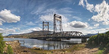
Bridgewater Causeway and Bridgewater Bridge with Granton and Mt Wellington behind.
|
|||||||||||||||
| Population | 1,736 (2016 census) | ||||||||||||||
| Postcode(s) | 7030 | ||||||||||||||
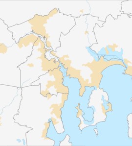
| Location | 9 km (6 mi) N of Glenorchy | ||||||||||||||
| LGA(s) | Derwent Valley Council (80%), City of Glenorchy (20%) | ||||||||||||||
| Region | South-east, Hobart | ||||||||||||||
| State electorate(s) | |||||||||||||||
| Federal Division(s) |
|
||||||||||||||
|
|||||||||||||||
Granton is a small community in Tasmania, Australia. It is mostly a rural area where people live. Granton is about 9 kilometers (about 5.6 miles) north of Glenorchy, a larger town.
In 2016, about 1736 people lived in Granton. It is considered a suburb of Hobart, Tasmania's capital city. Granton is managed by two local councils: the Derwent Valley Council and the City of Glenorchy. Most of Granton (80%) is in the Derwent Valley area.
You can find public places in Granton, like the Granton War Memorial Hall. There are also public toilets and the Granton Green Reserve. These are all located in the part of Granton managed by the Derwent Valley Council.
History of Granton
Granton officially became known as a "locality" in 1970. Before that, it was called South Bridgewater.
The Granton Convict Site
Granton is home to an important historical place called the Granton Convict Site. This site includes the Old Watch House, which was built in 1838. There was also a quarry here. Stone from this quarry was used to build the Bridgewater Causeway. The causeway is a long road bridge that crosses the River Derwent.
Geography of Granton
The northern edge of Granton is formed by the waters of the River Derwent. This river is a major waterway in Tasmania.
Roads in Granton
The main road that goes through Granton is called Route A10, also known as the Lyell Highway. It runs from the east side of Granton to the west side.
 | William L. Dawson |
 | W. E. B. Du Bois |
 | Harry Belafonte |


