Great Island facts for kids
|
Native name:
An tOileán Mór
|
|
|---|---|

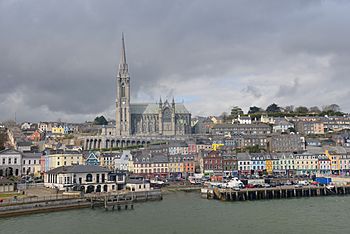
Cobh is the largest town on Great Island
|
|
|
Location in Ireland
|
|
| Geography | |
| Location | Cork Harbour |
| Coordinates | 51°51′57″N 08°16′02″W / 51.86583°N 8.26722°W |
| Area | 53.21 km2 (20.54 sq mi) |
| Length | 8 km (5 mi) east>west (approx) |
| Width | 4 km (2.5 mi) north>sth (approx) |
| Administration | |
| County | County Cork |
| Demographics | |
| Population | Approximately 14,000 |
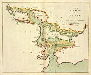
Great Island (Irish: An tOileán Mór) is a cool island located in Cork Harbour, which is a large natural harbour in Ireland. It sits near the mouth of the River Lee and is close to the city of Cork. The biggest town on the island is Cobh, which was known as Queenstown a long time ago (from 1849 to 1922).
For many years, the island's economy and way of life were closely connected to ships. This included building ships, naval activities (like military ships), and general shipping.
Today, things are a bit different. A new type of sea-related business has grown: tourism! Many visitors come to the island, especially on large cruise ships. The Port of Cork has special places for these ships to dock on Great Island. It's the only place in the Republic of Ireland specifically designed for cruise ships to stop.
Contents
Island History: A Look Back
The island's old name was Oilean Ard na Neimheadh. This means the "High (or important) island of Neimheadh." An old Irish book from the 11th century says that Neimheadh was a leader who came to this area in ancient times.
Scientists have found signs of people living on Great Island long ago. These include ringforts (circular forts), fulacht fiadh (ancient cooking sites), holy wells, and bee boles (small stone nooks for beehives). These findings are recorded by the National Monuments Service.

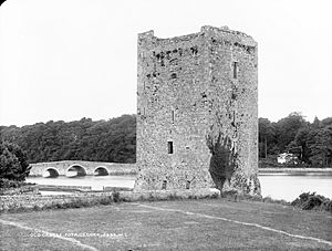
Around the early 1200s, the Anglo-Norman Hodnett family took control of the island. They built buildings like Belvelly Castle to protect the island and its waterways. Later, in the 1300s, the de Barra (Barry) family took over the island and its defenses.
The Barry family stayed in power for several centuries. Because of them, the island became known as "Barrymore Island" or Oileán Mór an Barraigh. This means "Great island of the Barrys."
In the 1700s and 1800s, Great Island became very important for defense. It was located perfectly to watch over the naval bases and military spots at Haulbowline and Spike Island. Because of this, the British built several forts on Great Island. These included Cove Fort and several Martello towers (round defensive towers).
The main town, Cobh, grew a lot during the 1800s and early 1900s. This growth was due to more shipping and naval activities in the area.
Getting Around: Location and Travel

Great Island is located in Cork Harbour on Ireland's south coast. It includes two main areas called Clonmel and Templerobin.
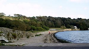
The island is connected to Fota Island to the north by a road bridge. Fota Island then connects to the mainland by a causeway. This road bridge, called Belvelly Bridge, was built in 1803. It's over 200 years old and is the only road bridge to Great Island.
There's also a railway line that runs through Fota Island to Great Island. You can find railway stations on Great Island like Carrigaloe station, Rushbrooke station, and the final stop at Cobh. A ferry service also helps people get to and from the island. It goes from near Carrigaloe to the mainland near Passage West.
In 2017, strong storms, including Storm Ophelia, hit the area. Trees fell and high winds closed the only road bridge to Great Island. Ferry and train services were also stopped. This left about 12,000 people stuck on the island. This event made people think about how to improve emergency access for the island's residents.
How the Land is Used and What People Do
In the 1800s, a book called Topographical Dictionary of Ireland described Great Island as "very fertile." It said the island had "light productive soil" that was good for farming. About two-thirds of the island was used for growing crops, and the rest was for grazing animals or large estates. The book also mentioned that the island's location and climate made it a popular place for many wealthy families to live.
Today, Great Island is still mostly used for farming and homes. The island has about 12,000 to 14,000 people living on it. While some people work on the island, many residents now travel to Cork city for their jobs. They use cars, the Cork Commuter Rail, and bus services to get to the city. Most of the homes are around Cobh. Other populated areas on the island include Ballymore, Ballynoe, and Belvelly.
In the past, the island had some big factories. For example, there was a fertilizer plant and a shipyard called Verolme Cork Dockyard. This shipyard built ships for the Irish Naval Service, like the LÉ Eithne. Many of these large industries have now closed down. However, some smaller companies that build boats are still located in Cobh.
Tourism is now a very important part of the island's economy. As of 2017, Great Island had the only special dock in Ireland for visiting cruise ships. This part of the economy has grown a lot in recent years.
Nature and Wildlife: Ecology

There are several important nature areas on and around Great Island that are protected. These include:
- Cuskinny Marsh Nature Reserve: This area is managed by BirdWatch Ireland and is a great place for birds.
- Marlogue Wood: This forest is managed by Coillte, an Irish forestry company.
- Great Island Channel Special Area of Conservation: This special area is looked after by the National Parks and Wildlife Service. It aims to protect the animals and birds that live in the area's salt marshes. This includes rules about things like fish farming to keep the habitats safe.
While very large fish are not common in the Great Island Special Area of Conservation, a big blue shark was seen near the island in mid-2018.
 | Aurelia Browder |
 | Nannie Helen Burroughs |
 | Michelle Alexander |


