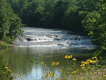
Greenville Creek facts for kids
Quick facts for kids Greenville Creek |
|
|---|---|

Greenville Falls
|
|
| Physical characteristics | |
| Main source | Near Spartanburg, Indiana ~ 1,155 ft (352 m) |
| River mouth | Stillwater River near Covington, Ohio ~ 875 ft (267 m) |
| Basin features | |
| Basin size | 200 sq mi (520 km2) |
Greenville Creek is a 44.4-mile-long (71.5 km) stream in the United States. It flows through southwestern Ohio. A stream like Greenville Creek that flows into a larger river is called a tributary. Greenville Creek joins the Stillwater River.
The water from Greenville Creek travels a long way! From the Stillwater River, it flows into the Great Miami River. Then, it reaches the Ohio River. Finally, its water joins the mighty Mississippi River. This journey ends in the Gulf of Mexico.
Contents
Where Greenville Creek Begins
Greenville Creek starts in eastern Indiana. Its journey begins in Randolph County. Soon after, it crosses into Darke County, Ohio. Here, it meets another stream called Dismal Creek. Dismal Creek also starts in Indiana.
Journey Through Ohio Towns
The creek flows through several towns in Ohio. It passes through Greenville. Then, it continues on to Gettysburg. After this, it enters Miami County.
Greenville Falls: A Natural Wonder
Near the end of its journey, Greenville Creek creates a beautiful sight. It drops about 20 feet (6.1 m) at a spot called Greenville Falls. This happens near Covington. The falls are part of a special area. It is a glacially-cut gorge. This means a glacier carved out the deep valley a long time ago. Today, Greenville Falls is a state nature preserve. It is a protected area for everyone to enjoy.
How We Measure the Creek
Scientists use special tools to learn about rivers and creeks. The USGS is a group of scientists. They study the Earth and its water. They have a stream gauge on Greenville Creek. This gauge is near Bradford.
Understanding Water Flow
A stream gauge helps measure how much water flows in the creek. Scientists call this "discharge." They recorded the average amount of water flowing in the creek. This average is called the "mean annual discharge." From 1931 to 2019, the average was 192.8 cubic feet per second (5.46 m3/s).
Highs and Lows of Water Flow
The amount of water in a creek changes. It depends on rain and other weather. The highest amount of water recorded in one day was 7,920 cu ft/s (224 m3/s). This happened on May 14, 1933. The lowest amount recorded was 5.3 cu ft/s (0.15 m3/s). This low flow happened on September 17, 1963.
 | Selma Burke |
 | Pauline Powell Burns |
 | Frederick J. Brown |
 | Robert Blackburn |

