Greenville, Ohio facts for kids
Quick facts for kids
Greenville
|
|
|---|---|

|
|
| Nickname(s):
"The Treaty City"
|
|

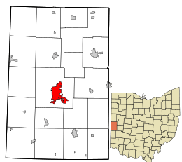
Location in Darke County and the state of Ohio.
|
|
| Country | United States |
| State | Ohio |
| County | Darke |
| Area | |
| • Total | 6.72 sq mi (17.39 km2) |
| • Land | 6.65 sq mi (17.23 km2) |
| • Water | 0.06 sq mi (0.16 km2) |
| Elevation | 1,004 ft (306 m) |
| Population
(2020)
|
|
| • Total | 12,786 |
| • Estimate
(2023)
|
12,696 |
| • Density | 1,922.13/sq mi (742.09/km2) |
| Time zone | UTC-5 (Eastern (EST)) |
| • Summer (DST) | UTC-4 (EDT) |
| ZIP code |
45331
|
| Area code(s) | 937, 326 |
| FIPS code | 39-32340 |
| GNIS feature ID | 2394994 |
| Website | http://www.cityofgreenville.org/ |
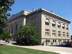
Greenville is a city in Darke County, Ohio, United States. It's also the main city, or county seat, of Darke County. You can find Greenville near Ohio's western edge, about 33 miles northwest of Dayton. In 2020, about 12,786 people lived there.
Contents
History of Greenville
Early Days and Fort Greene Ville
Long ago, many Native American tribes lived in this area. These included the Wyandot, Delaware, Shawnee, and Miami. They were part of the Northwest Indian War. This was their effort to keep European Americans from settling in the Northwest Territory.
Greenville is famous for being the site of Fort Greene Ville. General Anthony Wayne and his army, called the Legion of the United States, built this fort in November 1793. It was during the Northwest Indian War. The fort was named after a hero of the Revolutionary War, Nathanael Greene.
Fort Greene Ville was huge, covering about 55 acres. It was the largest wooden fort in North America at that time. Around 3,000 soldiers trained here. They also used it as a base before marching north to the Battle of Fallen Timbers in August 1794.
The Treaty of Greenville
A year after the battle, something very important happened at the fort. The Treaty of Greenville was signed there on August 3, 1795. Chiefs from the Native American tribes and the United States signed this treaty. It helped end the Indian wars in the area. It also opened up the Northwest Territory for new settlers. This is why Greenville is sometimes called "The Treaty City."
Tecumseh and the Shawnee People
Around 1805 or 1806, a famous Shawnee chief named Tecumseh and his younger brother Tenskwatawa came to Greenville. They started a settlement there. They were peacefully protesting the boundary line set by the Treaty of Greenville. Their group stayed near Mud Creek and Greenville Creek until 1808.
Later, Tecumseh, Tenskwatawa, and their followers moved to Indiana. This was due to pressure from the governor and new settlers. Their group was later defeated at the Battle of Tippecanoe. Tenskwatawa returned to Greenville in 1826 when the Shawnee were moved by the U.S. Army.
Founding the City
The army left Fort Greenville in 1796. Parts of it were later burned to get the nails. Some of its logs were even used to build the new settlement of Dayton, Ohio. During the War of 1812, the army used what was left of the fort as a supply base. The first European-American settlers arrived in 1807. The city of Greenville was officially founded in August 1808.
Geography and Climate
Greenville's Location
Greenville covers about 6.66 square miles. Most of this area, about 6.60 square miles, is land. A small part, about 0.06 square miles, is water.
If you need to fly, there are two local airports. Darke County Airport is about seven miles away in Versailles. The larger James M. Cox Dayton International Airport is about 35 miles away in Dayton, Ohio.
Greenville's Weather
| Climate data for Greenville, Ohio (1991–2020 normals, extremes 1893–present) | |||||||||||||
|---|---|---|---|---|---|---|---|---|---|---|---|---|---|
| Month | Jan | Feb | Mar | Apr | May | Jun | Jul | Aug | Sep | Oct | Nov | Dec | Year |
| Record high °F (°C) | 71 (22) |
75 (24) |
85 (29) |
90 (32) |
98 (37) |
101 (38) |
105 (41) |
101 (38) |
100 (38) |
90 (32) |
80 (27) |
72 (22) |
105 (41) |
| Mean maximum °F (°C) | 57.4 (14.1) |
61.5 (16.4) |
71.2 (21.8) |
80.5 (26.9) |
87.0 (30.6) |
91.6 (33.1) |
91.9 (33.3) |
90.8 (32.7) |
89.6 (32.0) |
82.8 (28.2) |
69.7 (20.9) |
60.1 (15.6) |
93.5 (34.2) |
| Mean daily maximum °F (°C) | 35.1 (1.7) |
39.1 (3.9) |
49.6 (9.8) |
62.8 (17.1) |
73.2 (22.9) |
81.6 (27.6) |
84.6 (29.2) |
83.3 (28.5) |
78.1 (25.6) |
65.6 (18.7) |
51.6 (10.9) |
39.8 (4.3) |
62.0 (16.7) |
| Daily mean °F (°C) | 27.0 (−2.8) |
30.2 (−1.0) |
39.9 (4.4) |
51.6 (10.9) |
62.5 (16.9) |
71.2 (21.8) |
74.1 (23.4) |
72.2 (22.3) |
65.7 (18.7) |
54.0 (12.2) |
42.1 (5.6) |
32.2 (0.1) |
51.9 (11.1) |
| Mean daily minimum °F (°C) | 19.0 (−7.2) |
21.4 (−5.9) |
30.2 (−1.0) |
40.3 (4.6) |
51.7 (10.9) |
60.9 (16.1) |
63.6 (17.6) |
61.1 (16.2) |
53.4 (11.9) |
42.4 (5.8) |
32.6 (0.3) |
24.6 (−4.1) |
41.8 (5.4) |
| Mean minimum °F (°C) | −7.1 (−21.7) |
−0.3 (−17.9) |
10.7 (−11.8) |
24.5 (−4.2) |
35.5 (1.9) |
46.5 (8.1) |
51.7 (10.9) |
49.0 (9.4) |
38.6 (3.7) |
26.9 (−2.8) |
17.4 (−8.1) |
5.4 (−14.8) |
−9.8 (−23.2) |
| Record low °F (°C) | −33 (−36) |
−23 (−31) |
−14 (−26) |
10 (−12) |
23 (−5) |
36 (2) |
43 (6) |
36 (2) |
26 (−3) |
14 (−10) |
−2 (−19) |
−21 (−29) |
−33 (−36) |
| Average precipitation inches (mm) | 2.84 (72) |
2.23 (57) |
3.23 (82) |
4.18 (106) |
4.31 (109) |
4.42 (112) |
3.95 (100) |
3.40 (86) |
2.75 (70) |
2.90 (74) |
3.17 (81) |
2.88 (73) |
40.26 (1,023) |
| Average precipitation days (≥ 0.01 in) | 11.6 | 9.6 | 11.4 | 13.0 | 12.7 | 11.9 | 9.7 | 8.1 | 8.4 | 9.3 | 9.2 | 10.4 | 125.3 |
| Source: NOAA | |||||||||||||
People of Greenville
| Historical population | |||
|---|---|---|---|
| Census | Pop. | %± | |
| 1840 | 793 | — | |
| 1850 | 1,045 | 31.8% | |
| 1860 | 1,650 | 57.9% | |
| 1870 | 2,520 | 52.7% | |
| 1880 | 3,535 | 40.3% | |
| 1890 | 5,473 | 54.8% | |
| 1900 | 5,501 | 0.5% | |
| 1910 | 6,237 | 13.4% | |
| 1920 | 7,104 | 13.9% | |
| 1930 | 7,036 | −1.0% | |
| 1940 | 7,745 | 10.1% | |
| 1950 | 8,859 | 14.4% | |
| 1960 | 10,585 | 19.5% | |
| 1970 | 12,380 | 17.0% | |
| 1980 | 13,002 | 5.0% | |
| 1990 | 12,863 | −1.1% | |
| 2000 | 13,294 | 3.4% | |
| 2010 | 13,227 | −0.5% | |
| 2020 | 12,786 | −3.3% | |
| 2023 (est.) | 12,696 | −4.0% | |
| Sources: | |||
Who Lives in Greenville?
In 2010, about 13,227 people lived in Greenville. There were 5,933 households, which are groups of people living together. About 3,430 of these were families.
Most people in Greenville (96.7%) were White. About 0.9% were African American, and 0.7% were Asian. A small number of people were Native American or from other backgrounds. About 1.4% of the population was Hispanic or Latino.
In these households, 26.3% had children under 18 living with them. Many households (41.2%) were married couples. About 12.0% had a female head of household without a husband. About 4.7% had a male head of household without a wife. The average household had 2.17 people.
The average age in Greenville was 43.4 years old. About 21.5% of residents were under 18. About 22.5% were 65 years or older. The city had slightly more females (54.0%) than males (46.0%).
Greenville's Economy
Greenville is home to offices for several well-known companies. These include KitchenAid, which makes kitchen appliances, and BASF North America, a large chemical company.
Fun Things to Do in Greenville
Annual Fair and Historic Mill
Greenville hosts the Darke County Fair every year. It's a big event that lasts for nine days in August.
You can also visit the historic Bear's Mill. It was built in 1849 and is a great example of an old stone-grinding flour mill. It was added to the National Register of Historic Places in 1977. Today, the mill still grinds cornmeal, whole-wheat flour, and pancake mixes. The mill and its grinding stones are powered by water. You can take a self-guided tour during business hours.
Museums and Arts
Greenville has a local history museum called the Garst Museum. It has amazing collections related to famous people. You can see many items from Annie Oakley, a famous sharpshooter, and Lowell Thomas, a writer and broadcaster. Both of them were born nearby.
The museum also has historical items about Anthony Wayne and the Treaty of Greenville. You can also find Native American artifacts there. The museum includes a village of shops and a section with early American furniture and military uniforms. There's even an early Indianapolis 500 race car that was built in Greenville! If you like history, there's a large room for family research.
Another important place is St. Clair Memorial Hall. This is Darke County's main center for the arts. It was built in 1910 and has been fully updated. It's a beautiful place for performances and events.
Local News
The city and nearby areas get their news from a daily newspaper called The Daily Advocate. It is published right in Greenville.
Famous People from Greenville
- Jack Baldschun, baseball player
- Jack Curtner, racing driver
- Jeffrey D. Feltman, United Nations diplomat
- Ray Hathaway, baseball player
- Walter Law, film and stage actor
- Matt Light, American football player
- Rick Macci, tennis coach
- Clayton Murphy, Olympian
- Paul Norris, comic book artist
- Annie Oakley, American sharpshooter
- Bob Peebles, Scottish-American professional golfer
- Gene Riegle, harness racing driver and trainer
- Lowell Thomas, writer and broadcaster
- Jim Van Bebber, film director
See also
 In Spanish: Greenville (Ohio) para niños
 | Selma Burke |
 | Pauline Powell Burns |
 | Frederick J. Brown |
 | Robert Blackburn |


