
Grosse Pointe Farms, Michigan facts for kids
Quick facts for kids
Grosse Pointe Farms, Michigan
|
||
|---|---|---|
| City of Grosse Pointe Farms | ||

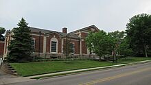
Grosse Pointe Farms City Offices
|
||
|
||

Location within Wayne County
|
||

Grosse Pointe Farms, Michigan
Location in Michigan

Grosse Pointe Farms, Michigan
Location in the United States
|
||
| Country | ||
| State | ||
| County | Wayne | |
| Incorporated | 1893 (village) 1949 (city) |
|
| Government | ||
| • Type | Mayor–council | |
| Area | ||
| • City | 12.33 sq mi (31.92 km2) | |
| • Land | 2.73 sq mi (7.08 km2) | |
| • Water | 9.59 sq mi (24.84 km2) | |
| Elevation | 607 ft (185 m) | |
| Population
(2020)
|
||
| • City | 10,148 | |
| • Density | 3,713.14/sq mi (1,433.79/km2) | |
| • Metro | 4,285,832 (Metro Detroit) | |
| Time zone | UTC-5 (EST) | |
| • Summer (DST) | UTC-4 (EDT) | |
| ZIP Code(s) |
48230, 48236
|
|
| Area code(s) | 313 | |
| FIPS code | 26-35520 | |
| GNIS feature ID | 0627463 | |

Grosse Pointe Farms is a city located in Wayne County, Michigan, in the United States. It's a part of the larger Metro Detroit area. In 2020, about 10,148 people lived there.
Grosse Pointe Farms is one of several cities in the "Grosse Pointe" area. It shares a small border with the city of Detroit. The area first became a village in 1893 and then officially became a city in 1949.
Contents
History of Grosse Pointe Farms
The area that is now Grosse Pointe Farms was first set up as a village in 1879. It was called the Village of Grosse Pointe. By 1889, this village covered a large area.
In 1893, a part of the village decided to form its own community. This happened after a disagreement about where a local tavern should be. This new part became the Village of Grosse Pointe Farms. Later, in 1949, the village officially changed its status and became a city.
The U.S. Postal Service has a post office in Grosse Pointe Farms. It helps deliver mail to the community.
Geography and Landscape

Grosse Pointe Farms covers about 12.32 square miles (31.92 square kilometers). Most of this area, about 9.57 square miles (24.84 square kilometers), is water. This water is part of Lake St. Clair. The land area is about 2.75 square miles (7.08 square kilometers).
The city has a varied landscape. Unlike some nearby areas that are mostly flat, Grosse Pointe Farms has some gentle hills. Its streets are not all straight like a grid. Some parts have curving roads, which gives the city a unique look.
A noticeable ridge runs through the middle of the city. Grosse Pointe Farms also includes the actual "point" of the Grosse Pointe area. Here, the lakeshore bends, so people on the shore face east towards the lake.
The buildings in the city are quite diverse. You can find old homes, from smaller bungalows to large mansions. There are also newer areas with modern houses. The city has a downtown area on Kercheval Avenue. It mixes older buildings with newer shops designed to look traditional.
Population and People
| Historical population | |||
|---|---|---|---|
| Census | Pop. | %± | |
| 1900 | 817 | — | |
| 1910 | 862 | 5.5% | |
| 1920 | 1,649 | 91.3% | |
| 1930 | 3,533 | 114.3% | |
| 1940 | 7,217 | 104.3% | |
| 1950 | 9,410 | 30.4% | |
| 1960 | 12,172 | 29.4% | |
| 1970 | 11,701 | −3.9% | |
| 1980 | 10,551 | −9.8% | |
| 1990 | 10,092 | −4.4% | |
| 2000 | 9,764 | −3.3% | |
| 2010 | 9,479 | −2.9% | |
| 2020 | 10,148 | 7.1% | |
| U.S. Decennial Census | |||
The population of Grosse Pointe Farms has changed over the years. In 2010, there were 9,479 people living in the city. There were 3,718 households, which are groups of people living together.
Most residents, about 95.4%, were White. About 1.8% were African American, and 1.3% were Asian. About 2.0% of the population identified as Hispanic or Latino.
Many households, 33.7%, had children under 18 living with them. The average household had 2.55 people. The average age of people in the city was 45.1 years old. About 25.8% of residents were under 18.
Climate and Weather
| Climate data for Grosse Pointe Farms, Michigan (1991–2020 normals, extremes 1950–present) | |||||||||||||
|---|---|---|---|---|---|---|---|---|---|---|---|---|---|
| Month | Jan | Feb | Mar | Apr | May | Jun | Jul | Aug | Sep | Oct | Nov | Dec | Year |
| Record high °F (°C) | 63 (17) |
69 (21) |
81 (27) |
90 (32) |
93 (34) |
105 (41) |
102 (39) |
101 (38) |
98 (37) |
90 (32) |
79 (26) |
69 (21) |
105 (41) |
| Mean daily maximum °F (°C) | 31.5 (−0.3) |
33.9 (1.1) |
42.9 (6.1) |
55.5 (13.1) |
67.0 (19.4) |
77.2 (25.1) |
82.0 (27.8) |
79.8 (26.6) |
72.7 (22.6) |
60.4 (15.8) |
47.3 (8.5) |
37.0 (2.8) |
57.3 (14.1) |
| Daily mean °F (°C) | 24.0 (−4.4) |
25.8 (−3.4) |
33.9 (1.1) |
45.7 (7.6) |
57.3 (14.1) |
67.5 (19.7) |
72.2 (22.3) |
70.5 (21.4) |
63.3 (17.4) |
51.4 (10.8) |
39.6 (4.2) |
30.4 (−0.9) |
48.5 (9.2) |
| Mean daily minimum °F (°C) | 16.6 (−8.6) |
17.7 (−7.9) |
25.0 (−3.9) |
35.8 (2.1) |
47.5 (8.6) |
57.8 (14.3) |
62.4 (16.9) |
61.2 (16.2) |
53.9 (12.2) |
42.5 (5.8) |
31.9 (−0.1) |
23.8 (−4.6) |
39.7 (4.3) |
| Record low °F (°C) | −17 (−27) |
−17 (−27) |
−6 (−21) |
11 (−12) |
27 (−3) |
38 (3) |
44 (7) |
40 (4) |
32 (0) |
21 (−6) |
4 (−16) |
−10 (−23) |
−17 (−27) |
| Average precipitation inches (mm) | 2.09 (53) |
2.15 (55) |
2.55 (65) |
3.41 (87) |
3.86 (98) |
3.64 (92) |
3.38 (86) |
3.47 (88) |
3.31 (84) |
2.80 (71) |
2.79 (71) |
2.36 (60) |
35.81 (910) |
| Average snowfall inches (cm) | 9.4 (24) |
7.4 (19) |
3.5 (8.9) |
0.3 (0.76) |
0.0 (0.0) |
0.0 (0.0) |
0.0 (0.0) |
0.0 (0.0) |
0.0 (0.0) |
0.0 (0.0) |
0.4 (1.0) |
6.9 (18) |
27.9 (71) |
| Average precipitation days (≥ 0.01 in) | 10.7 | 8.3 | 8.4 | 11.3 | 11.9 | 10.7 | 10.0 | 9.4 | 8.9 | 10.1 | 9.5 | 10.5 | 119.7 |
| Average snowy days (≥ 0.1 in) | 5.2 | 4.3 | 1.9 | 0.3 | 0.0 | 0.0 | 0.0 | 0.0 | 0.0 | 0.1 | 0.6 | 3.2 | 15.5 |
| Source: NOAA | |||||||||||||
Grosse Pointe Farms experiences a varied climate throughout the year. Summers are generally warm, while winters are cold. The city gets a good amount of rain and snow.
The hottest month is usually July, with average temperatures around 72.2°F (22.3°C). The coldest month is January, with average temperatures around 24.0°F (-4.4°C). Snowfall is common in winter, especially in January and February.
Economy and Jobs
The biggest employer in Grosse Pointe Farms is the Grosse Pointe Schools. This means many people in the city work for the local school system. The second largest employer is the Country Club of Detroit.
Education in Grosse Pointe Farms

Public Schools
The community is served by the Grosse Pointe Public Schools (GPPSS). This school district provides education for students from elementary to high school.
Schools located within Grosse Pointe Farms include:
- Père Gabriel Richard Elementary School
- Kerby Elementary School
- Brownell Middle School
- Grosse Pointe South High School
Some students in Grosse Pointe Farms also attend Monteith Elementary School, which is in Grosse Pointe Woods. All middle school students in the city go to Brownell Middle School. Most high school students attend Grosse Pointe South High School. A small number of students in the northwest part of the city go to Grosse Pointe North High School in Grosse Pointe Woods.
Private Schools
Saint Paul Catholic School is a private school located in Grosse Pointe Farms.
Public Libraries
The Grosse Pointe Public Library has its main branch, called the Central Branch, in Grosse Pointe Farms. This library provides books, resources, and programs for the community.
Famous People from Grosse Pointe Farms
Several notable people have lived in Grosse Pointe Farms:
- Anna Thompson Dodge: She was a wealthy woman and a generous giver to charities. She was the wife of Horace Elgin Dodge, who helped start the Dodge car company.
- Elena Ford: She is part of the famous Ford family. Her great-great-grandfather was Henry Ford, who founded the Ford Motor Company.
- Meg White: She is a musician, best known as one half of the band the White Stripes. She grew up in Grosse Pointe Farms.
Images for kids
-
Water Filtration Plant


See also
 In Spanish: Grosse Pointe Farms (Míchigan) para niños
