Gualala River facts for kids
Quick facts for kids Gualala River |
|
|---|---|

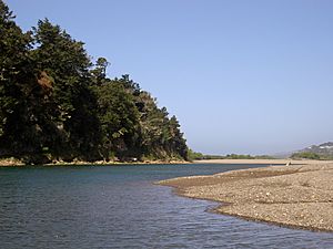
The Gualala River near its mouth
|
|
|
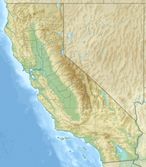
Location of the mouth of the Gualala River in California
|
|
| Country | United States |
| State | California |
| Region | Sonoma County, Mendocino County |
| City | Gualala, California |
| Physical characteristics | |
| Main source | South Fork Gualala River Mohrhardt Ridge 1,880 ft (570 m) 38°34′17″N 123°10′3″W / 38.57139°N 123.16750°W |
| 2nd source | North Fork/Billings Creek Snook Mountain 1,840 ft (560 m) 38°50′46″N 123°19′56″W / 38.84611°N 123.33222°W |
| River mouth | Pacific Ocean west of Gualala, California 0 ft (0 m) 38°46′7″N 123°32′2″W / 38.76861°N 123.53389°W |
| Length | 3.4 mi (5.5 km)confluence to mouth |
| Basin features | |
| Basin size | 298 sq mi (770 km2) |
The Gualala River is a river located on the northern coast of California. Most of this river flows through Sonoma County. A smaller part is in Mendocino County. The river starts high up in the Coast Range mountains. It then flows about 40-mile-long (64 km) before emptying into the Pacific Ocean. For its last few miles, the Gualala River forms the border between Sonoma and Mendocino counties.
Contents
What's in a Name?
The name of the Gualala River has an interesting story. A militia captain named Ernest Rufus, who worked for John Sutter, is said to have named it. There are two main ideas about where the name came from:
- Some believe it comes from the Pomo word Walali. This word means "where the waters meet."
- Others think it comes from an English phrase, "What Water read The Law" (Que Agua Le La Ley).
River Branches
The Gualala River has three main branches, also called forks:
- The South Fork is the longest. It flows northwest, running alongside the San Andreas Fault zone.
- The Wheatfield Fork starts west of Lake Sonoma. This fork carries the most water. It joins the South Fork first.
- The North Fork is the only part of the river that is entirely in Mendocino County. It flows southwest towards the coast, also along the San Andreas Fault zone. It meets the South Fork just a few miles before the river reaches the ocean.
Several smaller streams, called tributaries, also feed into these forks. For example, Buckeye Creek, Rockpile Creek, and Big Pepperwood Creek all flow into the South Fork.
River Area and Its Use
The area drained by the Gualala River is called its watershed. This mountainous watershed covers about 298 square miles (770 km2). About three-quarters of it is in Sonoma County, and one-quarter is in Mendocino County.
The amount of rainfall in the watershed changes depending on the location. It can be about 38 inches (970 mm) per year near the coast. Further inland, it can reach 70 inches (1,800 mm) per year. Not many people live in this area.
Historically, and even today, the main activity in the watershed is timber production. This means cutting down trees for wood. In the past, grazing animals (like cows) was also important, but it is less common now.
Importance of the River
The Gualala River is very important for several reasons:
- Recreation: People enjoy activities like fishing and swimming in the river.
- Water Supply: It provides water for the community of Gualala, California, for homes and businesses.
- Wildlife Habitat: The river is a home for many animals. It's especially important for fish, providing cool, fresh water where they can migrate and lay their eggs.
River Challenges
The biggest challenge for the Gualala River is too much erosion. Erosion happens when soil and rock are worn away, often by water. The area naturally has a lot of erosion because of the San Andreas Fault. This fault causes the land to move and lift.
However, human activities have made the problem worse. Logging (cutting down trees) and building roads have greatly increased the amount of sediment in the river. Sediment is loose material like sand and mud. Too much sediment can harm fish habitats. For example, Kelly Road is a major source of sediment in the river.
Another big problem is high water temperatures. When large trees along the river are removed during logging, there is less shade. This makes the water warmer. Also, less large woody debris (fallen trees and branches) means fewer pools in the river. These pools are important cool spots for fish.
Protecting the River
In 2002, there was a plan to collect water from the Gualala River (and another river called the Albion River). The idea was to put the water into large bags and tow them to San Diego for drinking water.
However, many local people were against this plan. The state government then passed new laws. These laws required detailed studies on how such a plan would affect fish and their homes. Because of this, the water-bag plan was stopped. Later, the governor signed a law that declared both the Gualala and Albion rivers as recreational areas. This helped protect them from similar attempts to use their resources in ways that could harm them.
See also
 In Spanish: Río Gualala para niños
 | Lonnie Johnson |
 | Granville Woods |
 | Lewis Howard Latimer |
 | James West |


