Haines Borough, Alaska facts for kids
Quick facts for kids
Haines Borough
|
|
|---|---|

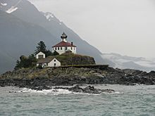
Lighthouse on Eldred Rock island.
|
|

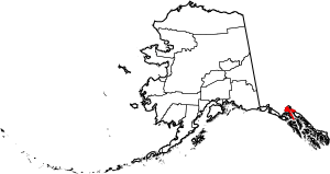
Location within the U.S. state of Alaska
|
|
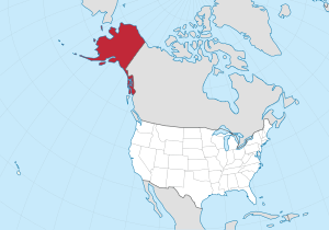
 Alaska's location within the U.S. |
|
| Country | |
| State | |
| Founded | August 29, 1968 |
| Named for | Haines |
| Area | |
| • Total | 2,726 sq mi (7,060 km2) |
| • Land | 2,319 sq mi (6,010 km2) |
| • Water | 407 sq mi (1,050 km2) 14.9%% |
| Population
(2020)
|
|
| • Total | 2,056 |
| • Density | 0.7542/sq mi (0.29121/km2) |
| Time zone | UTC−9 (Alaska) |
| • Summer (DST) | UTC−8 (ADT) |
| Congressional district | At-large |
The Haines Borough is a special kind of local government area, like a county, located in the state of Alaska in the United States. It was officially created on August 29, 1968. In 2020, about 2,056 people lived here.
Contents
Geography of Haines Borough
Haines Borough covers a large area. Its total size is about 2,726 square miles (7,060 square kilometers). Most of this area, about 2,319 square miles (6,006 square kilometers), is land. The rest, about 407 square miles (1,054 square kilometers), is water. This means about 15% of the borough is covered by water.
Neighboring Areas
Haines Borough shares its borders with several other places.
- To the northeast, it is next to the Municipality of Skagway Borough, Alaska.
- To the southeast, you'll find the Juneau City and Borough, Alaska.
- To the south and west, it borders the Hoonah-Angoon Census Area, Alaska.
- To the northwest and east, it touches the Stikine Region, British Columbia, which is in Canada.
Protected Natural Areas
Part of the famous Tongass National Forest is located within Haines Borough. This is a very large national forest. Inside it, there's also a special protected area called the Endicott River Wilderness. These areas help protect nature and wildlife.
Who Lives in Haines Borough?
This section tells us about the people who live in Haines Borough. It looks at how many people there are and some general facts about them.
| Historical population | |||
|---|---|---|---|
| Census | Pop. | %± | |
| 1970 | 1,504 | — | |
| 1980 | 1,680 | 11.7% | |
| 1990 | 2,117 | 26.0% | |
| 2000 | 2,392 | 13.0% | |
| 2010 | 2,508 | 4.8% | |
| 2020 | 2,056 | −18.0% | |
| 2023 (est.) | 2,070 | −17.5% | |
| U.S. Decennial Census 1900-1990 1990-2000 2010-2020 |
|||
In 2000, there were 2,392 people living in Haines Borough. These people lived in 991 different homes. About two-thirds of these homes were families.
Most of the people living in the borough were White (about 82.5%). A smaller number were Native American (about 11.5%). Other groups made up the rest of the population.
About 31.6% of the homes had children under 18 living there. The average home had about 2.4 people. The average family had about 2.9 people.
The median age of people in Haines Borough was 41 years old in 2000. This means half the people were younger than 41 and half were older. About 25.6% of the population was under 18. About 10.5% of the people were 65 or older.
Getting Around Haines Borough
Transportation is important for people living in and visiting Haines.
Haines is a stop on the Alaska Marine Highway. This is a ferry system that helps people travel along the coast of Alaska. Many people use the ferry in winter to avoid driving on the long Alaska Highway.
You can also get to Haines by flying. There are air services that connect Haines to nearby Juneau, Alaska.
Cool Things to See
One of the most amazing things to see in Haines Borough happens every year around November. Thousands of bald eagles gather here! They come to feast on the salmon that are swimming in the rivers. This is a huge event, and many photographers visit to take pictures of these magnificent birds.
Communities in Haines Borough
Haines Borough has several communities within its borders. These are often called "census-designated places." This means they are areas that the government counts for population, but they might not have their own separate city government.
Census-designated places
- Covenant Life
- Excursion Inlet
- Haines (This is where the main borough offices are located)
- Lutak
- Mosquito Lake
- Mud Bay
See also
 In Spanish: Borough de Haines para niños
 | Valerie Thomas |
 | Frederick McKinley Jones |
 | George Edward Alcorn Jr. |
 | Thomas Mensah |

